Snow potential has diminished somewhat leaving the Piedmont in a boundary region of… Cold Rain and Wet Snow.
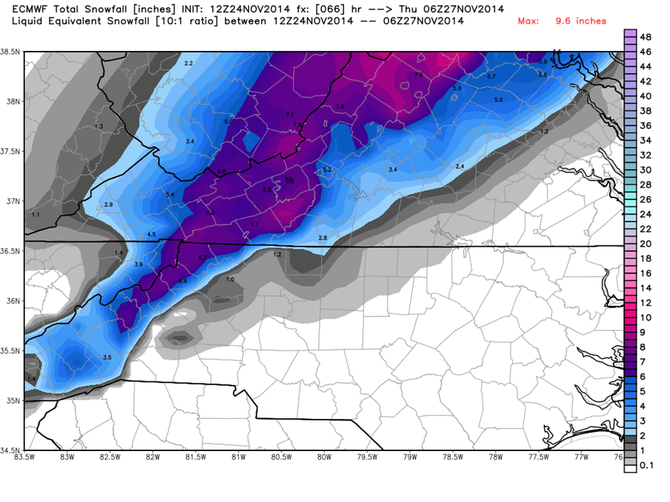
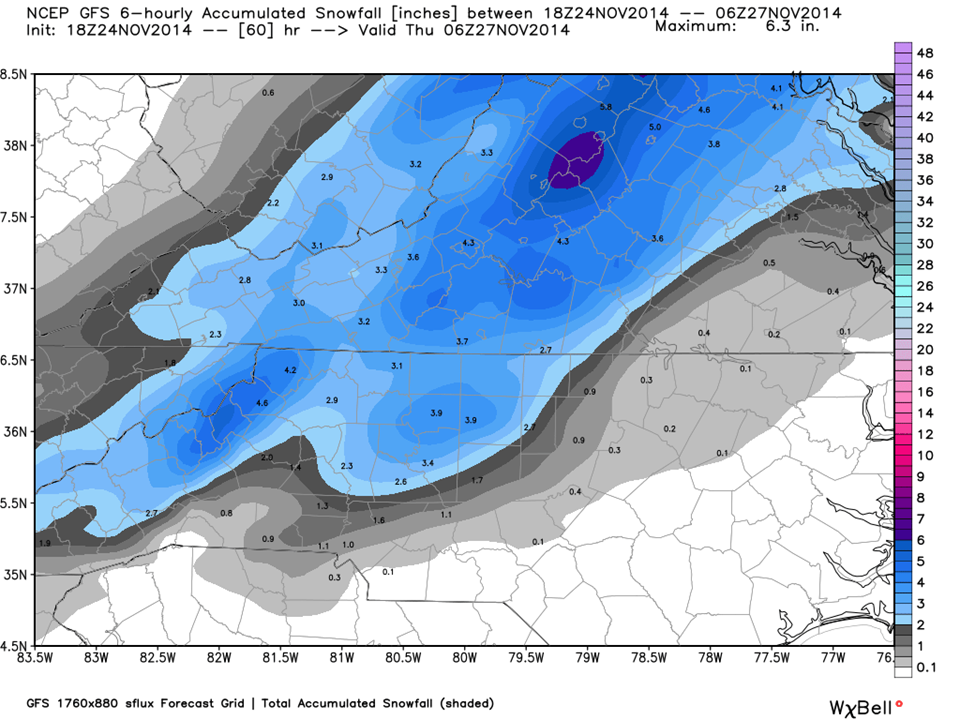
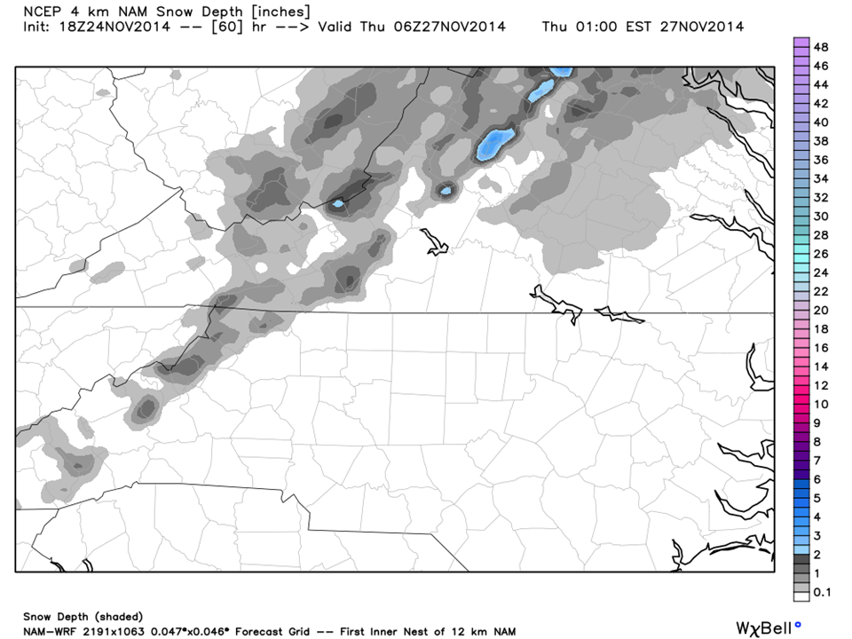
A very complicated system has found us here in the NC Piedmont. All models are chiming in now and it looks like a cold rain with some wet snow mixed in. Our border counties in Virginia will see some accumulation as will our mountains at elevations above 2500 feet.
As this system pulls through, the cold air will filter in…a scenario we see all too often here, giving us a potential for some accumulating snow AFTER the storm leaves.
Right now, NC Weather Happens is advising caution if you are travelling up the eastern seaboard and for black ice early Thanksgiving morning in our area.
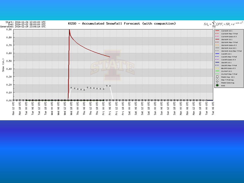
Here is a look at the Models… The European, GFS, and NAM. If we take a good look at those and take into consideration their strengths and weaknesses, we see a cold rainy day Wednesday followed by some brief periods of snow.
The Bottom Line:
NC Weather Happens wants you to be prepared, informed, and weather smart. Again if you are travelling north of Piedmont North Carolina, be patient and allow for extra time. It will be a hot mess up there on a holiday weekend! If you are staying here, watch for black ice Thanksgiving morning.
NC Weather Happens…Can’t do anything about it, so enjoy it!
