Originally published September 9, 2014
This outlook is for Central North Carolina
Let’s do this differently. I’ll put the bottom line at the top so your eyes won’t glaze over.
Bottom Line:
This winter season (December, January, and February) will be quite similar to last year with a bit more emphasis on cold. We can expect to see a bit more precipitation and cooler than average temperatures. Couple these together and yes, there may be more precipitation in frozen form. January looks to be the most cool with an increasing likelihood of polar air visiting and staying in our region.
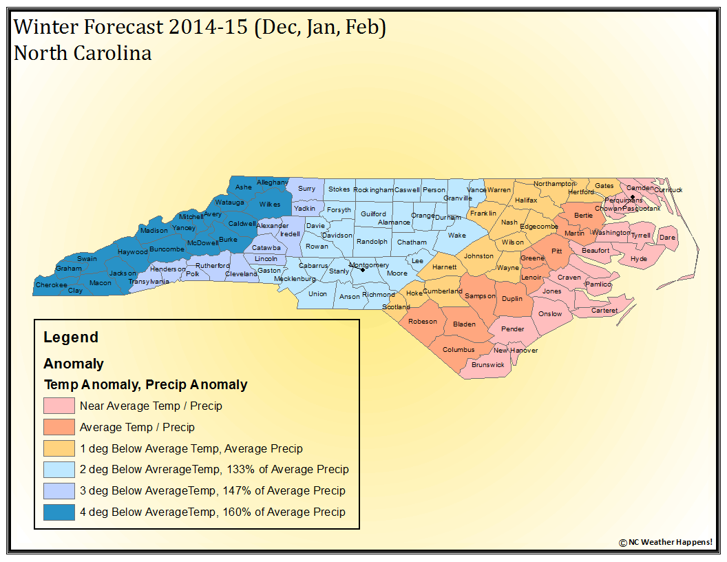
Map Interpretation:
For central North Carolina (light blue), we can see a run of temperatures 2 degrees below normal and precipitation 133% above average.
Temperatures:
2 degrees doesn’t sound like much, but when averaged over 90 days, it is significant. With a normal high of 48 and a normal low of 29, periods of extreme cold can bring that average down. For reference, our area was 1.5 degrees below normal for the same period last year.
Precipitation:
133% above average precipitation! The normal is 6.6 inches of snow. Add 133% and we could receive 15.3 inches of snow through the 90 day period. For reference, last year, we received 15 inches so it makes a bit more sense.
I will spare you how I came to this conclusion as that is not the mission of this site.
All you want to know is what it’s going to do. I will offer that dozens of weather models and historical analog data went into this forecast and if you would like to talk about those, please visit www.ncwxhappens.com and send me a note.
NC Weather Happens!
Enjoy it!
This is NOT an official forecast…
just an interpretation of the same source information.