
Now that’s a loaded Title!!!
Let’s take a look at the 7 day into Christmas.
First, Sydney insisted that this be posted as she is such a Diva!

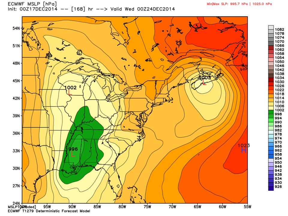
Looking ahead, another system riding the Southern Polar Jet, takes a dip near the Gulf of Mexico loading itself with moisture and then travels North East. Right now (and this far out) things are subject to change. It appears that this system will travel up the West Side of the Appalachians towards the Great Lakes.
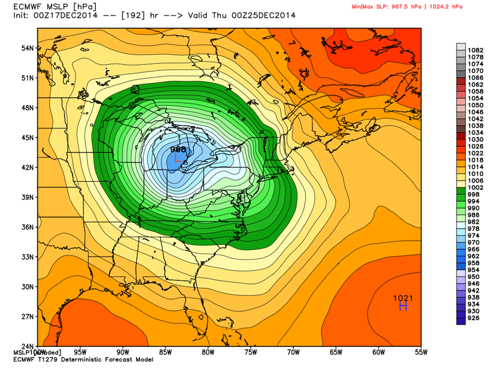
As the trailing edge of the low pressure system passes through our area, temps will warm up ahead of the front then rapidly drop. In fact, this more closely resembles a springtime thunderstorm event!

You can see the wrap-around arctic cold diving into the Piedmont on the back edge of the front. We will see this Christmas Day and it has some staying power, so this event sets the stage for our winter cold.
What is more impressive, are the temperatures Christmas evening and Christmas Day… ( there is considerable model agreement on this)
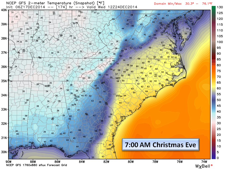

With this much of a temperature gradient, we are thinking Christmas Eve thunderstorms will be passing through. Look at the 7:00 am 24th image. We also see Dew Points into the 60’s and CAPE (Convective Available Potential energy) around 600 [J/kg]. What this means is that there is sufficient energy to produce thunderstorms.

The timing of the frontal passage is approximate and will likely change as we get closer to the Holidays, but it doesn’t look like we will be getting a White Christmas here in the Piedmont this year 🙁
The Bottom Line:
Sydney is very disappointed but she will be happy nonetheless diving into mountains of wrapping paper Christmas morning. The very noteworthy item to mention is the cold that will be arriving Christmas Day which appears to set the stage for our long anticipated cold winter weather. So if you love winter, then it’s on for you next week.
Meanwhile, we are still looking at a cold rain with some wet snow mixed in this weekend but if you are travelling northeast, pay attention to the weather as there may be travel delays this weekend. Concerning Christmas Day, it is too early to forecast severe weather but as we get closer, you can check any severe potential here and at the National Weather Service.
NC Weather Happens. Enjoy it!
PS: Don’t forget to Subscribe.