
Models are pretty much locked in for this weekend.
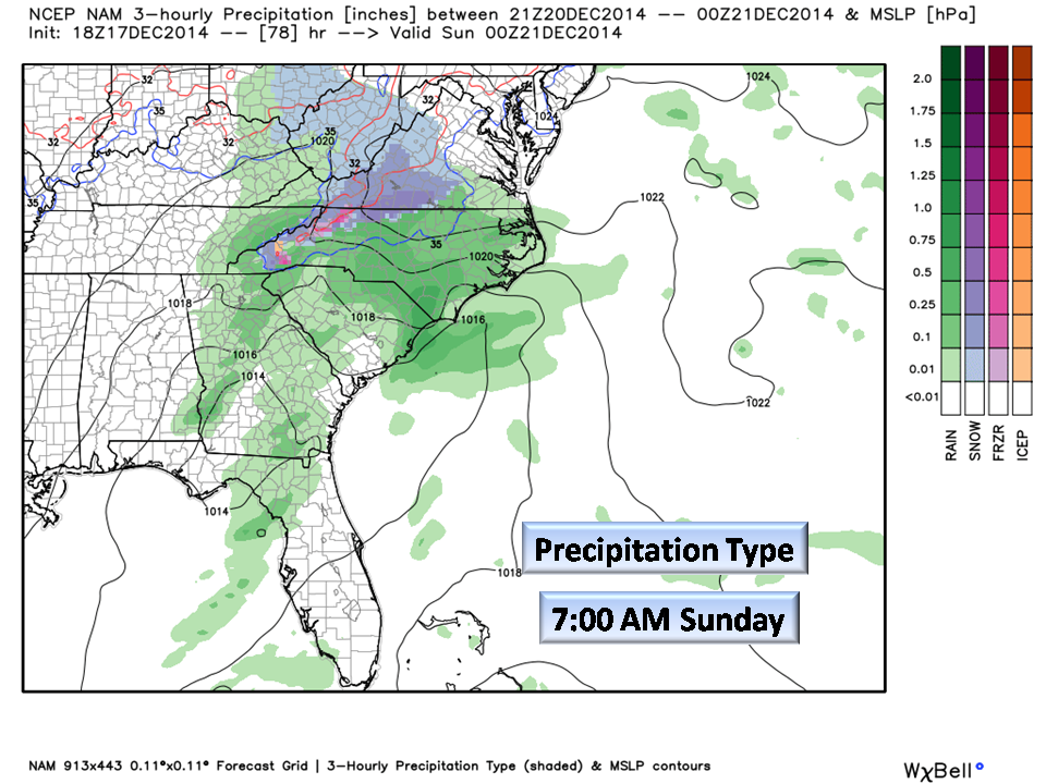
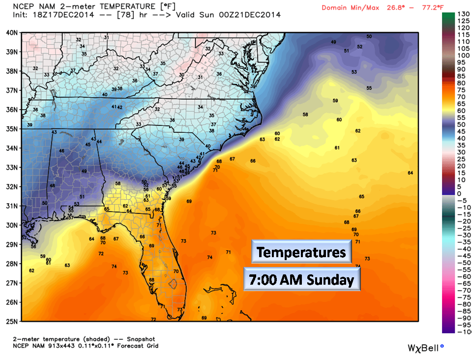
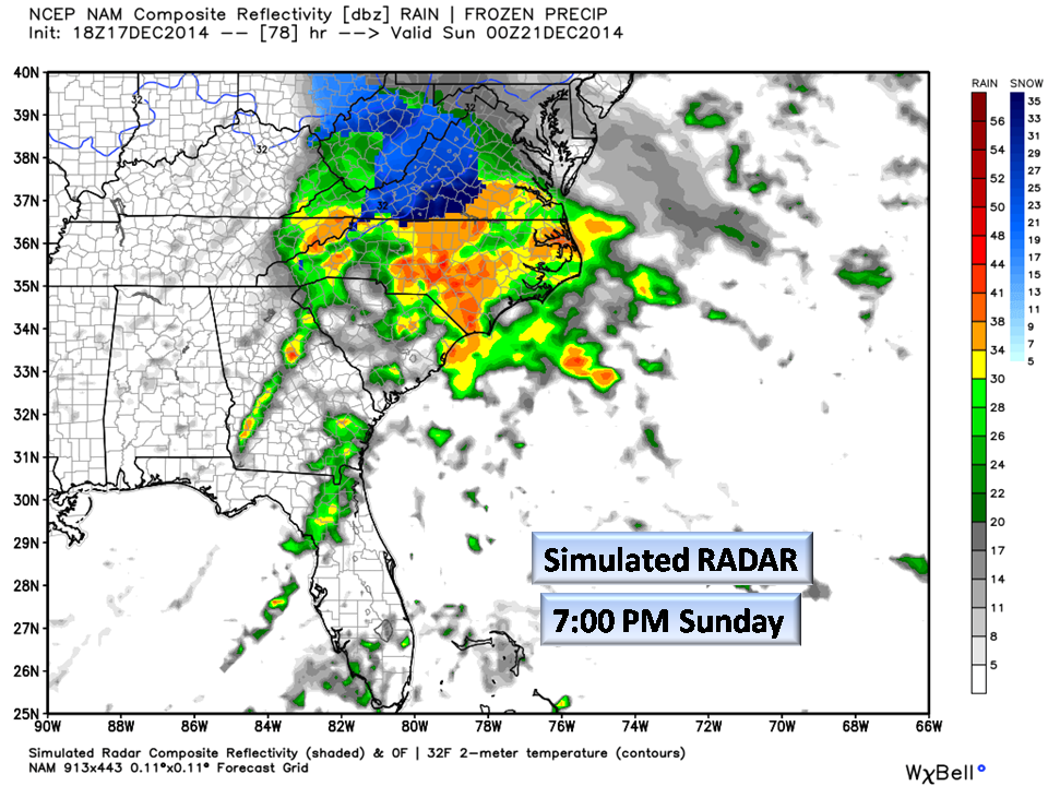
This weekend, the Piedmont can expect to see a cold rain. Our Virginia border areas may see a light accumulation as will our mountain areas. Here in Central NC, Cold Rain but don’t be surprised to see some snow flakes especially during heavier rain.
The medium-range models are now sampling this system so we are getting really good information. The popular winter model (the European) has backed so far off that it’s not even worth mentioning. We only offer these to show that with ALL things considered and not just one single model, forecasting is possible.
Christmas Eve and Christmas Day:
Here is where things get tricky! We have seen this system in the Long-Range models for some time. Now that we are inside of the 10 day area, we can make mention of some observations. Here is the setup… The system will come up out of the Gulf of Mexico through Tennessee, over the Great Lakes and into Canada. Most all of the “Winter Energy” will be confined west of the Appalachians…we are not talking about snow or winter weather in the Piedmont at this time.
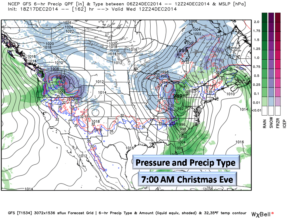
This is a very strong storm system and will affect nearly 1/3 of the country. It will draw moisture and energy from the Gulf of Mexico and the Atlantic as it moves north. What does this mean for the Piedmont?
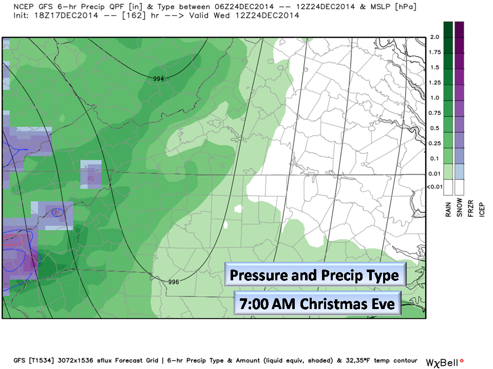
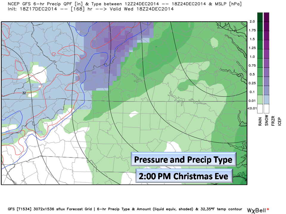


Early Christmas Eve morning, we will begin to feel the effects of this system. It is forecast to be loaded with moisture and we may even see a 25 degree temperature drop between 6:00 am and 6:00 pm!
The center of the storm will be over Illinois, but it will be drawing Atlantic moisture up over us into the Great Lakes.
Now don’t worry, this isn’t the end of the world with dogs and cats sleeping together, it’s just a very potent storm the like of which we would normally see moving up the east coast as a Nor’Easter. This will be inland.
Our mountains will likely see snow but that is outside of our forecast area, so if anyone up that way would like to add to this, please let us know.
Once this system passes through our area later in the day, cold air will filter in for a chilly Christmas morning. Highs Christmas Day will stay in the 30’s to near 40 for our area.
We wish we could say “White Christmas”…this evening we just don’t see it in the Piedmont. Hoping on hope that we might!!!
Here is the only advice we can give at this time…
If you will be travelling on the 23rd, please pay attention to the weather especially if you will be travelling to the upper midwest. They should get a white Christmas for the books up there.
As always,
NC Weather Happens. Enjoy it!
Don’t forget to Subscribe.