
- Posted 1/20/2015 10:15 am
- Expires 5:00 pm
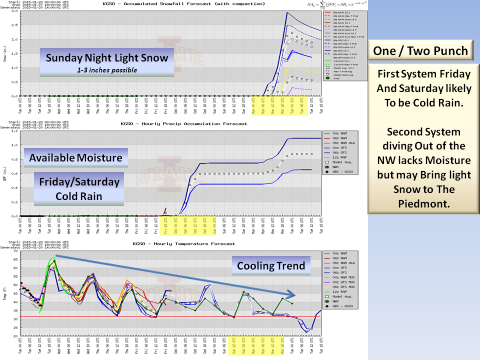
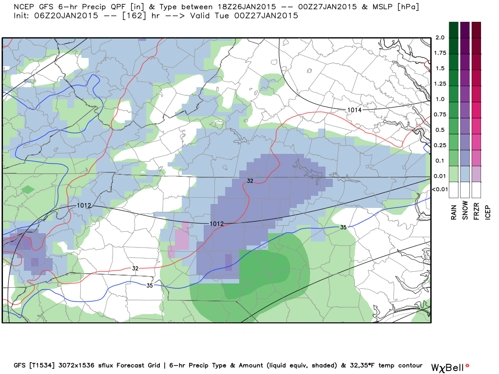
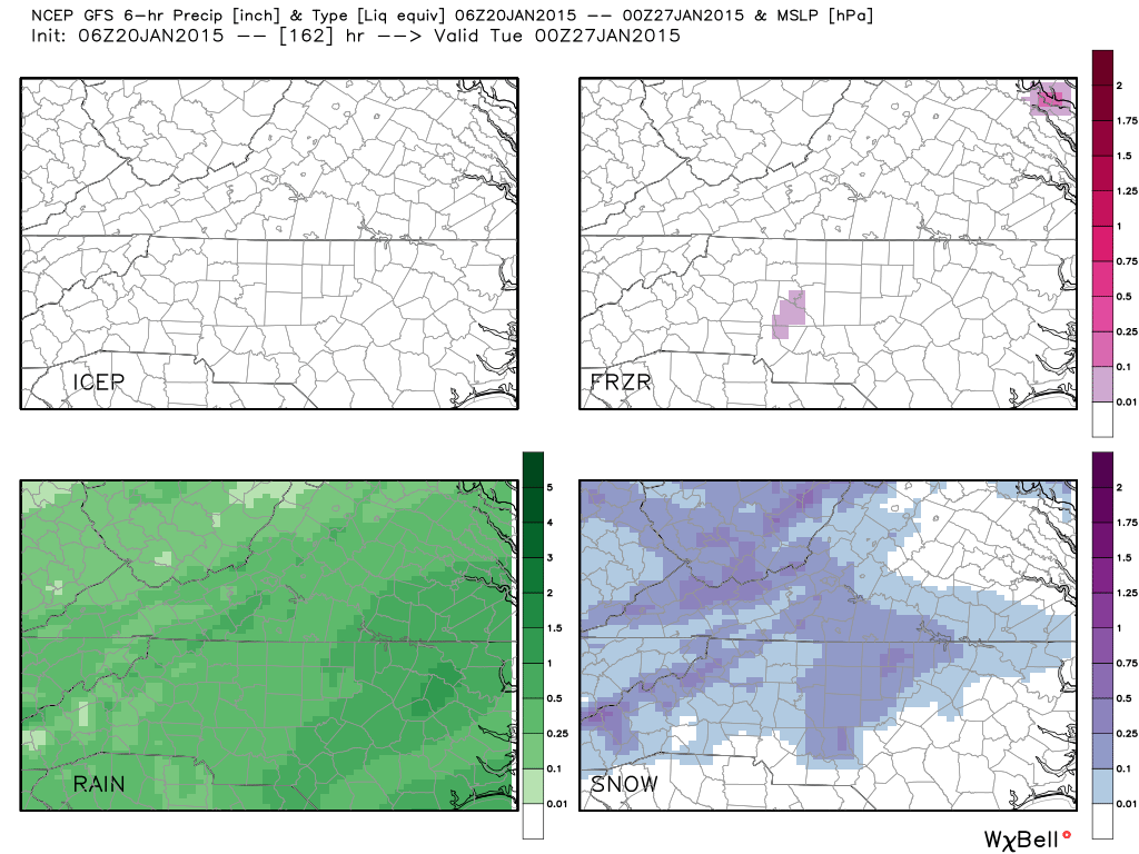
With the lack of a strong Canadian High Pressure system sending cold air into the Piedmont, Friday and Saturday look to be largely a Cold Rain with some snow showers possible in the mountains (outside of our coverage area).
Round One:
- Track:
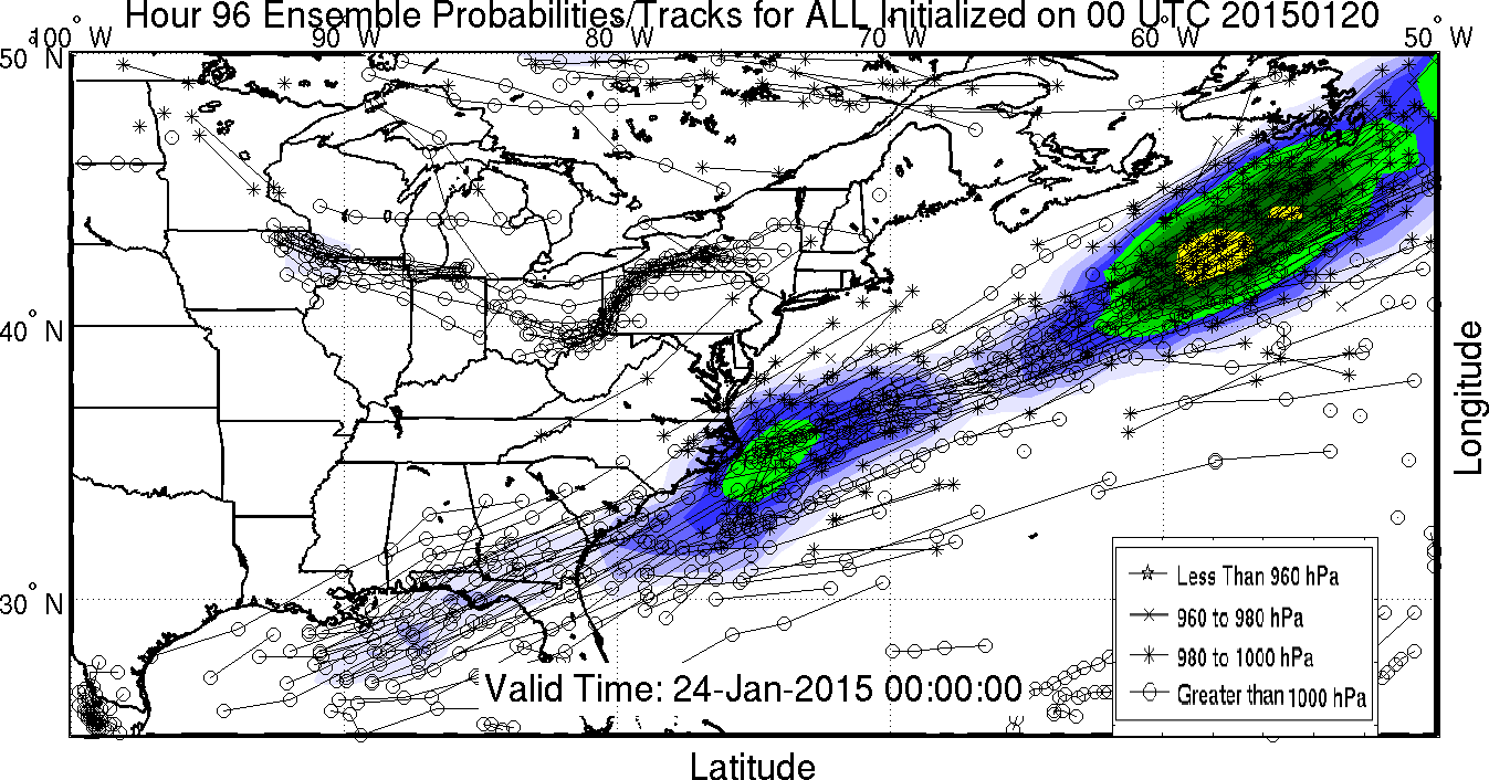
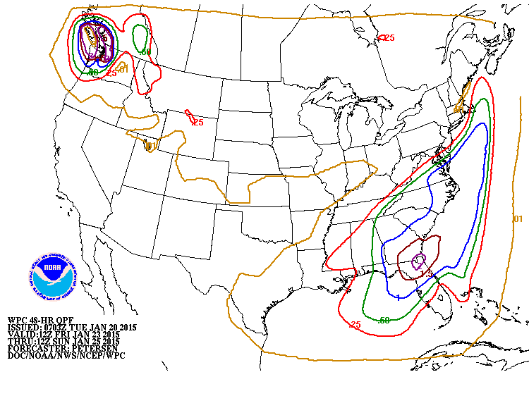
The track of the developing Low Pressure off our coast is also in question as Spaghetti models show about a 100 mile margin. A track more to the north and west would bring more precipitation to the area Friday and Saturday.
- Timing:
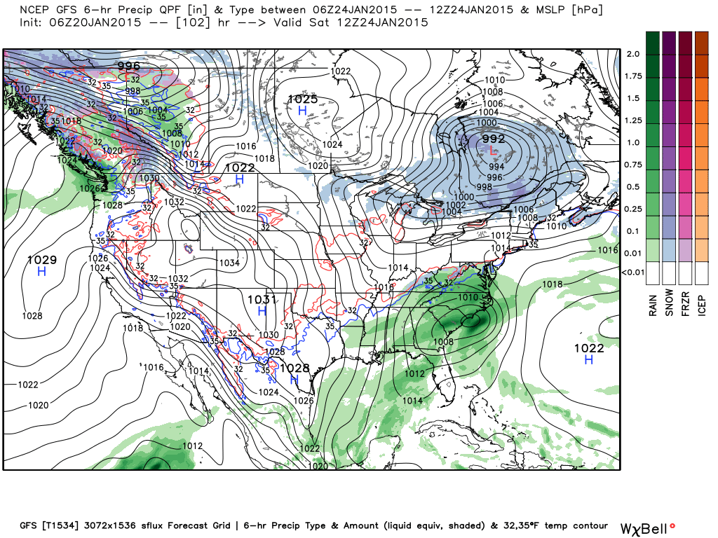
Low pressure passing just to our south is expected to strengthen off the NC coast Saturday. The precipitation shield entering into the area beginning Friday night, is forecast to be all liquid at this time as there is no parent High in place sending cold into the region. The higher elevations in the NW may see a wintry mix to mostly snow Friday night into Saturday.
Round Two:
An upper level system diving out of the NW has a good chance of running into cooler air brought in by the departing offshore storm. The timing for this event would be overnight Sunday into Monday morning. There is not as much available moisture to work with (around 1/4″ liquid) as in “round one” but enough to be a concern. Thermal profiles indicate a Snow/Sleet mix with the predominate Precip being snow. Another concern is ground temperatures as they will likely be in the low 40’s by the time this system comes around.
The Bottom Line:
This is a very complex set of weather processes coming together. Temps are forecast to trend down and two systems are entering the area on top of that trend. Flurries are already being advertised on Broadcast Media for Sunday Night and Monday, so we thought it best to provide you a worst case scenario so you can make your plans.

Surface (soil) temperatures will likely be above freezing so road impacts this far out cannot be determined. As we get closer to the weekend, confidence will increase and we will be able to give you more precise information. This forecast WILL change in the coming days. Meanwhile, you have this on your RADAR and there should be no surprises.
NC Weather Happens. Enjoy it!
Be sure to get articles like this in your email by subscribing at ncwxhappens.com…its free, No ads, and No spam but more importantly, No delay! We are also on Twitter @ncwxhappens.