
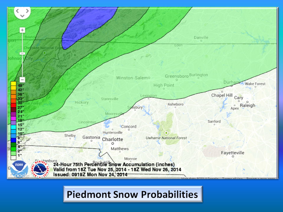

With about as much agreement as Congress, the main weather models are more of a hinderance than help. The 1028 millibar high pressure that is setting up to our north Tuesday and Wednesday is cold but not cold enough. Piedmont NC will see snow mixed with rain while the Mountains receive 4+ inches.
The North American Model (NAM) is featuring mostly a mountain snowfall event for Wednesday and Thursday.


The wintertime favorite (the European) model is featuring a mostly mountain snow with some flurries to wet snow in the Northwest Piedmont.
The outlier is the GFS model which brings in more cold air and brings it much farther east.

The Bottom Line:
This will be a fairly decent snow along the middle Atlantic seaboard from Norfolk to Maine. Our region in the NW Piedmont is right on the boundary of warm Gulf of Mexico moisture and Cold Arctic air and this is a perfect case where the moisture arrives before the cold.
If you will be travelling to points North of the Piedmont, please allow extra time and be very patient! If you will be staying in the area, be careful for Black Ice Thanksgiving morning especially on bridges and shaded areas.
NC Weather Happens is the perfect name for our weather as it changes on a dime all the time! We can’t do anything about so we may as well enjoy it!