
1/04/2015 9:20 am
Thunderstorm activity this afternoon to be highest East of the Triad.
The erosion of the cooler air locked in over the Piedmont is subsiding this morning with Highs rising into the 60’s (Greensboro and east) and 50’s (Winston Salem and west). Once again, our beloved mountains have taken some of the energy out of the front but as usual, it will develop again right over the Triad.
This afternoon, the Piedmont may hear some thunder and have some gusty winds, but any severe threat will be confined east of our area.
Weather Speak:
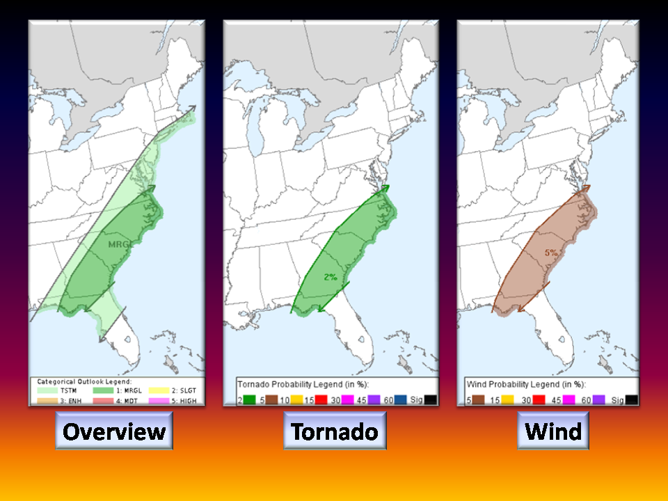
This is a High Shear Low Cape (HSLC) environment which is typical for winter thunderstorm activity. Given EHI values at or near 1, a rotating low topped supercell structure is possible and more likely to occur on the coastal plain (I-95 corridor). Highest CAPE values in the Piedmont range from 100 to 800 West to East with values of 400+ greatest again, on the coastal plain. In areas from the Triad and east, strong gusty winds are possible with a brief Tornado possible especially on the coastal plain.
Current Situation:
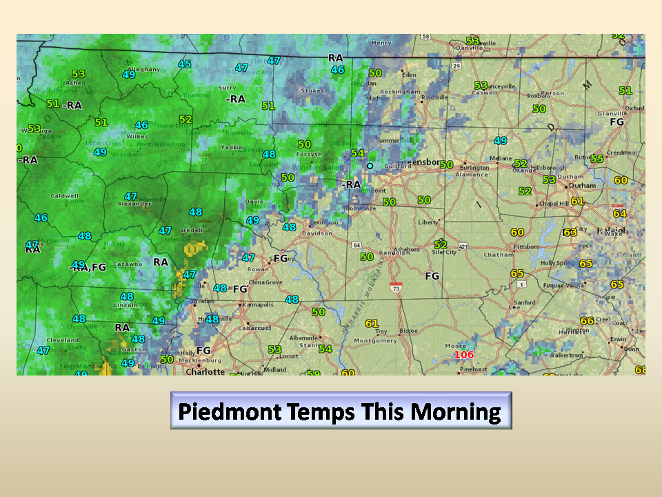
Areas of rain and fog persist this morning with fog going away by lunchtime. temps generally in the 40’s and 50’s with moderate rain entering the area from the south.
This Afternoon, please keep a weather radio handy and an eye on the weather if you are in the Triad and areas east. It might be a bumpy ride for a while…then the Weather “Chills Out” for us all..
NC Weather Happens. Enjoy it!