
Models are coming into better agreement this morning for the likelihood of some winter precipitation late this week.
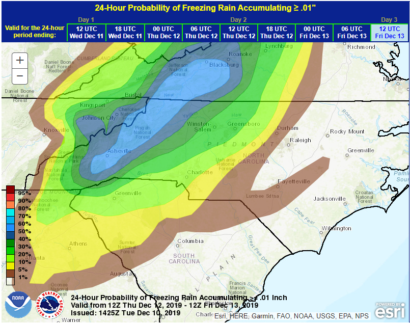
Arctic high pressure moving through New England will setup a CAD (cold air dam or Appalachian Wedge) into the region east of the mountains. This pool of cold air will begin to pull out to the NE just as deep Gulf moisture arrives Thursday evening.
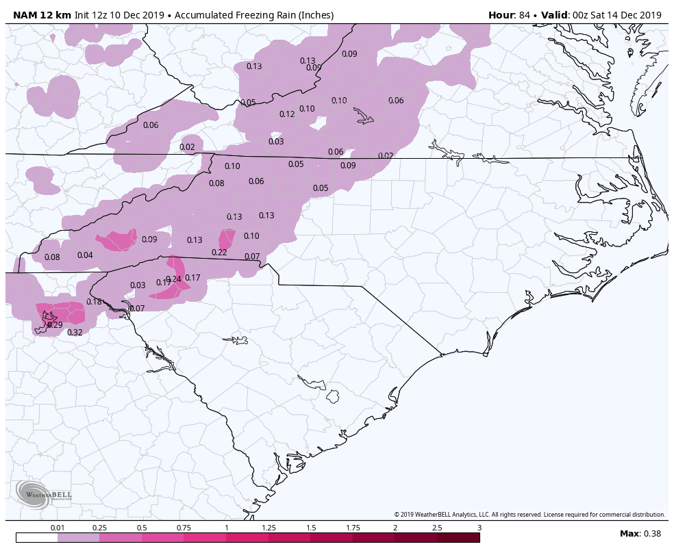
As such, warm air overrunning the cold surface air may make conditions favorable for some Freezing Rain to develop. Conditions will be most favorable along and west of the I-85 corridor to the mountains.
Impacts:
Impacts are expected to be low as a glaze of ice is possible on elevated surfaces and ONLY for a few hours. Think grassy areas, trees, and landscaping. Any ice that does develop will be light and as of this writing, should remain well below damage thresholds. Temperature at daybreak are modeled to rise above freezing so we are just looking at a few hours where some low impact issues can happen.
Mountains:
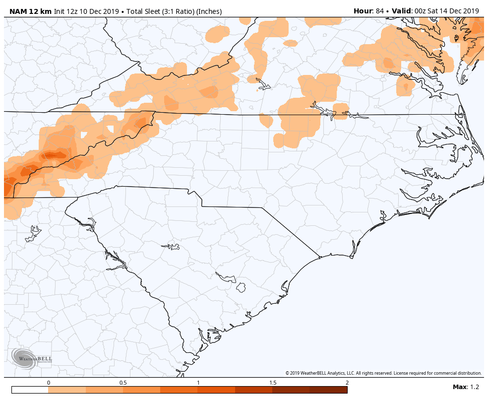
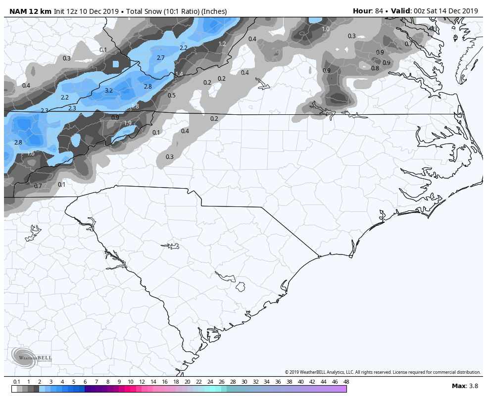
For our mountains, the western facing slopes along the Tennessee border can see a modest accumulation of snow and sleet. Elsewhere, a wintry mix is possible with Sleet, Snow and Freezing rain. Monitor local media for pertinent information regarding delays and closures Friday.
Piedmont:
Areas along and west of the I-85 Corridor may see a light glaze of ice on elevated surfaces overnight Thursday. Monitor local media for delays Friday morning. Conditions (if existent) will improve through the morning hours.
Coastal Plain:
No winter issues are expected and precipitation is expected to be all rain.
Overall, this “event” is not expected to be very impactful and mostly all rain save for a few hours where freezing rain might become a short term issue. If you will be travelling overnight in the affected area, please use caution. Remember as this is primarily a rainfall event, pre-treating the roads will be ineffective as the salt washes away. Monitor local media Thursday Night and Friday morning for any closing or delays.
By mid-morning, we should be all clear for a very rainy weekend with temps near normal and above freezing.