
Colder, Arctic Air returns late next week:
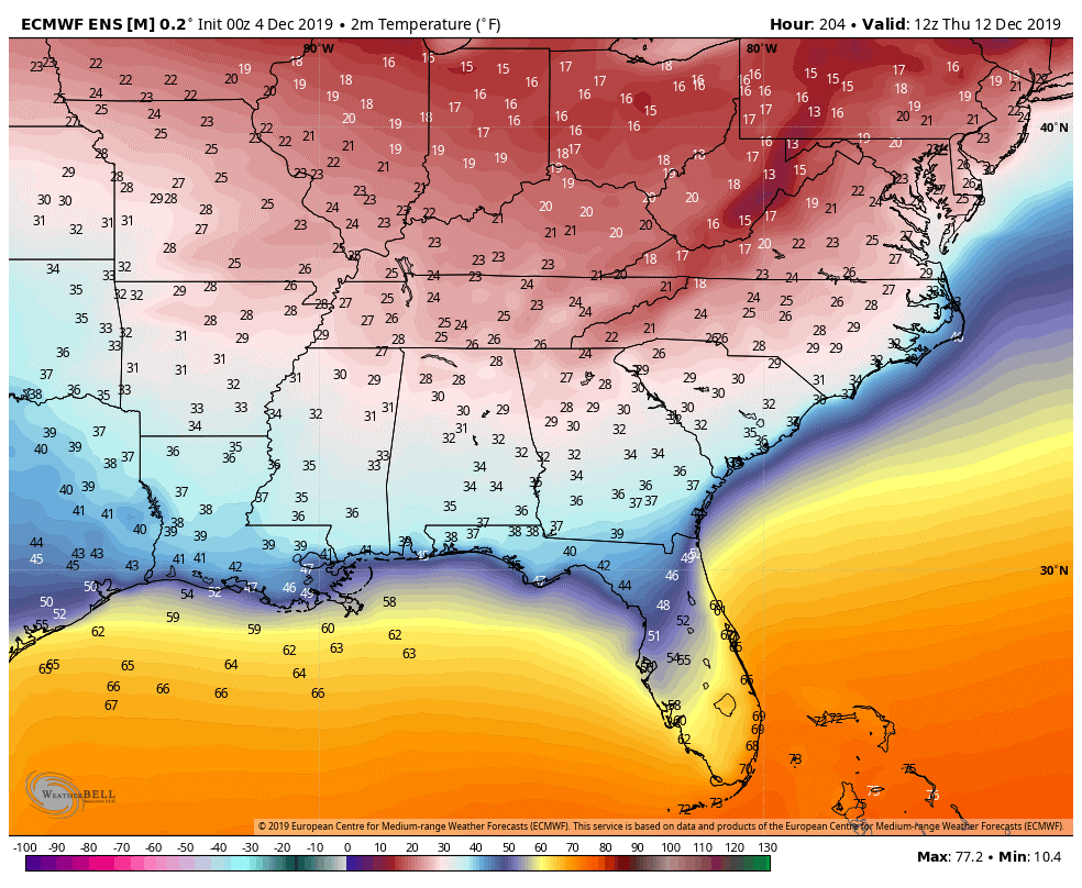
A disruption in the Polar Vortex (PV) will send some Arctic air southward late next week bringing surface temperatures into the teens and twenties. By now you have seen some social media posts about winter precipitation and we caution readers that specifics this far out are nearly impossible to pin down. What we can say is that the pattern for much colder than normal conditions is growing.
So will it snow?
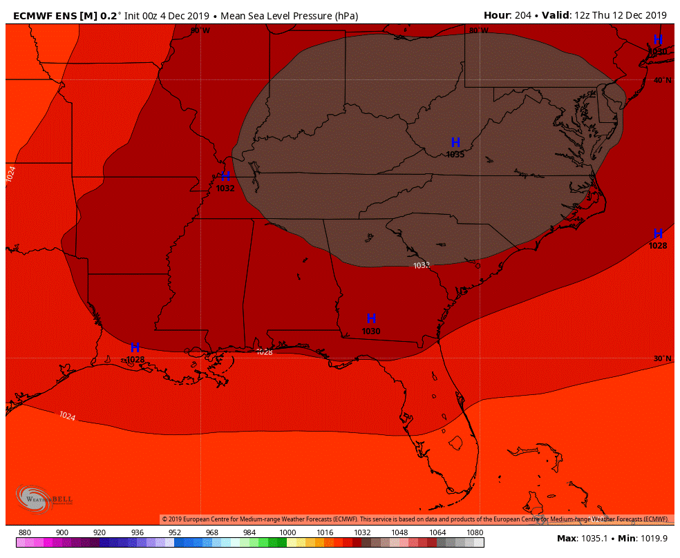
In setups like this, the air favors subsidence (descending air) so it will be hard to get precipitation. “It will be too cold to snow”…is the operative term here. Extremely high pressure will dominate the period with this particular model suggesting pressures as high as 1032 millibars. For reference, 1014 millibars is considered standard pressure so this will be on the high side. For those with aches and pains, Wednesday, Thursday, and Friday may be uncomfortable. Visit our Arthritis / Neuropathy (pain) page for details.
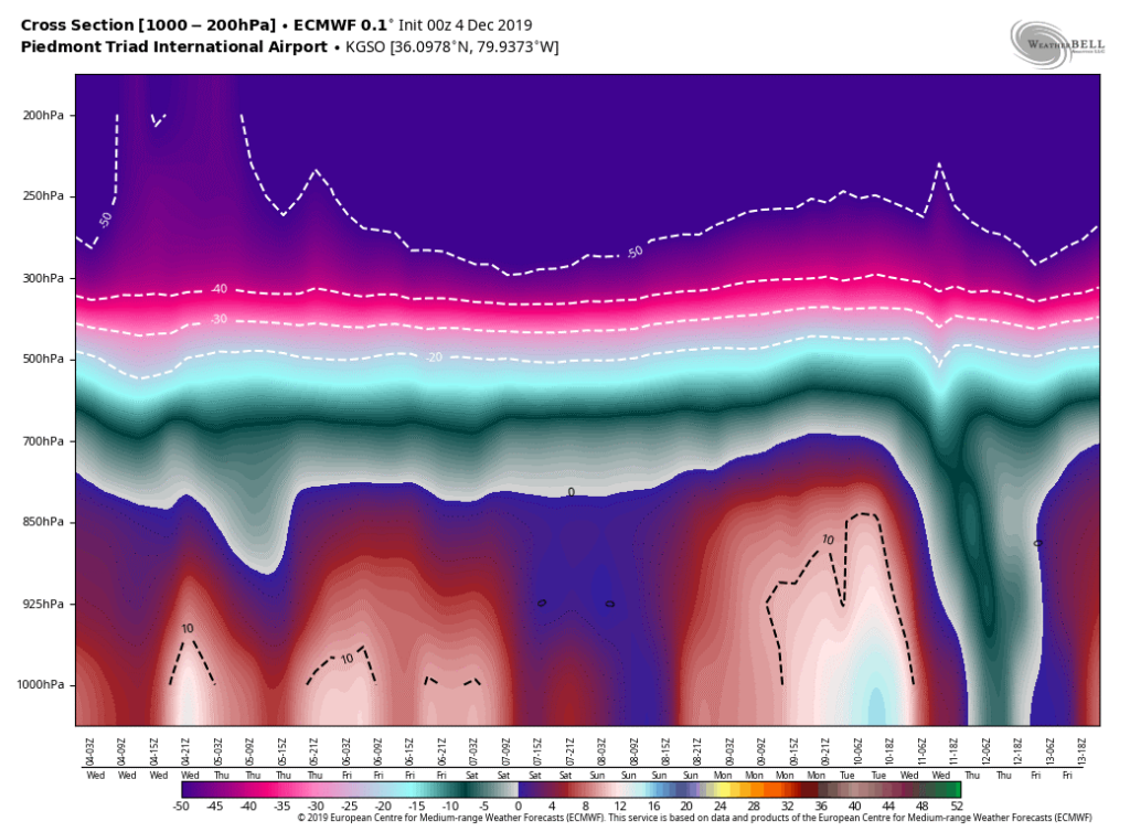
We don’t show this often, but the thermal cross section (for Greensboro, NC) clearly shows how deep the cold air will reach. The teal color reaches to the ground! It won’t be that cold on the surface, but it shows how strong the trough will be digging into the southeast.
White Christmas?
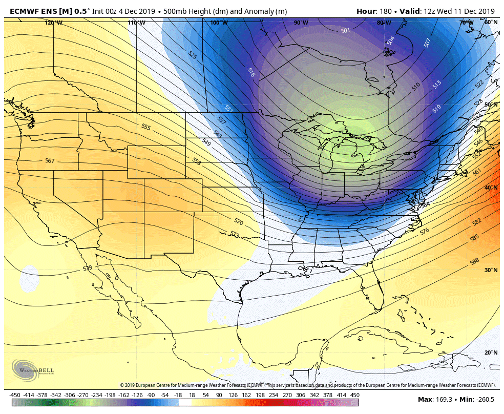
It is Waaaaay too early for any reasonable forecast however, we do see a trend towards a much cooler end of the month in global models. The month of December occasionally puts on a winter show here in North Carolina but our hard-core winter months are January and February. Still…it only takes one strong winter storm to make it an epic winter!
We are only getting the season started so hang on…it might get busy moving forward.