
The first week of March is coming in “Like a Lion” as the saying goes. We have Ice on the 1st, a little warm up the 2nd and 3rd, Rain and lots of it on the 4th with 60 degree temperatures, then a rapid cool-down with a good chance of a Wintry Mix on the 5th and teens for lows on the 6th followed by a nice weekend. WHEW!
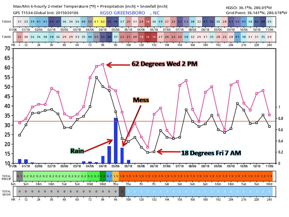
With Monday looking like our best day (comparing all models) we see rain entering the Piedmont Tuesday evening and lasting through Thursday evening. The Big News Maker for this week will be the High temps Wednesday that will generally be in the upper 50’s West and Low 60’s East. It won’t be a sunny day though, and we run a small risk for flooding as there is a lot of moisture flowing in from the gulf.
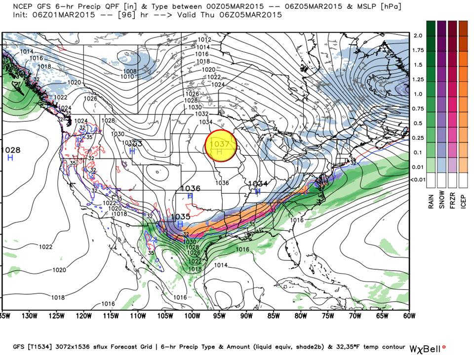
A Strengthening High Pressure coming over the plains, will filter in cold air about the time a strong southern stream front it passing through. Usually this spells convection (thunderstorms) but for the Central Piedmont the risk appears to be low. We do see a higher risk more on the Coastal plain east of the Triangle in the US-1 Corridor.
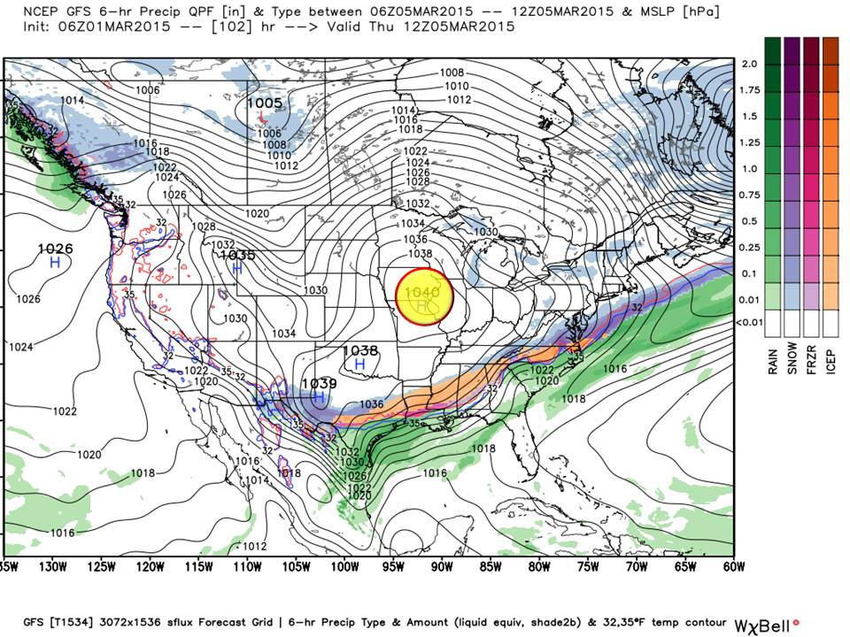
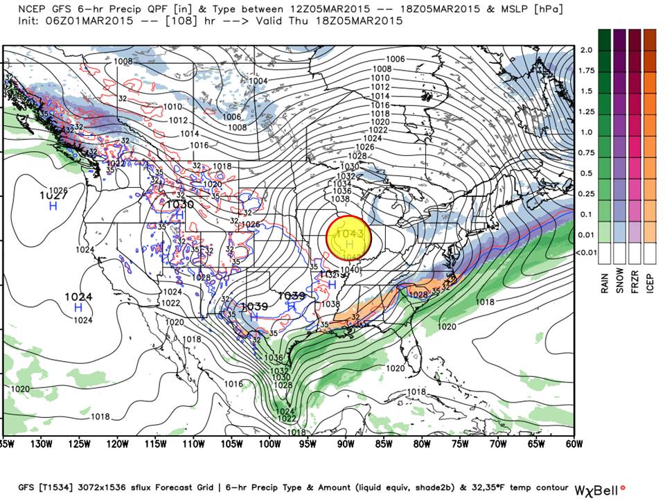
While this front is passing through, a sharp temperature drop can be expected. This overrunning of cold air over warm will squeeze the moisture out and we may see areas of wintry precipitation on the back-side of the front as it departs. Accumulation is shown to be light at this time.
Timeline:
What to expect:
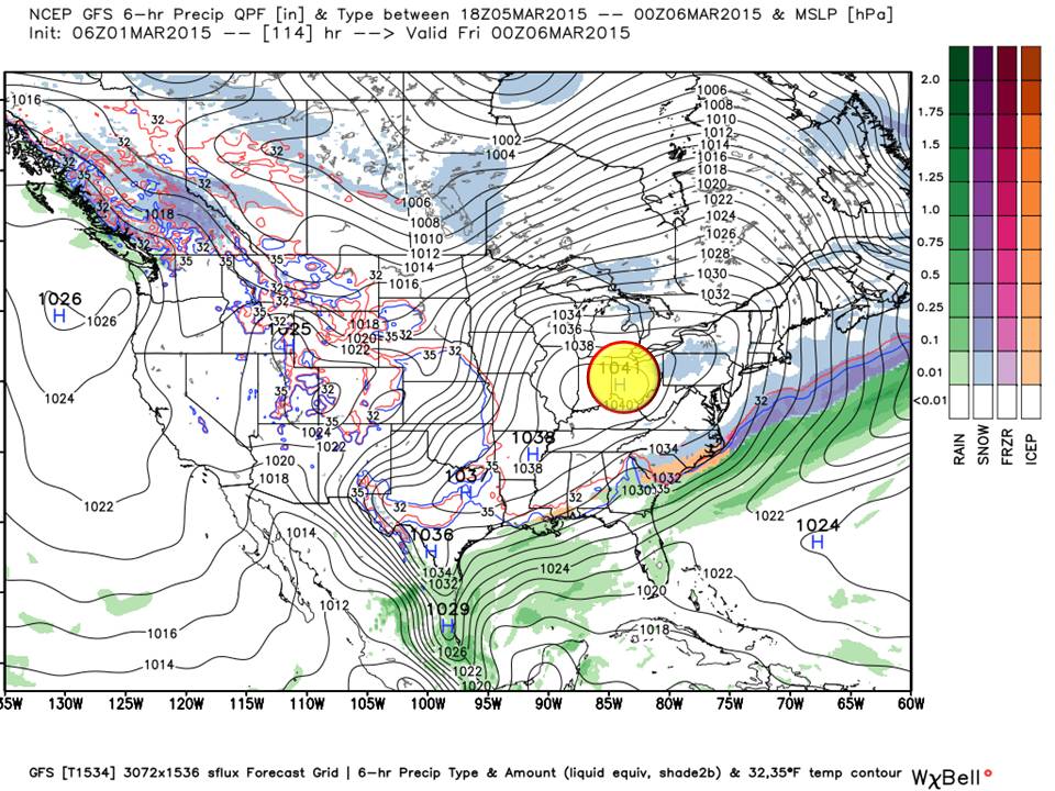
We have shown the GFS here to just get this event on your calendar. The EURO is trending more frozen precipitation into the Northern Piedmont but with overrunning cold as we see in this scenario, it seems to be overdone.
At this time we see a Wintry Mix for the Piedmont with better chances over areas that have seen recent snowfall and still have it on the ground.

This is just another example of “Cold chasing Rain” in our most likely outcome. Accumulations are not possible to predict this time but rest assured we will be watching this the next few days. Short Range models will begin picking up this Piedmont system Tomorrow.
Looking ahead:
The weekend looks to be seasonal for the first of March (meaning right around normal) with highs in the 50’s lows in the upper 20’s.
For our Newcomers:
A survey sent out in December indicated that folks just wanted to know what was going on with the weather and most didn’t care for all the jargon. If you would like to discuss Isentrophic Lift, Southern/Northern Stream phasing, teleconnections, or Lapse rates, …we always offer the option of a private message…an it is used! Here at NC Weather Happens all of that is boiled down into a forecast you can depend on…
- We also don’t introduce our personal bias in weather. Recently you probably saw forecasts for 14-18 inches of snow in the Piedmont and a half-inch of Ice today.
- We don’t “Wishcast” meaning adding 2-5 inches to a forecast because we like snow.
- We don’t “Shockcast”. Headings in all caps (DANGEROUS WINTER STORM AND EVERYONE WILL DIE) are for those that want to be liked and take your money someday.
- We don’t “Hypecast” meaning that we make the forecast more than it is or show you wild scenarios that might happen.
- We don’t frighten you with “shock and awe” with a forecast and we help you to decide how best to prepare.
- We bring fresh insight to the weather and cover all sources of information providing that to you when it is available.
- No matter what others say, every forecaster follows models, but the skill is in their interpretation.
We bring you the weather as it is. It will change. You live in North Carolina, so you know it does! The NC Weather Happens’ track record is nearly 2 decades long so welcome aboard!
The Bottom Line:
We have a wild weather week. Nothing extreme but typical for early March. As we receive more information tomorrow, you will be the first to know.
NC Weather Happens. Enjoy it!
Be sure to get articles like this in your email by subscribing at ncwxhappens.com…its Free, No ads, and No spam but more importantly, No delay! We are also on Twitter @ncwxhappens.
If you are interested in advertising on this high volume webpage, please send us a note and we’ll send you some information.