
When is the best and earliest time to get those spring plants out? Are we going to see any more snow? When will winter be over?
- Garden plans all worked out…Check
- Spring planting scheduled…Check
- First trip of the season planned in the RV…Check
- Put away the snow shovel…Check
This has been a strange and very unpredictable winter with the term “Nowcast” being thrown around all season. Models last year could tell you 14 days in advance what was going to happen, and it turned out to be on forecast. This year, beyond 3-5 days we could only guess! Now we have a latecomer to the winter game…
Greenland Blocking.

This is an atmospheric mechanism that usually sets up in January where a High Pressure dome essentially keeps winter weather over North America. Cold air from the Arctic is “blocked” sending it further south and then back over the pole. This year, the High never really set up so all this winter, we missed many snows and brutal cold outbreaks… they just went out to sea into Europe. Our winter weather nemesis was a more southern High Pressure dome moving between Bermuda and Florida. This kept us warm and also funneled south Atlantic moisture north. Witness the New England snow fall this season!
Greenland Blocking has returned…a little late, but still enough to prolong our winter a few weeks. (Thanks Phil).
The Next 14 days:
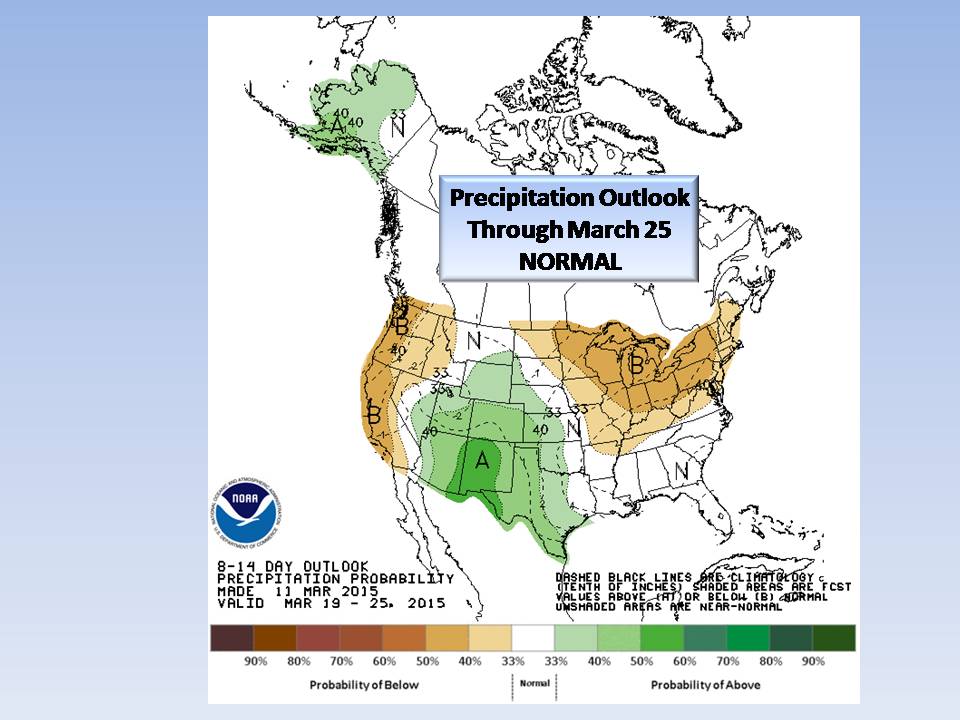
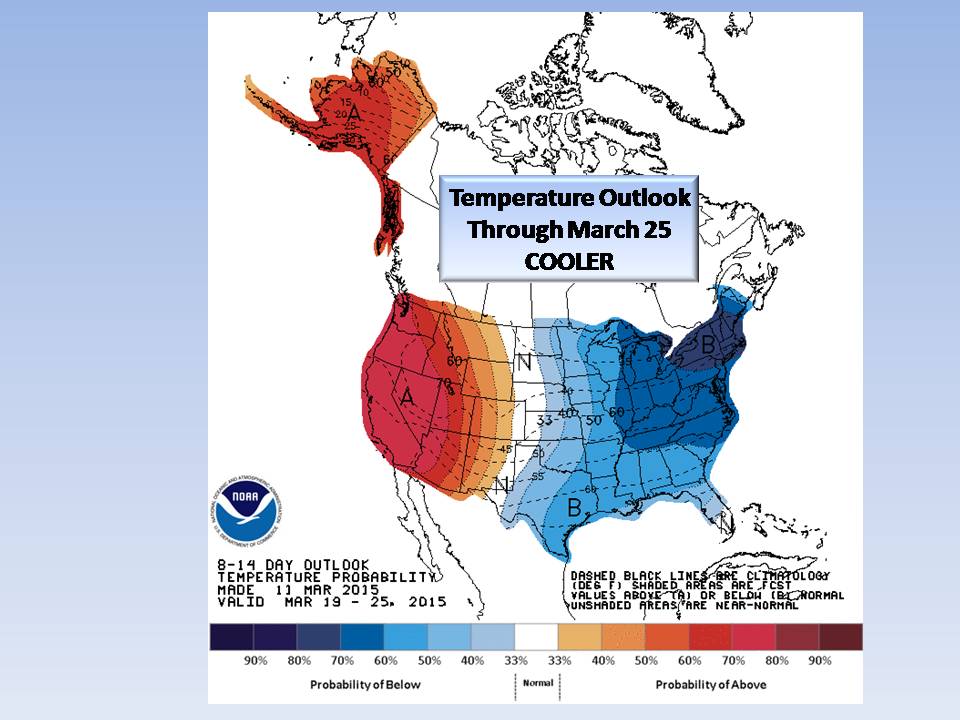
We are looking at cooler temperatures and normal precipitation. What does this mean?
If you are putting in plants that will be subject to frost, here is your calendar.
Dates for overnight freezing:
- March 18 through March 21. For the Piedmont, we may dip into the 20’s especially in the Foothills.
- March 22, a brief warm up but hold out…
- March 24 through March 27 will again be cold with temps near (or below) freezing.
- March 29 and 30 also look below normal which for the Piedmont will be near freezing.
- March 31 through April 9 look to be near to above normal for the Piedmont.
Statistically, our last frost (for the Triad) is April 22…
Are we done with Snow?
We are in an interesting pattern shift (blocking) but as it is so late in the season, it just doesn’t appear likely here in the Piedmont. As we have seen all season, if it appears likely, you will be the first to know! Snow cannot be ruled out so stay tuned.
Bottom Line:
We are heading into Spring and this is transition time. It looks like winter will hang on for a few more weeks, but by Easter weekend, we should be in the home stretch. Now here is the kicker… we are 10 days from Spring so almost ANY front that comes through with drastic temperature changes could bring us severe weather.
NC Weather Happens is moving out of “winter mode” and into “storm mode” at this time. We’ll still keep an eye on winter but it is fading away. You have the dates above so use them as a guide for your Spring Planting. When weather looks like it will be interesting, we’ll let you know!
NC Weather Happens. Enjoy it!
Be sure to get articles like this in your email by subscribing at ncwxhappens.com…its Free, No ads, and No spam but more importantly, No delay! We are also on Twitter @ncwxhappens.
If you are interested in advertising on this high volume webpage, please send us a note and we’ll send you some information.