
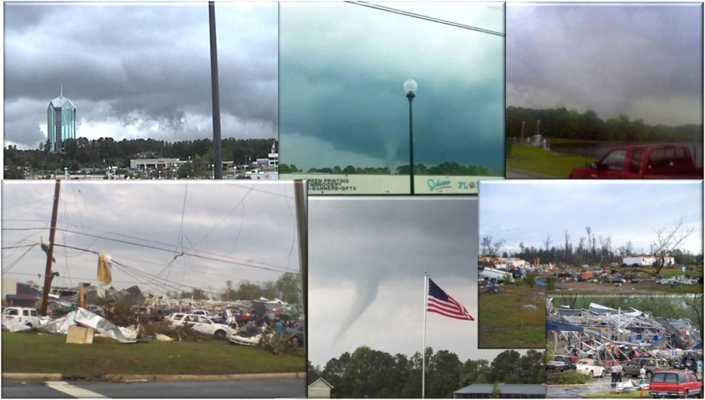
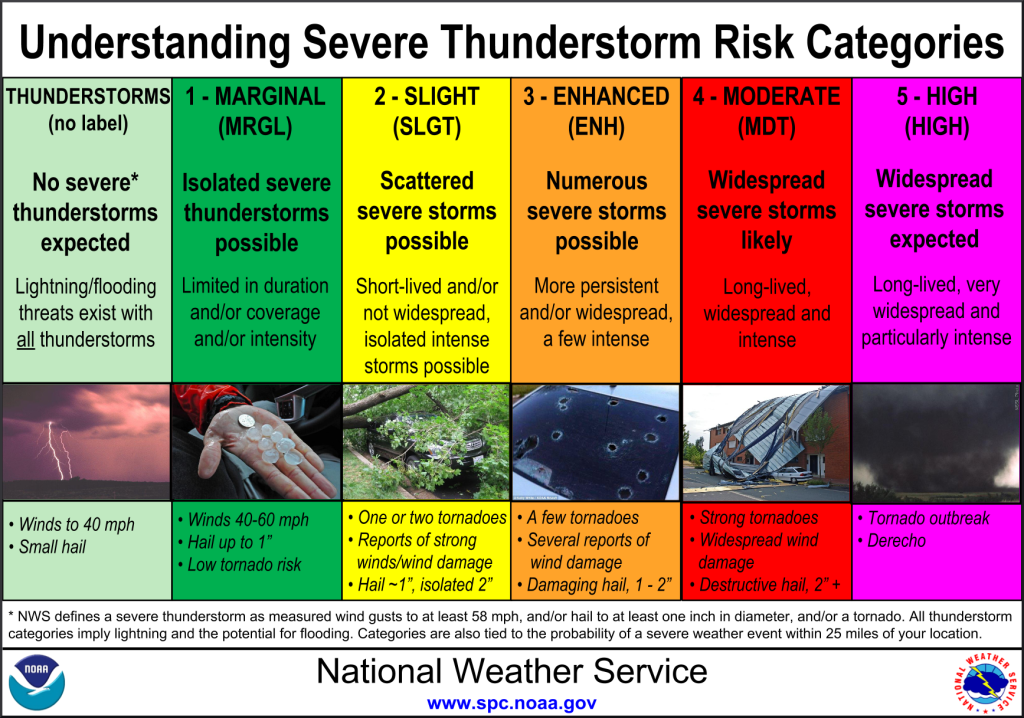
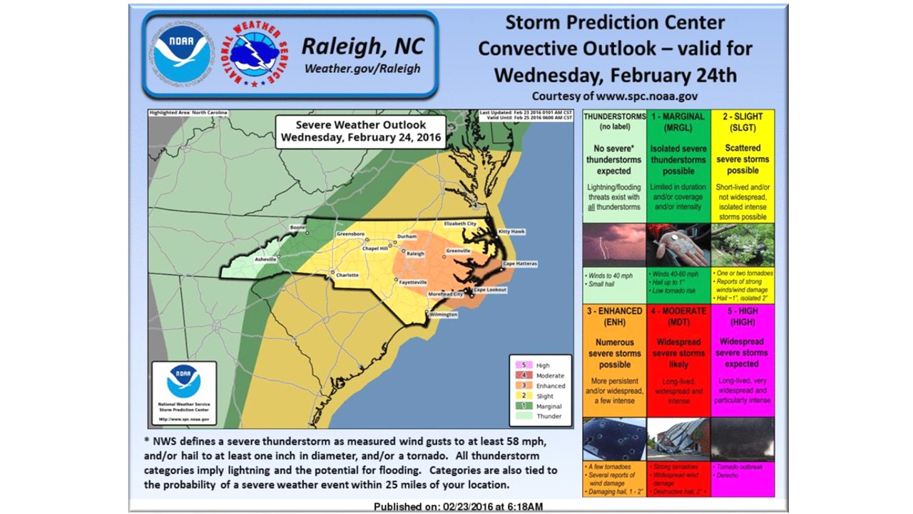
At the time of this writing, there is exists a severe weather threat for North Carolina Wednesday. The Storm Prediction Center (SPC) has the majority of the state in a Slight Risk with an Enhanced Risk for portions of the coastal plain. Shown below are some of the risks associated with these classifications:
The Setup:
Significant Tornado Parameter (STP), Helicity, Lift, Temperature, and Dew Point as well as Convective Available Potential Energy (CAPE), Shear, Supercell Composite Parameter (SCP), Bulk Richardson Number (BRN), and a few more indices, seem to be coming together during the heat of the day creating a very unstable atmosphere. I wanted to show you some of these without going into jargon.
A strong low pressure system will move into the plains with a trailing front passing through NC midday Wednesday. A warm front will move cooler air out of the state from south to north about the same time as the front arrive. Great instability will be present and we run the risk of strong to severe thunderstorms with embedded tornadoes possible and straight line winds. Isolated discrete supercells are possible ahead of the front, so it will be a very busy day.
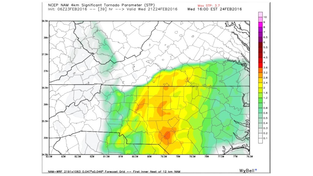
A majority of significant tornadoes (F2 or greater damage) have been associated with STP values greater than 1.
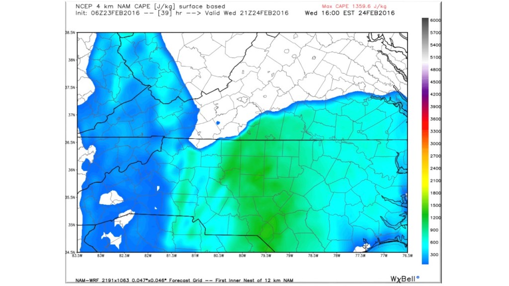
Cape Values under 350 are typical for a garden variety thunderstorm. Values over 1000 indicate a lot of energy available to produce thunderstorms with severe potential.
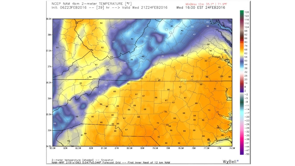
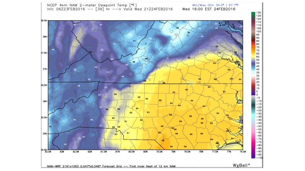
Temperature and Dew Point values for peak heating times of 3:00 – 4:00 PM show there is a warm soupy atmosphere to add fuel to our approaching front.
Bottom Line:
We can have severe weather outbreaks anytime of the year so this coming in February is not uncommon. Please take note of your surrounds and identify a safe location where you can ride out the storm when a warning is issued. Please keep local media or a radio handy so that you can receive any warning information
Regardless of severity or even a passing rain shower…following this front will be high gusty winds. With saturated soil, winds will likely topple some trees so we may have to manage some power outages. Stay tuned to our Watch/Warning page or weather.gov for late-breaking information.
NC Weather Happens!
Be sure to get articles like this in your email by subscribing at ncwxhappens.com…its Free, No ads, and No spam but more importantly, No delay! We are also on Twitter @ncwxhappens.
Advertise your business on this high volume webpage. Send us a note and we’ll send you some information.