
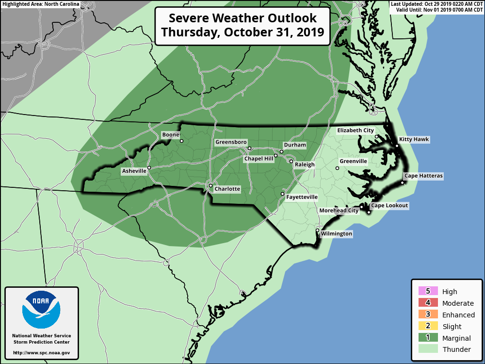
Weakening high pressure will allow a warm front to bring ample rain to the state through Thursday. A strong cold front will pass through Thursday Night bringing a severe threat followed by the coldest air of the season.
Strong / Severe Thunderstorms Possible Thursday Night.
With the frontal passage Thursday night, strong to severe thunderstorms will be possible especially in the Western Piedmont.
“Thunderstorms are expected to develop along and ahead of a cold front crossing the region from the west Thursday into Thursday night. These thunderstorms may become strong, especially east of the mountains during the afternoon hours. Frequent cloud-to-ground lightning, gusty winds, and torrential downpours can be expected with any of these thunderstorms. A few may produce damaging wind gusts, and an isolated tornado cannot be ruled out. The greatest chance of heavy rain and associated isolated flooding will be over the mountains, while the greatest chance of isolated severe thunderstorms will be over the Piedmont, especially near the Interstate 77 corridor late Thursday.” – NWS – GSP Hazardous Weather Outlook
Forecast
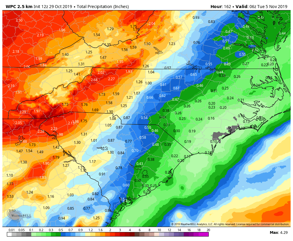
Today will be cloudy but warm with highs generally in the 70’s. Rain should begin to filter in overnight becoming scattered Wednesday and Thursday. Remain weather aware overnight Thursday for strong to severe thunderstorms moving from west to east. Friday will be clear and MUCH cooler.
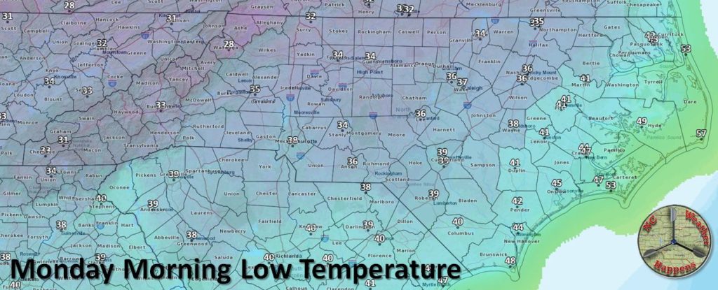
Dew points following the frontal passage will fall from the 70’s into the 30’s Friday leaving plenty of room for overnight temperatures to flirt with freezing. The coldest night of the period will be Sunday where Monday morning temperatures will be near freezing for much of the state. Expect Frost/Freeze Advisories to be posted by the NWS.