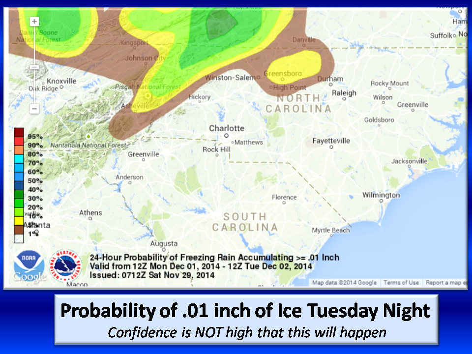
Watching for Potential of Light Ice Glaze on Tuesday.
Monday will be our warmest day in a long time with highs in the upper 60’s. A strong high pressure system over the great Lakes will send cold air down the eastern side of the Appalachians (Cold Air Dam). Tuesday a front will pass into our cooler air giving us the possibility of some ice.
At this time confidence is very very low that this will happen as the arriving front is expected to be starved of moisture…thus the low accumulation of .01 inches. The upper air dynamics show warming which melts frozen precipitation before it can refreeze, so in this case, it hits the ground and then freezes (freezing rain).
As you know, the threshold for nasty ice here is .25 inches which brings down tree limbs and power lines. This system is nowhere near that, so we should be ok.
This far out it is really to early to call, but it is on the RADAR nonetheless, so keep Tuesday’s plans flexible and of course, stay with NC Weather Happens for updated information.
On another note, the NC Weather Happens refrigerator died and needed emergency replacement so we have not completed the December Outlook as promised. Look for that later today.
Whew! NC Weather Happens. Enjoy it!


