
The Setup:
The rain that passed through our area Saturday, is expected to stall just off our coast. Meanwhile, a moderately strong Cold Air Dam will setup here Monday giving us highs generally in the 30’s. The coastal Low offshore will strengthen and begin moving up the eastern seaboard.
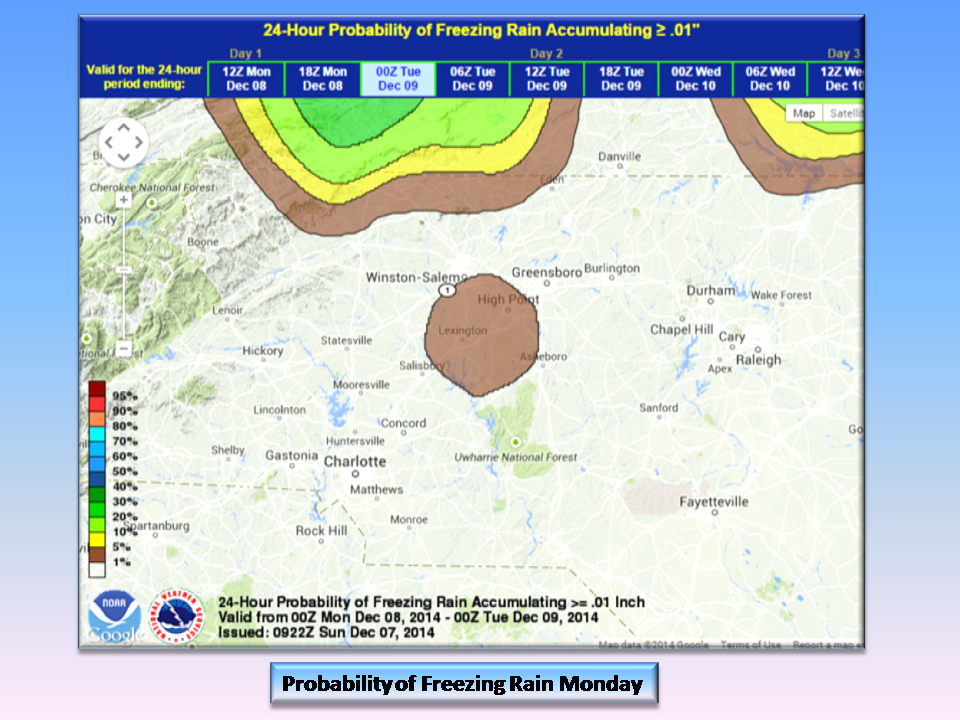
For us, this is another case where there just won’t be much precipitation to work with and the timing of the Cold Air Dam reducing us to that shady “MIGHT” area of a forecast creation. NC Weather Happens is seeing a small chance for Freezing Rain here as is NOAA, so it’s a good plan to let you know.
 We see in this image the GFS model which is suggesting less than .03 inches of freezing rain. That is barely a glaze and would be visible in trees, grassy areas, and your picnic table. Roads shouldn’t be an issue as ground temperatures are above freezing.
The big news will be the cold and wind. Wit Temps in the mid 30’s and 10-15 mph winds, we are going to really feel the cold as wind chills dip into the upper 20’s.
Looking Ahead:
Updated models will be out tomorrow that will give us a really good glimpse at the Holidays. Once we have a chance to ingest and digest the information, you will be the first to know! As Always, NC Weather Happens. Enjoy it!

