
Chances are better this year than in previous years and we give it a 20% chance!
For the weekend expect only minor weather related issues if any. We are still looking at a cold rain event with areas north and northwest of the Triad having the best chances of seeing a light winter mix. Ground temperatures remain too high for any accumulation so any winter mix that does fall, will instantly melt.
Christmas Eve we are looking at periods of heavy rain and gusty winds followed by a rapid cool down. Any precipitation in the area after the front passes through may be frozen. At this time confidence is LOW that that we will see winter precip, but it is a holiday and travel plans may be affected.
Bottom Line:
This weekend:
- Very low impact weather for the area with light rain with a snowflake or two in areas northwest.
Christmas Eve:
- Strong weather system will bring heavy rain and wind gusts to 35.
- Later in the evening, precip MAY be in the form of snow…at this time it’s our same old problem of “Cold chasing Rain”.
- Too soon to discuss accumulations or types of precipitation at this time.
- System needs close monitoring and once medium range models pick it up Saturday, we will be able to talk more about this. Stay tuned!
Christmas Day:
- Any precipitation should end by daybreak. Winds should increase throughout the day and advisories may be needed.
The Christmas event is unfolding rapidly and needs close monitoring. Updates will be issued as needed.
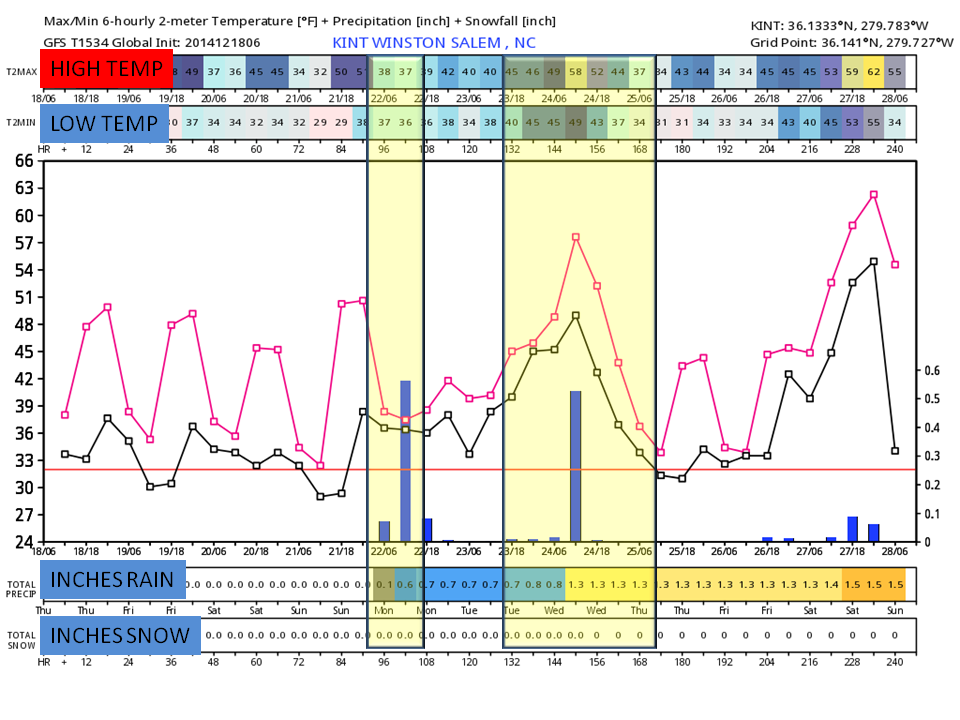
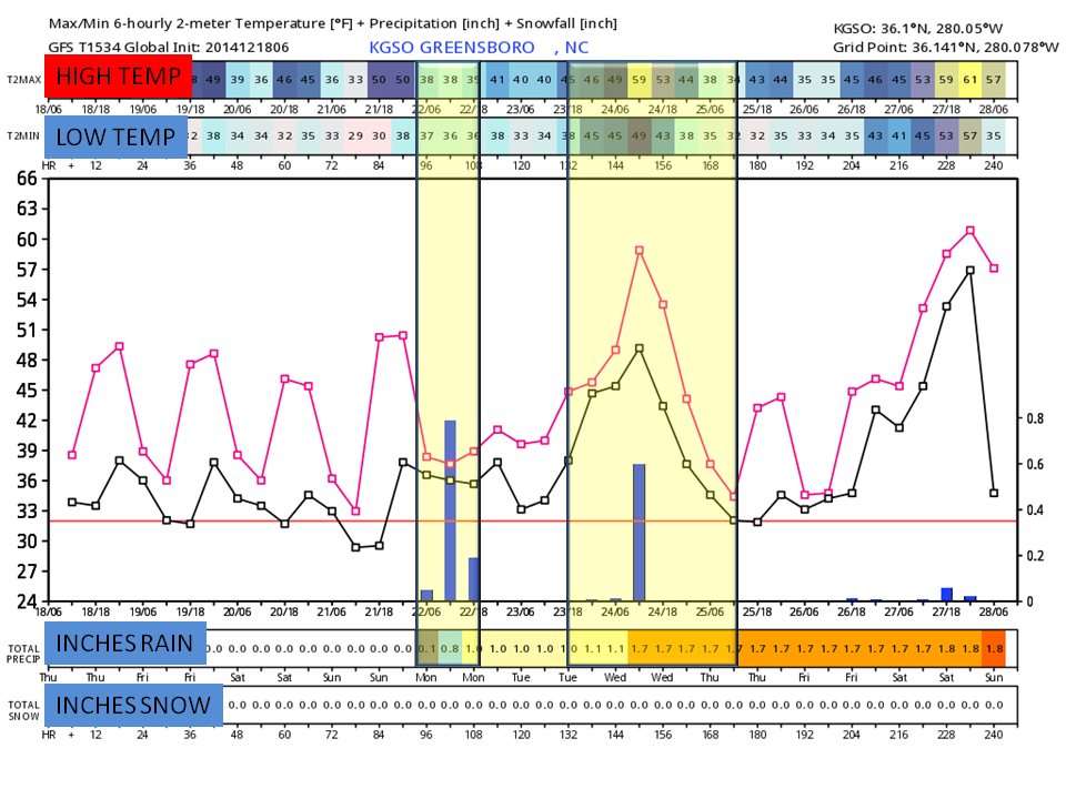
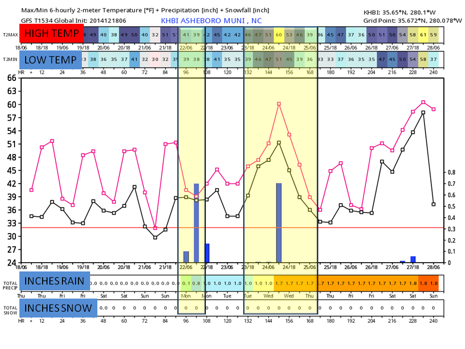
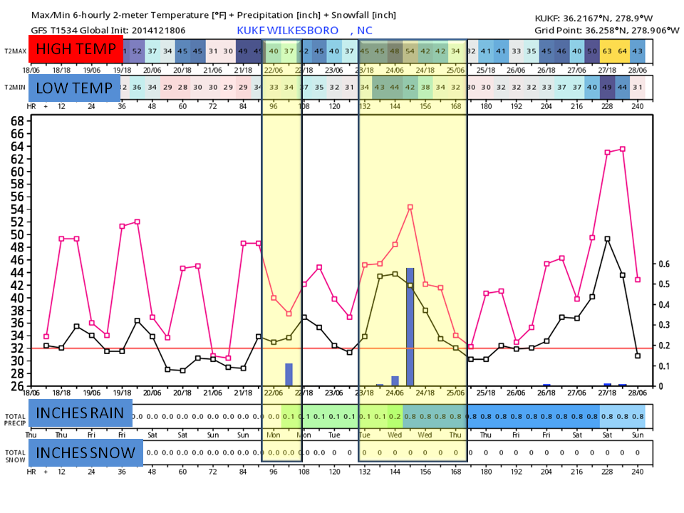
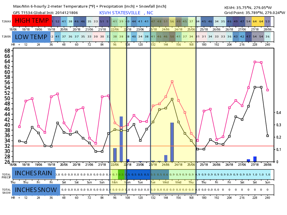
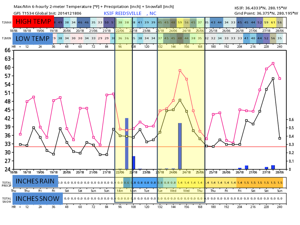
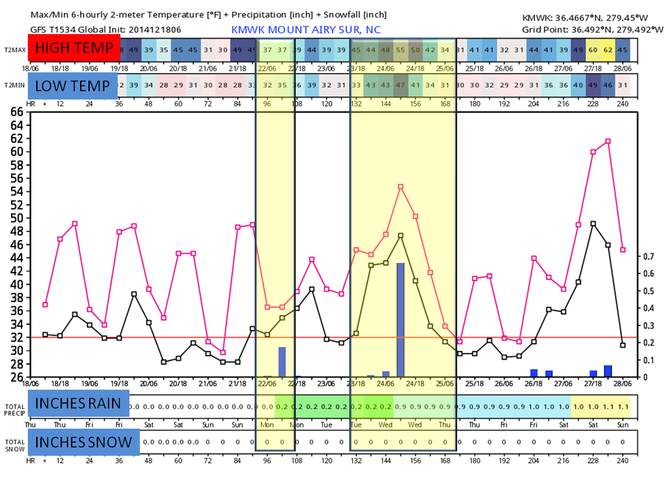
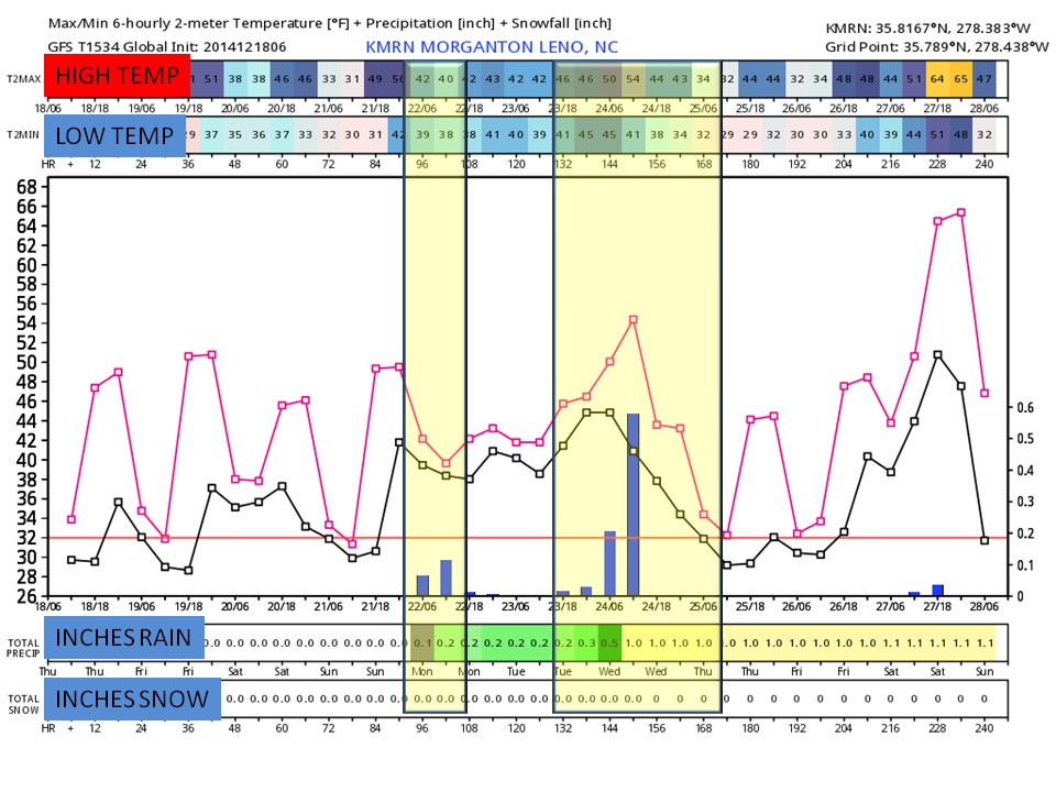
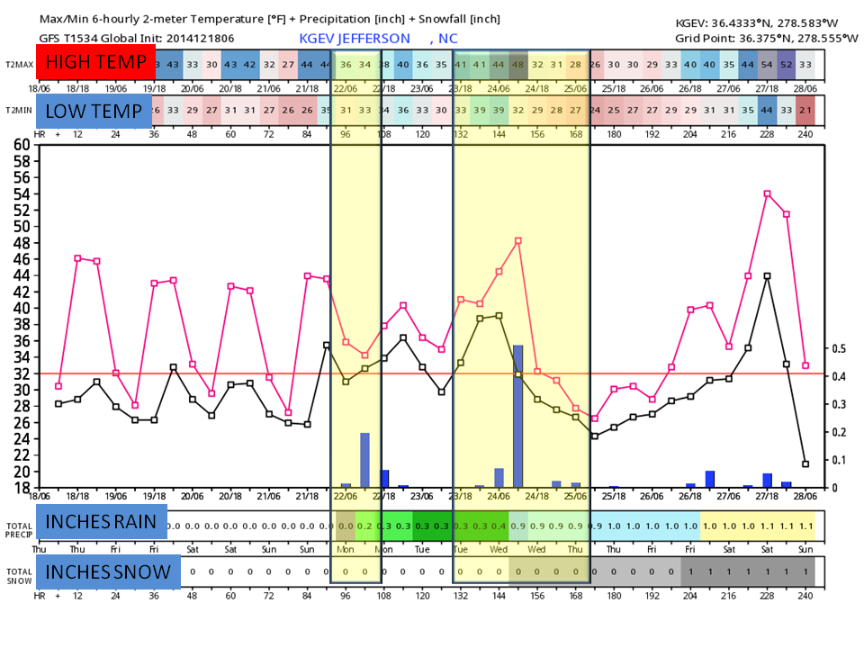
Your Temperature and Precipitation Profiles for the Week Ahead.
Find your town: (Charts have been highlighted to show this weekend and the holidays).

As we approach the Holidays, our attention turns towards the weather as we all wish for an old fashioned White Christmas. Our Christmas lights glistening in the snow is a wonder to behold!
If mother nature can time this right and bring in the cold air along with the precipitation, we may just get that wish. In the current pattern, our mountains appear to be preventing the cold air from getting into the Piedmont. A more eastward track of the storm will give us the cold…and give us some snow.
NC Weather Happens. Enjoy it!
Don’t forget to Subscribe.