
01/05/2015 – 9:30 AM
The trend towards periods of Cold and Precipitation in the Southeast is now easily visible.
What we are seeing in the medium and long-range:
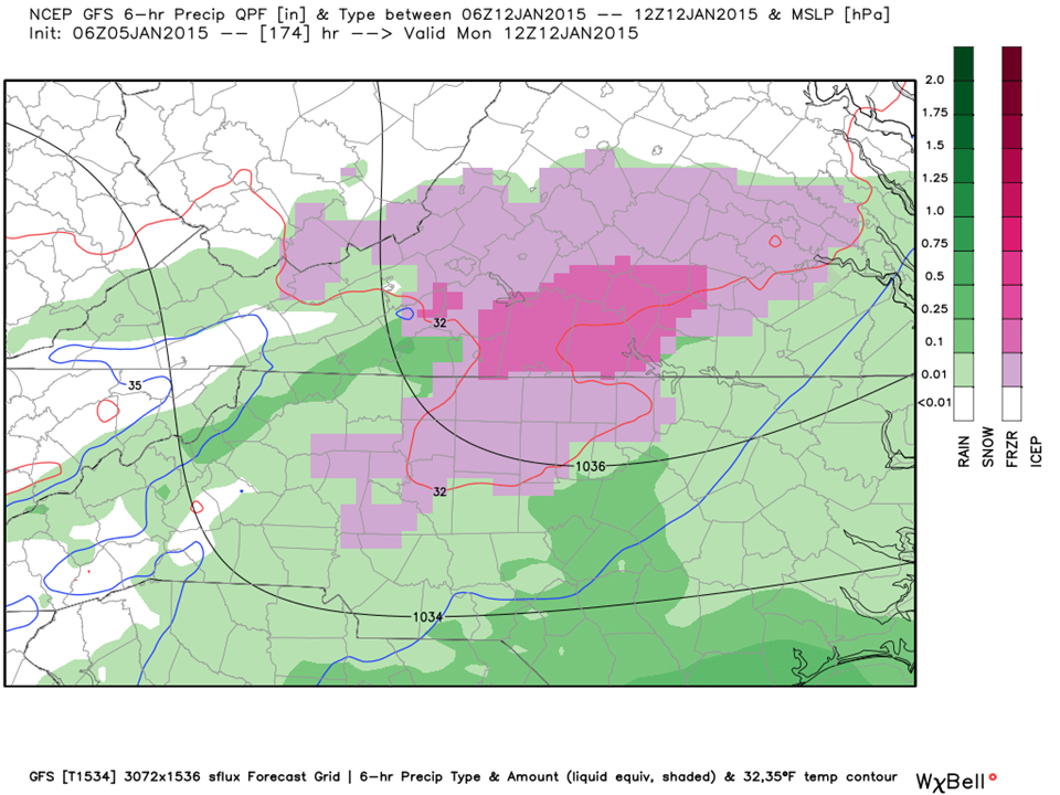
Incredibly strong 1040+ mb High Pressure domes are setup to “train” out of the Yukon bringing the Piedmont cycles of cold. Meanwhile, the Southern stream Jet continues to being us moisture out of the Gulf of Mexico. Bringing these two systems together is what we are watching for and we have a really good opportunity Sunday 1/11 and Monday 1/12 (and possibly another on the 18th).
On the tail of this weeks Arctic Blast will be an upper level Low Pressure system coming out of the Gulf into the Carolinas. The cold air will be moving out at the same time as warm moisture arrives. This scenario typically brings us Ice rather than snow.
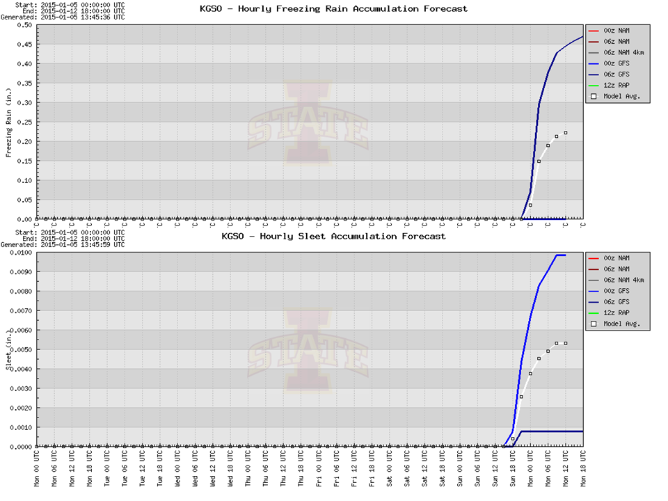
At this time, our first real opportunity for frozen precipitation appears to be in the form of Sleet and Freezing Rain.
The initial meteogram shown here has Greensboro with .25 inches of Ice. Don’t lock in on that right now as it will fluctuate widely this week. At 8 days out it is too early to mention any accumulation but we are concerned with what we are seeing as an Ice Storm is not good in any amount!
Regardless, we will be watching this for any developments and let you know when there are. Keep Sunday and Monday on your RADAR for winter weather at this time.
NC Weather Happens. Enjoy it!
Receive articles like this in your email by subscribing at ncwxhappens.com or following us on Twitter @ncwxhappens.