
- Posted: 1/15/2015 5:45 PM
- Expires: 1/16/2015 5:45 AM
- Weather Model Discussion and NOT a Forecast
The last week of January looks really interesting with Polar Cold and a modeled Gulf Stream Low…a favored combination for frozen precipitation.
- Between today and the 22nd, we should have seasonal weather with generally normal temperatures and a few small chances for rain. Then the Cool down begins.
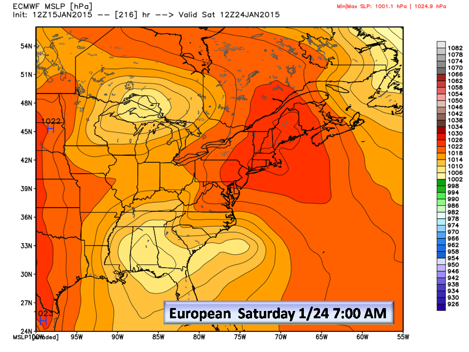
- How it looks this evening (which is why we have an expiration date) a piece of Polar Cold (not ready to call it a vortex) will begin to slide into the US. Meanwhile, a low pressure in the deep south will develop moving across the Gulf Coast and then NE.
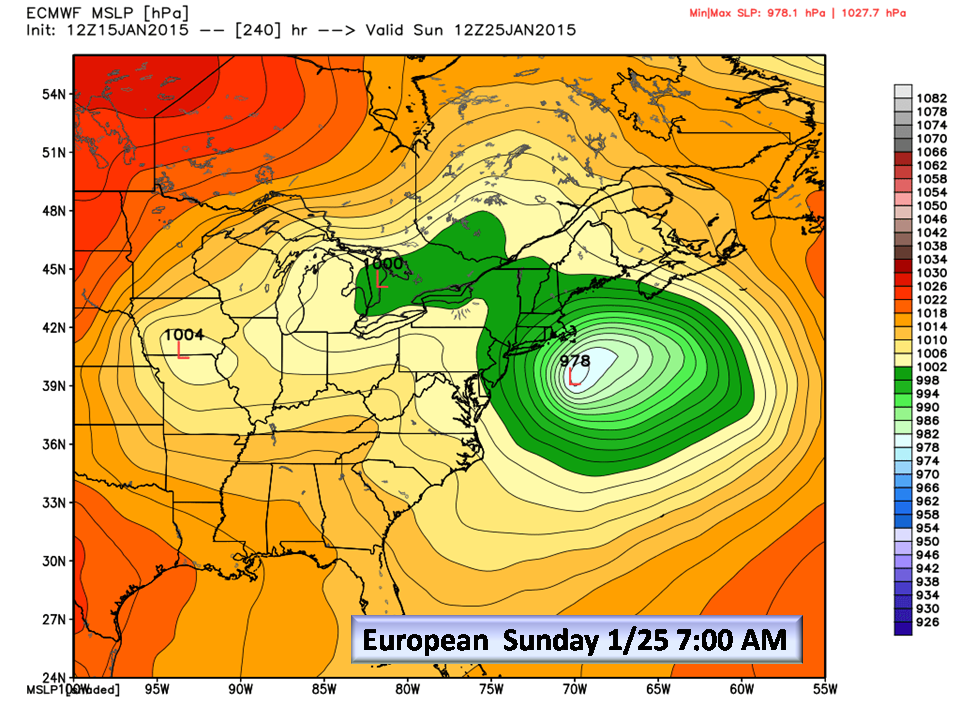
- We have 3 major medium-range models and they each have different scenarios…one of which gives the Piedmont a significant snowfall.
- Other models are processing at this time so current data is unavailable.
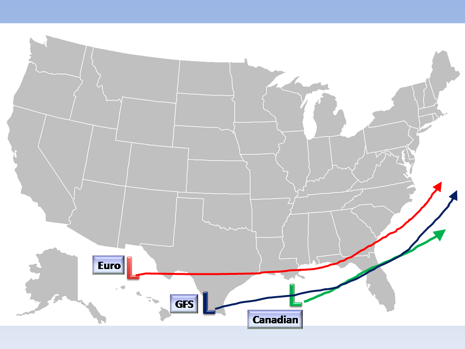
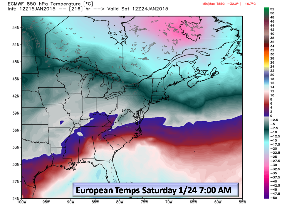
Examining the European, Canadian, and the GFS we see 3 very different solutions. Right now, the GFS and Canadian are interesting… The GFS has been trending the storm track more south and tonight has brought it northward, while the Canadian has only picked it up today. The European has also been trending more south…and a more southern track (but not much) would be ideal if you like snow!
Here is what is very interesting… All the models agree on at least something! A first for this year beyond 3 days!
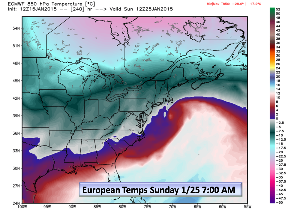
The most likely scenario in our sample would lean more towards the European (and the latest GFS is also trending towards that solution). It has done best this year with thermal solutions and only in the past week has it performed decently in the modifying southern stream. Not throwing out the other two models, but they are beginning to catch on to the flip-flopping teleconnections (which either are or trending towards a southeastern winter) and it appears that the GFS is seeing these right now.
So we have an approaching Low pressure system…All we need is some cold.

Now it looks like we have some cold to throw in the mix.
There are hosts of problems, but the big one here is 12-18 hours. The Euro is running a bit slower than the more progressive GFS (which has been slowing down) and Canadian which is well, the Canadian.
Here we go.
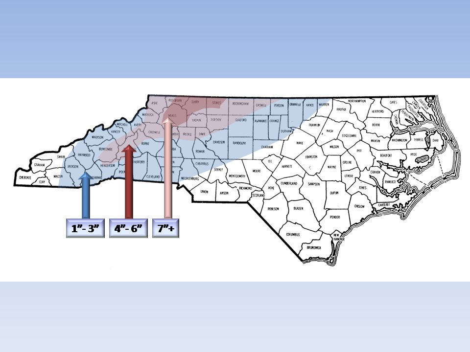
Disclaimer: This is a crappy map because our GIS license expired and depicts the European snowfall output which we are not allowed to circulate because of provider licensing…crappy maps are ok though. THIS SOLUTION WILL CHANGE).
Now that you have been advised and reminded that this is a discussion about what we are seeing in the weather ahead and that there are 10 days to sort this out… It looks interesting indeed!
Looking Ahead:
We have a really great snow opportunity the 23rd through 25th. Following that, is an increasing likelihood of a Polar outbreak around the 30th. As you know, with air that cold, it will be very dry so don’t look for frozen precip then. Going into February, there are a couple of opportunities that stand out…but we’ll save that for another article.
Bottom Line:
You’ve been looking for winter…it’s always been here! December came out Normal. January so far is running a bit below normal and it’s only the 15th. Let’s let winter happen!
NC Weather Happens. Enjoy it!
Be sure to get articles like this in your email by subscribing at ncwxhappens.com…its free, no ads, and no spam but more importantly, no delay!