
- Posted: 10:00 AM 2/15/2015
- Expires 6:00 PM 2/15/2015
Winter storm expected to enter Piedmont North Carolina Monday afternoon bringing a winter mix of precipitation along with accumulations that will disrupt travel, business, and schools.
This morning we see a more northward track in the development of our Gulf Low which would bring more of a winter mix to the Piedmont. This has been expected and looking forward, a track perhaps a little south is where we see it developing tomorrow.
The following Counties are under a WINTER STORM WATCH which means conditions are favorable for accumulating snow of 2-4 inches or any combination of ice in the next 24-36 hours.
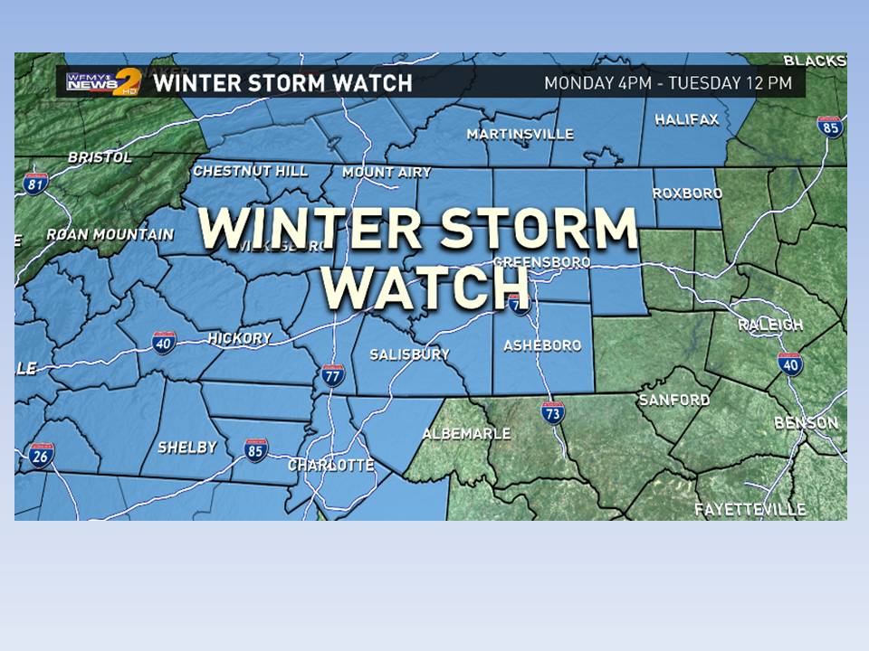
- Person (2-4 inches)
- Forsyth (2-4 inches)
- Guilford (2-4 inches)
- Alamance (2-4 inches)
- Davidson (2-4 inches)
- Randolph (2-4 inches)
- Stokes (3-6 inches)
- Caswell (3-6 inches)
- Rockingham (3-6 inches)
- Yadkin (3-6 inches)
- Iredell (3-5 inches snow, 1/4 – 1 inch sleet, 1/10 – 1/4 ice)
- Davie (3-5 inches snow, 1/4 – 1 inch sleet, 1/10 – 1/4 ice)
- Catawba (3-5 inches snow, 1/4 – 1 inch sleet, 1/10 – 1/4 ice)
- Rowan (3-5 inches snow, 1/4 – 1 inch sleet, 1/10 – 1/4 ice)
- Cleveland (3-5 inches snow, 1/4 – 1 inch sleet, 1/10 – 1/4 ice)
- Lincoln (3-5 inches snow, 1/4 – 1 inch sleet, 1/10 – 1/4 ice)
- Gaston (3-5 inches snow, 1/4 – 1 inch sleet, 1/10 – 1/4 ice)
- Mecklenburg (3-5 inches snow, 1/4 – 1 inch sleet, 1/10 – 1/4 ice)
- Cabarrus (3-5 inches snow, 1/4 – 1 inch sleet, 1/10 – 1/4 ice)
Any deviation in storm track or strength can upgrade these to a WARNING sooner than 12-24 hours which is usually when a Warning is issued as the storm approaches.
NOTE: Please follow Official NOAA reports as only they can close a school or trigger other responses.

For the Piedmont, we can expect to see Snow arriving from west to east mid morning and arriving in the Triad by lunchtime. At onset, a dusting is likely as surface temperatures will be frozen. Through the afternoon hours, an additional half inch can be expected which may cause travel issues at 5:00 drive time. The temperatures are too cold to pretreat (brine) roads so they will largely be available for any accumulation no matter what or how much falls.
Timing and Type:
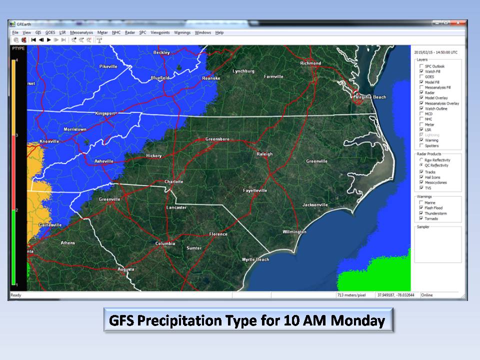
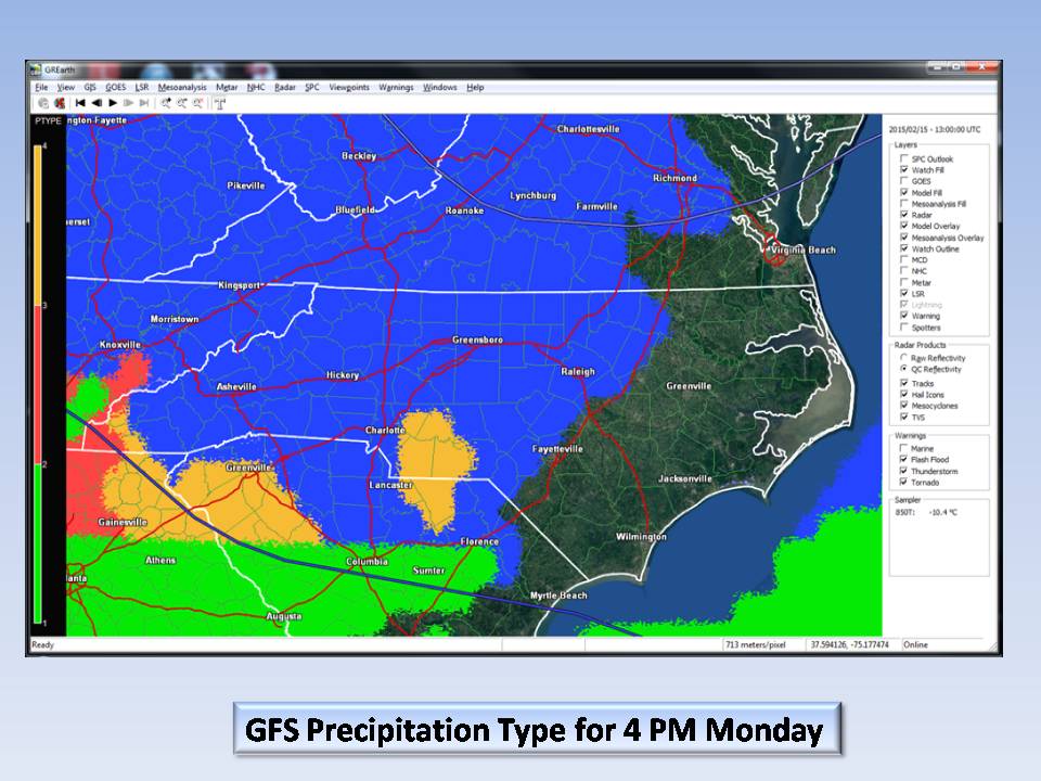
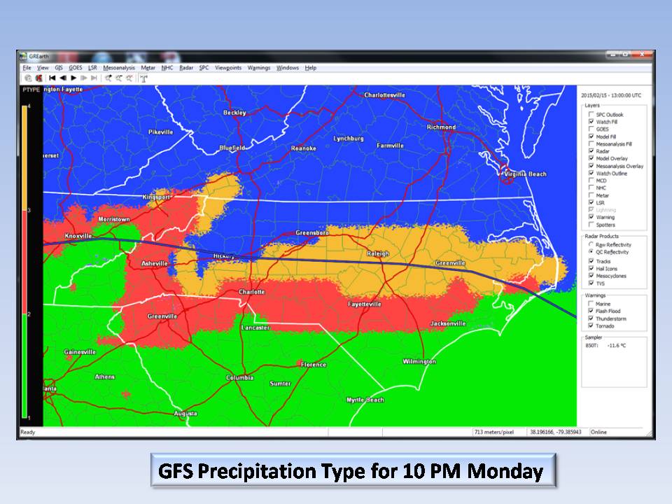
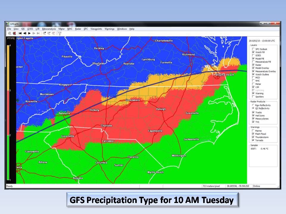
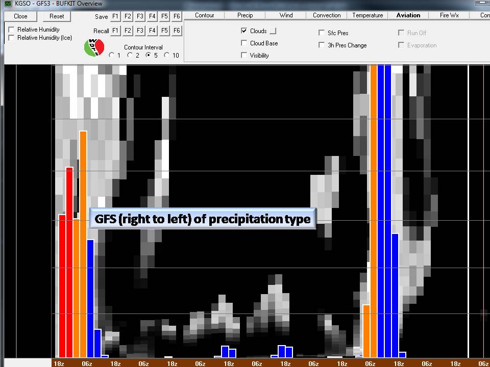
Other model simulations clearly indicate the winter mix we are expecting to see.
Note: Remember that IF all accumulation that falls is snow, then you will see impressive accumulations of 5 inches or more. Add sleet and a hefty glaze of ice and it compacts the snow so that 7 inch snowfall map you will see later today will in reality be about 3 inches real accumulation.
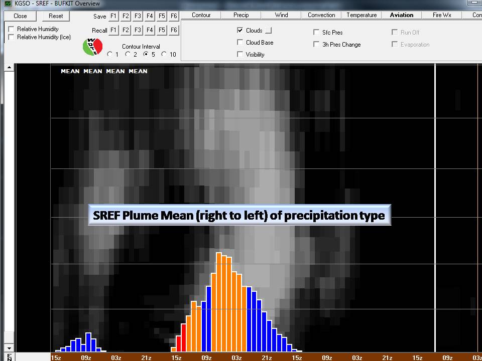
Official probabilities suggest a fairly decent winter storm for the Piedmont. Taking the middle of the road between all models, this is a fair estimate of what we are looking at:
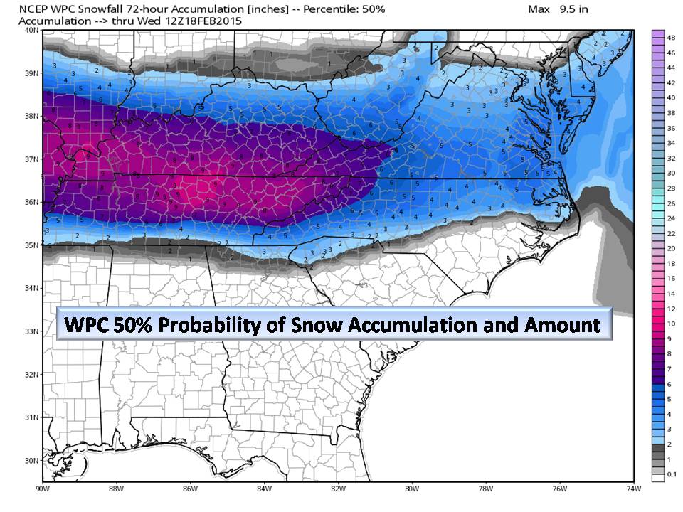
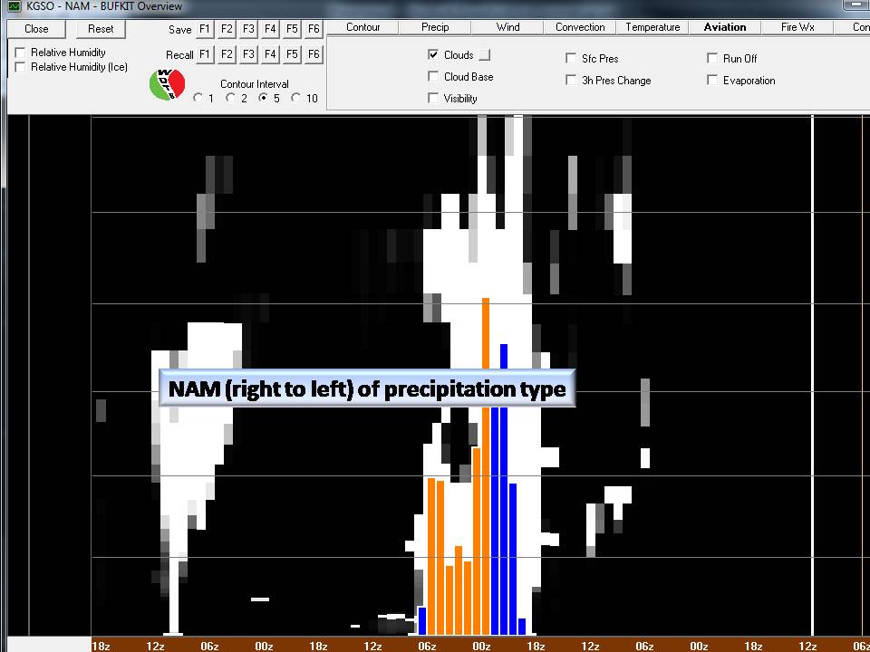
Which is very close to the NAM for the latest run cycle:

Emergency Management Statement:
Primary concerns for tomorrow is Timing and Untreated Roads. At the time of this writing it appears that for Counties west of the Triad precipitation will begin between 0900 and 1130. Precipitation is forecast to be light at onset with a dusting to an inch in the North and West Piedmont. Going through the afternoon, 1700 hrs drive time may become an issue especially on low volume roads. Through Monday night, precipitation will intensify yielding warning criteria conditions (but please follow official NOAA guidance).
Bottom Line:
Our first winter storm is fast approaching. Publishing snowfall accumulation maps is fun for some sites, but our focus at NC Weather Happens is to give you the best information available in an easy to understand way. We pull information from many reputable and official sites as well as utilize our own resources to bring you a comprehensive weather report.
This is a particularly bad storm for one reason…Timing. Schools will be in session as the storm approaches and it is too cold to pretreat roads, so Emergency Managers around the state will have to grapple with those decisions in the morning. Please watch your local media Monday morning for school closings or early dismissal!
Lastly, thank you for following NC Weather Happens and we hope you have found our service to be useful.
NC Weather Happens. Enjoy it!
Be sure to get articles like this in your email by subscribing at ncwxhappens.com…its Free, No ads, and No spam but more importantly, No delay! We are also on Twitter @ncwxhappens.
If you are interested in advertising on this high volume webpage, please send us a note and we’ll send you some information.