
- Posted: 7:45 PM, 2/17/2015
- EXPIRES: 6:00 PM 2/18/2015
The Piedmont endured a “minor” ice storm this week, but that was Monday. There were many successes and many “busts”…I took notes and we’ll get back to you about that. Meanwhile, we have more pressing matters to attend to. We have a clipper system that will bring us some snow Wednesday, followed by the season’s news maker, a record breaking cold outbreak and a potential winter storm this weekend.
Let’s get into it then!
- Wednesday, February 18, 2015.
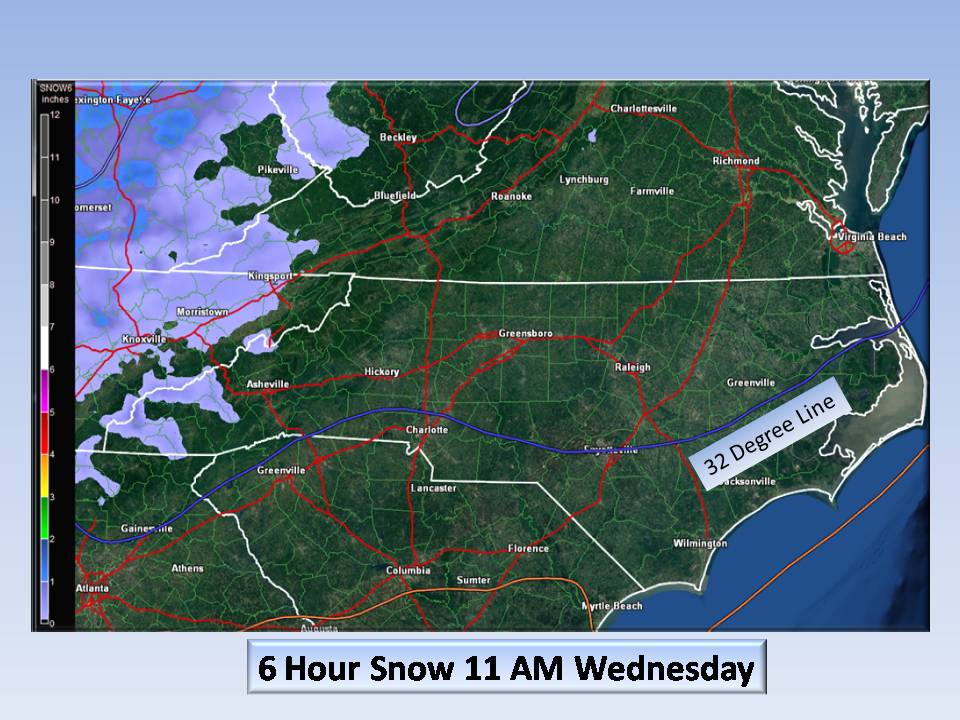
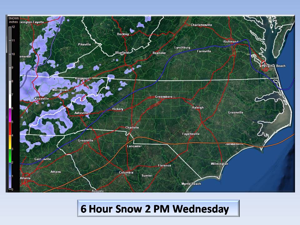
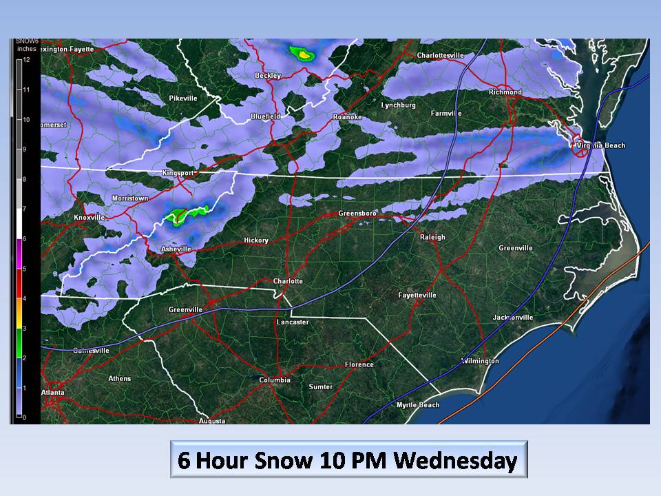
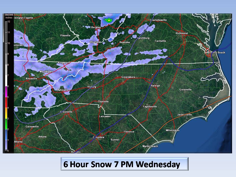
The day will start off cold with temps in the teens. We should see a high of around 35, but southwesterly winds may push that towards 40. A clipper system from the NW will approach the area pushed by a POTENT 1046 mb high pressure system that will usher in cross-polar Siberian cold air. The frontal boundary between our “warmer” air and this front will bring us a shot of snow showers mostly for our border counties with Virginia. You may even hear a clap of thunder as this frontal passage has a “convective” signature. It may only last a few minutes, but the chance is there and it may be heavy…don’t be surprised it will pass! Accumulations of 1/2 to 1 inch are possible.
Here is the timing:
- Then…Record Shattering Cold
Following this “nuisance snow opportunity” will be Siberian Cold! Once the clouds and snow showers pass, the winds will shift from the south to northwest and be INTENSE. Winds of 40 mph are possible and temps will drop several degrees/hour. This is LIFE THREATENING COLD. Add to this, we will see DANGEROUS wind chills well below zero. This is NOT the official forecast, but a fair representation of the cold outbreak for Wednesday night and Thursday night. This should be considered a worst-case scenario.
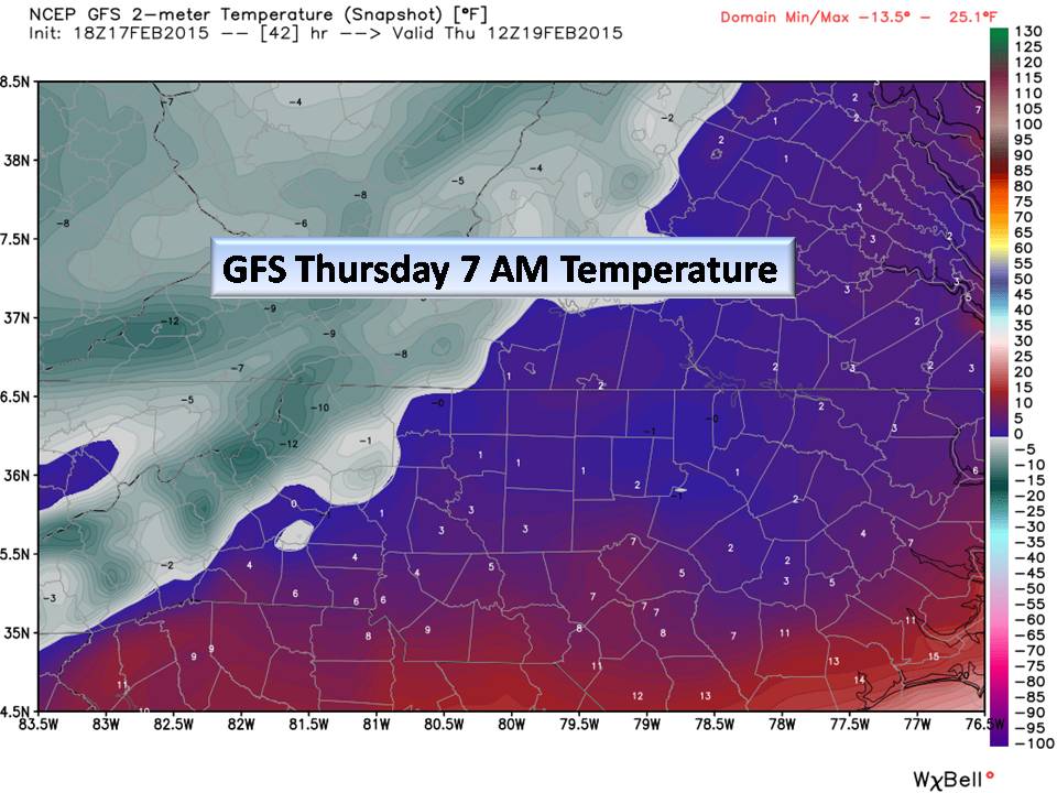
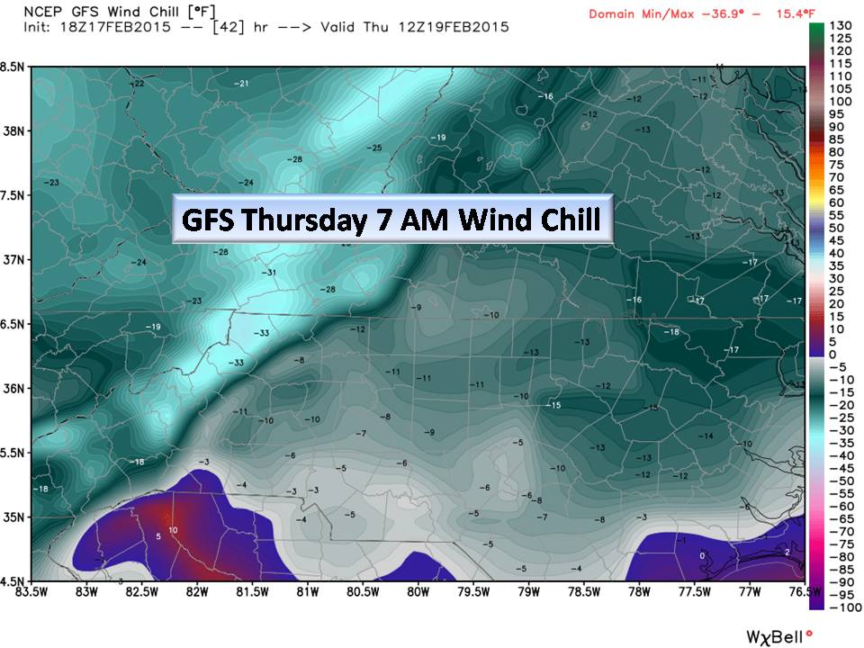
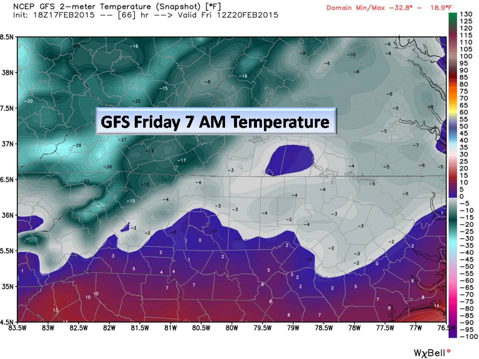
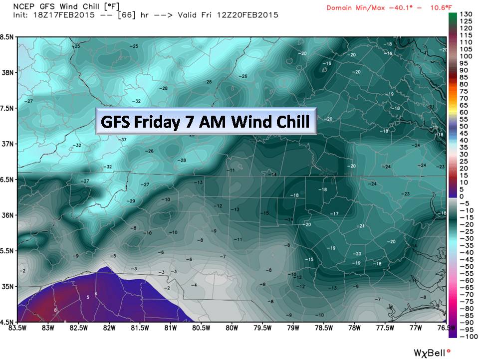
Folks, this is seriously cold air and will trump any weather topic we have this season! Records will be broken not only for lows, but for High temps for the day. Thursday and Friday will not make it out of the teens and 20’s for HIGHS!
Check on neighbors, invite them in if they have no power. Check on the elderly, and see if things are ok. If you see the homeless, help them to shelter or call 911 for assistance. People outside will not survive the night…give them a hand. BRING PETS IN. That’s my PSA in this article.
- This weekend’s Winter Storm “Opportunity”.
First (and here is the obligatory disclaimer), this is 5 days out. Models have done poorly with precipitation but generally well with temperature this season. So, now that you understand that, here we go.
This southern trough we are in, will spin off a Low pressure area in the Texas Panhandle sending it towards the Gulf. As it picks up energy, it begins to move NE slowly across the gulf states. Polar cold still in place, transitions this warm moist air into a wintry mix across much of the southeast. Strong High pressure in the Plains tries to bring in colder air aloft while a departing surface High pressure moves off the New England coast. These competing highs, bring great uncertainty in the weekend forecast…which one will win out?
The plains High will bring the Piedmont cold air in all levels of the atmosphere. The departing High, if it strengthens, will bring us warmer Atlantic air. Which one will win? Here is what we know today…
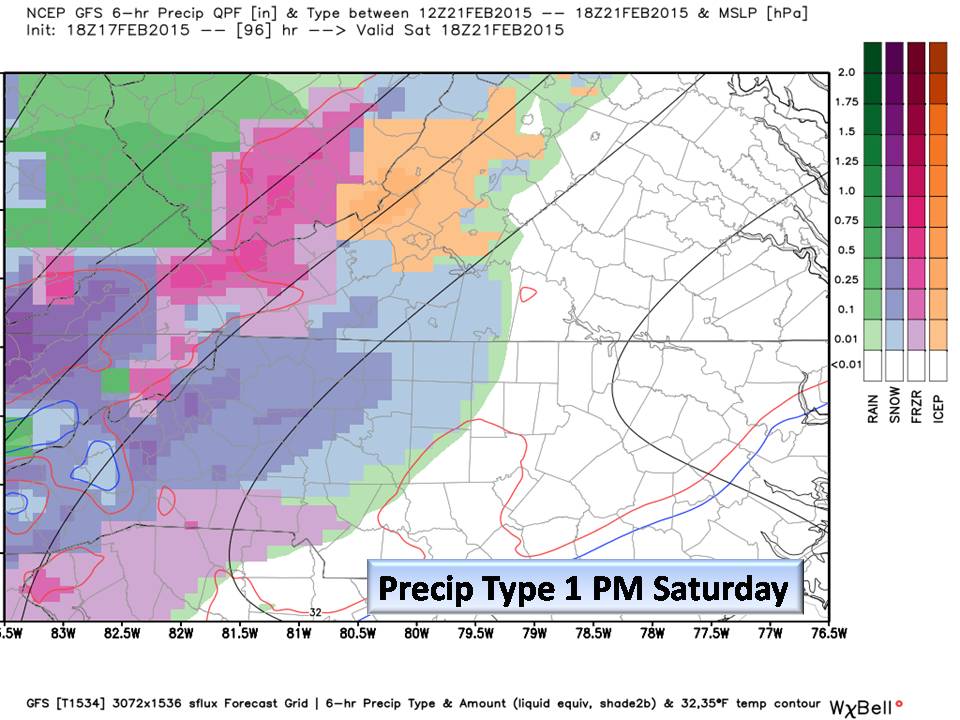
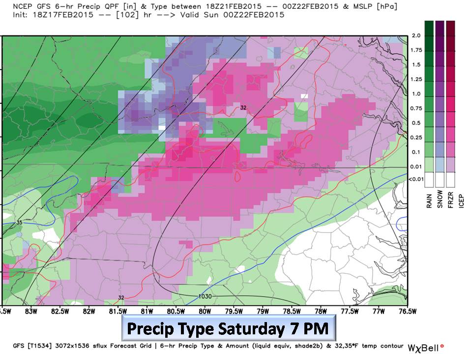
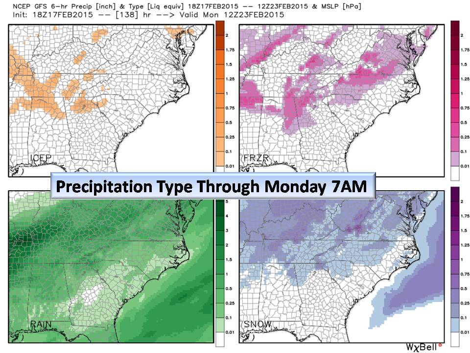
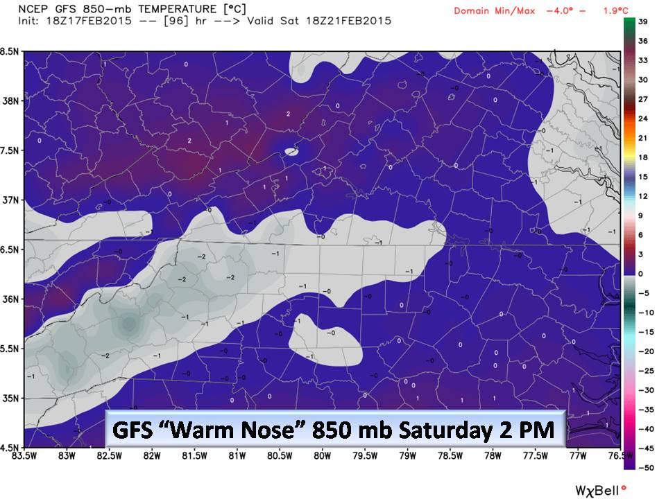
Our problem is that pesky 850 millibar layer (~5000 feet up) that wants to bring in warm air from that offshore High… For snow, we like to see the “mile up temperature” well below zero Celsius. When it rises ABOVE the surface temperature, we call that a “warm nose”. It is well below zero C as the system approaches, but then rises when it matters!

It is way to early to make a forecast on Accumulation or event type of precipitation, but right now…NC Weather Happens is urging that you keep this in your plans for next weekend. (One model suggests all rain!).
Bottom Line:
If you are a newcomer on Facebook, thank you for joining in! From time to time we offer more in depth articles like this from our website and post them on social media. Consider subscribing so you won’t get this article next week because of Facebook distribution delays.
This will be a very busy weather week. The big news maker will be extreme cold. Please watch out for your neighbors and even those you don’t know as this will be a very dangerous situation. Remember your pets, and that if you are cold, they are too! Lastly, I really want to find that person that said “Winter is over” and… well… show them a nice weather model!
NC Weather Happens. Enjoy it!
Be sure to get articles like this in your email by subscribing at ncwxhappens.com…its Free, No ads, and No spam but more importantly, No delay! We are also on Twitter @ncwxhappens.
If you are interested in advertising on this high volume webpage, please send us a note and we’ll send you some information.