
- Posted: 2/14/2015 9:00 AM
- Expires: 2/14/2015 9:00 PM
Our First “Official” Milk and Bread Alert for Monday – Wednesday. Beat the rush and make preparations for a Winter Storm.

The Setup:
Cold Arctic air will be in place from our outbreak on Sunday. Meanwhile, a series of shortwave low pressure systems will come out of the Pacific Northwest Ridge and spin off a Gulf Low pressure from the Southeast trough. The phasing (merging) of these systems will send Gulf moisture into the south overrunning the cold Arctic air and bring a wintry mix and accumulating snow to much of the Piedmont. The system should exit the area Tuesday evening and then strengthen off the coast before delivering another blast of snow to New England.
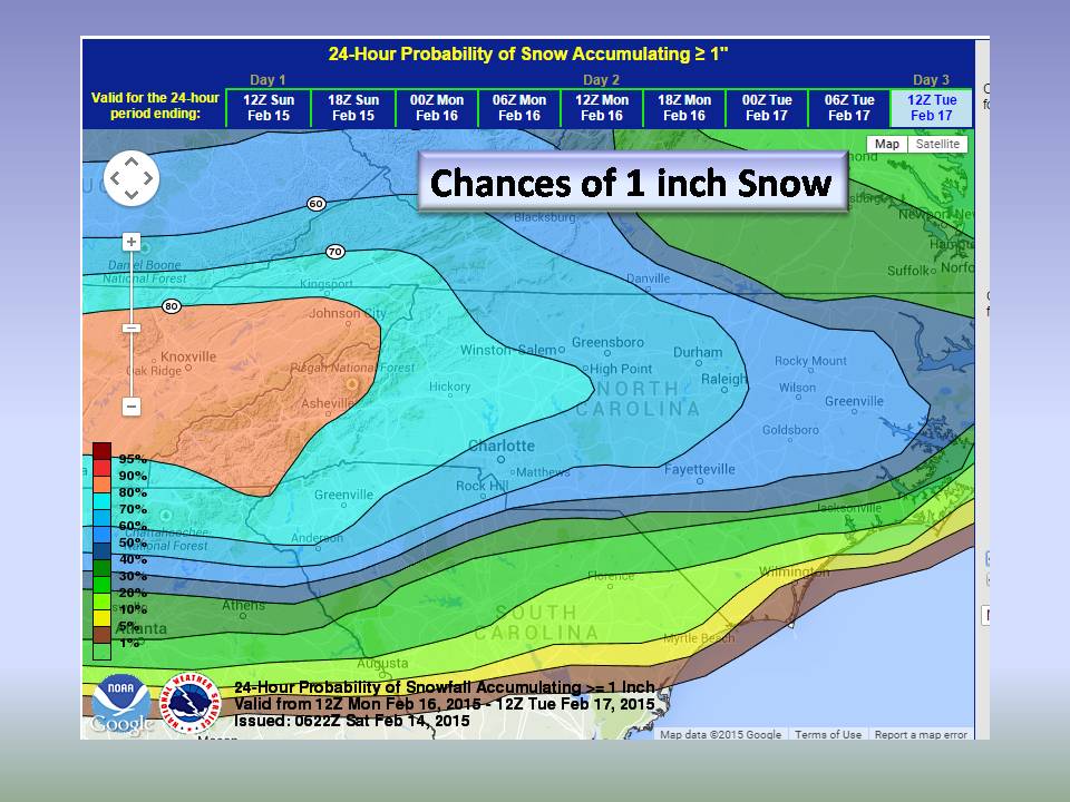
At this time, we are favoring a wintry mix with a predominate precipitation type of snow. Soundings of the atmosphere indicate that the warm gulf air will overrun the cold air at the surface especially in the Southern and Eastern Piedmont. The Northwest and Western Piedmont should remain ALL snow (at this time). As the system pulls away, all areas should see a transition to snow as cold air filters in behind the departing low.
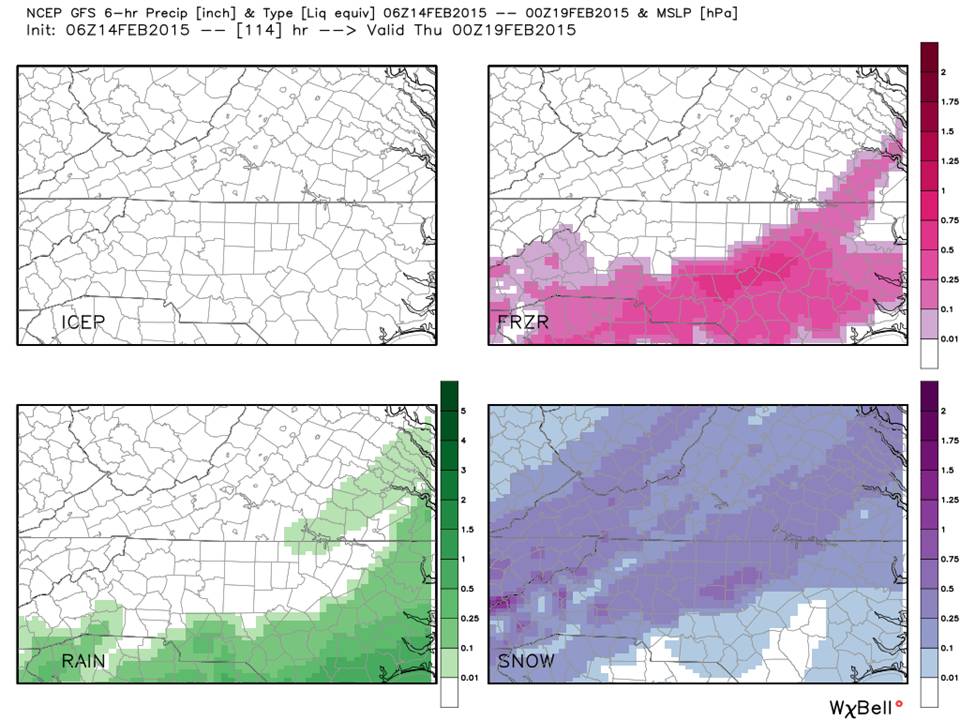
The Meteograms:
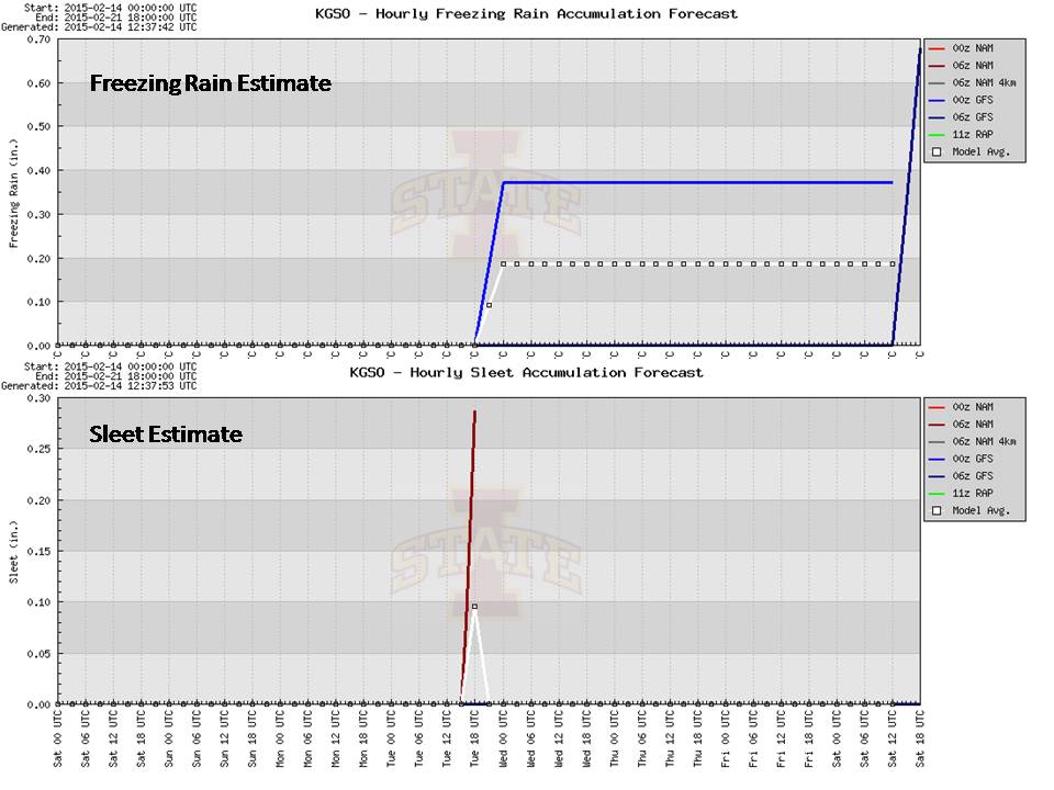
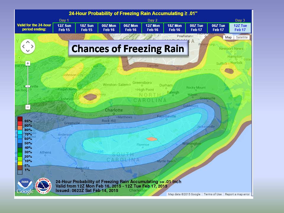
Note from the meteograms, we are seeing all Models (except European) indicating snow with a mix in the central Piedmont. Two items of interest is another shot of brutally record breaking cold on Thursday with another shot of accumulating snow! That is something we are watching and it is out in the 8 day, so we’ll speak to that later. Meanwhile, keep it on your calendar. The Sleet and Freezing Rain is also interesting and needs more information to reconcile, but it does indicate a fairly solid chance of Winter Mix.
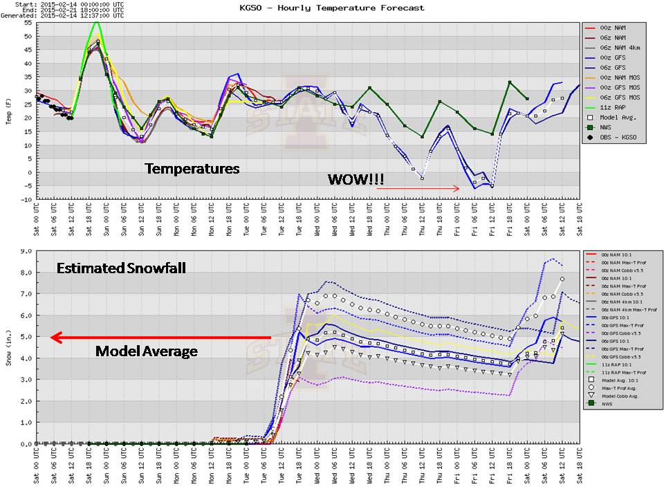
The GFS Meteogram Detail:

The GFS meteogram clearly indicates our two systems and plenty of cold. On that note, the GFS has done particularly well this season with the temperature forecasts, so seeing -8 in the Central Piedmont is frightening…This is overdone and will be reconciled the first of the week. We also cropped the Snowfall estimate off this image as it is a bit misleading and doesn’t account for mixed precipitation. We’ll break that down next.
Official Guidance:
The Weather Prediction Center (NOAA) is publishing probabilities this morning.
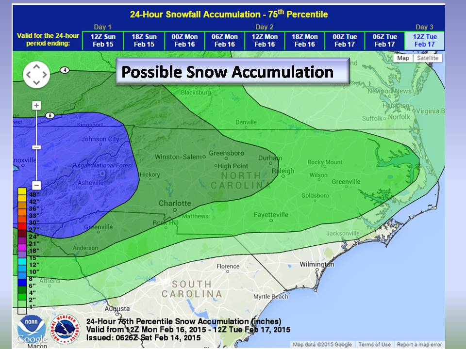
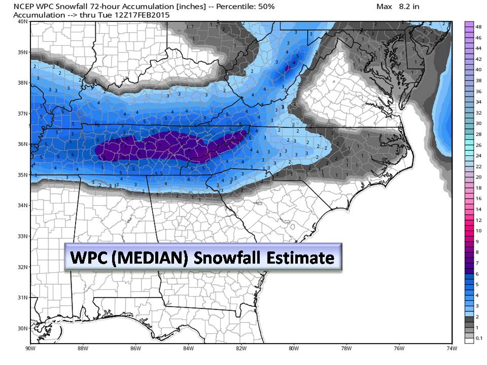
The WPC Percentile maps mean that using the Median (50th percentile) there are equal chances that we will/will not see that much. NC Weather Happens is leaning more towards the 75th percentile estimate as it accounts for Sleet and Freezing rain a bit better. NOT included is compaction so those that get a Mix will see smaller accumulations.

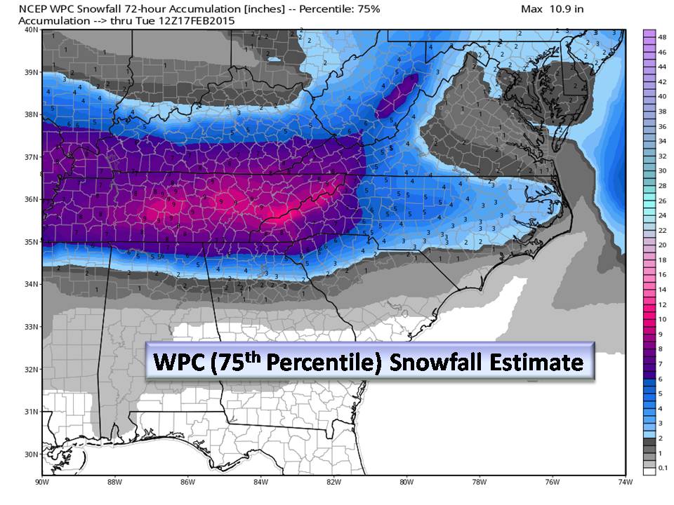
This GFS Worst-Case Scenario map does not consider Ice or Sleet. We expect that gradient to setup but where at this time is unknown. This article is about preparing you for a winter storm and NOT gamble with snow totals. We hope you are better informed this morning!
The Bottom Line:
We are expecting our first Winter Storm. Use today to prepare. We have a brutal cold 2 days ahead of us. Make your plans for the ENTIRE week to include winter weather and try to be flexible. We have informed our clients of this and the tipping point for them is generally 4 inches of snow (which requires the use of chains). In the TRIAD we will likely see that amount.
Also, prepare for possible power outages especially in areas EAST of the triad as accumulating Ice is a growing possibility. On the Piedmont’s western fringe in the foothills, if you like snow, we think you will be pleased!
Lastly, for Tonight through Monday morning, remember your pets. Here is a handy chart to help you know when they need your help in cold weather.

This will be a very busy week for the Piedmont. Stay current by subscribing to this newsletter and turning your notifications on for our Facebook page.
NC Weather Happens. Enjoy it!
Be sure to get articles like this in your email by subscribing at ncwxhappens.com…its Free, No ads, and No spam but more importantly, No delay! We are also on Twitter @ncwxhappens.
If you are interested in advertising on this high volume webpage, please send us a note and we’ll send you some information.