
We called this to your attention over the weekend and that forecast still stands. The Piedmont of North Carolina will see a Wintry Mix as a very strong cold front passes through but with little or no impact.
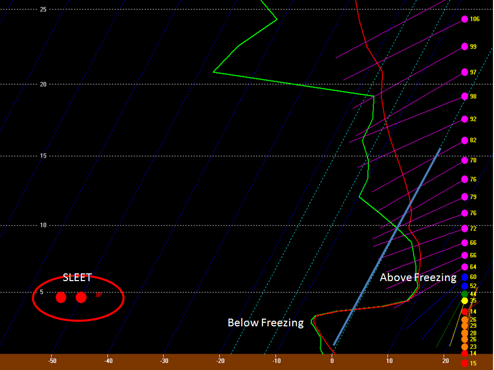
First, all indications for accumulating snow just aren’t there. A “warm nose” (layer above the surface) of warm air will transition our Rain into Sleet, Freezing Rain, and then a bit of Snow before the front finally clears things out. Our temperature difference between Wednesday afternoon and Friday morning will be nearly 50 degrees!!!
Any accumulation of frozen precipitation will be confined to elevated surfaces only. (This is for the Piedmont between basically Rutherford and Durham counties).
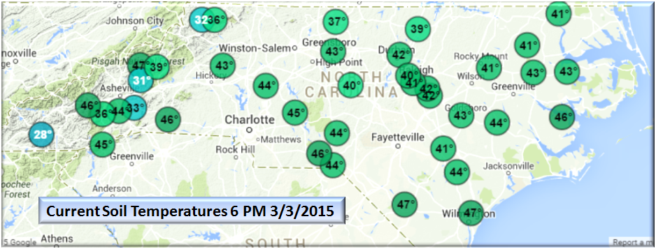
Second, ground temperatures will be coming out of a very warm period with nearly 40 hours above freezing with temps into the 60’s and 70’s on Wednesday.
Lastly, short range models (not the GFS or European) are all indicating atmospheric features where “Cold is Chasing Rain”. Some laws of thermodynamics just can’t be broken no matter how we wish…snow melts when it is warm.

Bottom Line:
This is not a very complex system but there are some things (like a stalled front, a developing meso-low to our south, and our beautiful mountains) that can make a forecast tricky. Right now, for the Piedmont this is the most likely outcome…
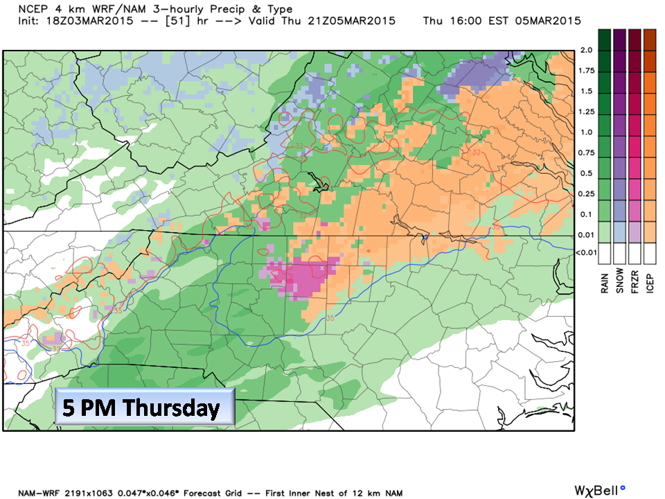
Wonderfully warm Wednesday with rain going into Thursday where temperatures will fall throughout the day. Towards late afternoon, rain will transition into a Sleet/Rain mix and before sunrise Friday, a few snow showers thrown in for good measure.
Our surface temps will be well above freezing for any accumulation, but we can’t rule out the possibility of elevated surfaces, and perhaps some bridges here and there.
With the rapid onset of cold air, ANY precipitation that falls may freeze. expect travel advisories Friday morning.
Folks up in the Northeast section of the State’s Coastal Plain have the best chance of seeing accumulations but it will be Sleet and about a half inch to an inch in places (outside of our area of expertise).
- For Tonight, temps will begin to rise and continue throughout the day Wednesday.
- Fog is developing and will likely approach Advisory Criteria, so be careful in the morning heading out!
Welcome to Meteorological Spring!!!
NC Weather Happens. Enjoy it!
Be sure to get articles like this in your email by subscribing at ncwxhappens.com…its Free, No ads, and No spam but more importantly, No delay! We are also on Twitter @ncwxhappens.
If you are interested in advertising on this high volume webpage, please send us a note and we’ll send you some information.