
Part 2 in our discussion of Piedmont Severe Weather touches on what the Storm Prediction Center (SPC) in Norman, Oklahoma issues in their advisories and what to expect here. We’ll also give you some tips on reporting severe weather to the NWS.
If you missed Part I, click here as it discussed specific information on what to do before, during, and after a Tornado.
Introduced in the Fall of 2014, the SPC gave us a more refined Convective Outlook product. You will see these from time to time on the Internet and social media, but what do they mean? Let’s take a look at the Day One Convective Outlook for today:
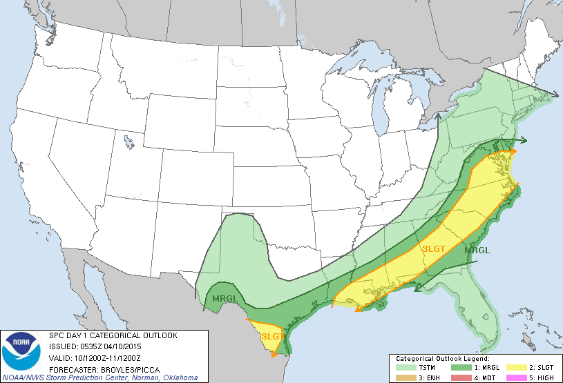
Here we see that there is a SLGT (slight risk) of severe thunderstorms shaded in the yellow area. So?
On the old scale, there was a slight risk just about any day of the year. With the new scale in place, we have a better definition of exactly what that means to us. NOAA put out a great slide that explains in simple English what the categories mean.

For today then, we have a Slight Risk of seeing scattered severe thunderstorms where wind, hail, and even a tornado is possible (where these storms flare up). Does this mean that it WILL happen? No. The weather services works with probabilities (chances) so given all the atmospheric variables used for thunderstorms available, they show an INCREASED LIKELIHOOD that storms will happen.
So what type of severe chances will we have?
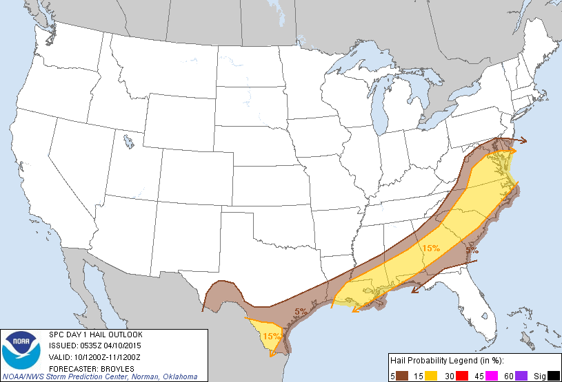


So looking at the day and our chances for Severe Weather, there is a 2% chance that a tornado will form, a 15% chance that we will receive damaging winds, and a 15% chance of hail. So should a storm develop we would suggest that the greatest severe weather would be Hail 1/4 inch or larger with winds greater than 58 mph but can’t rule out a tornado.
Wind and Hail:
A good reminder for our spotters, but also something good to know when making a report of hail.
Take a look at this chart:
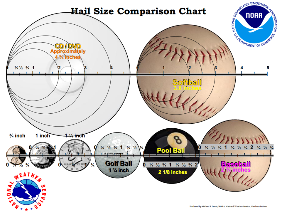
- When is Hail severe? The old rule suggested 1/4 inch as some damage can occur to crops, but the new rule is “Dime or Penny Size” 3/4 inch.
- When is Wind severe? Winds greater than 57.5 mph will bring down small trees and power lines. Also the signatures of tornadoes will make cause a storm to be issued a warning.
Not sure of the difference between a watch or a warning, information can be found here.
Reporting Severe Weather:
NC Weather Happens is available on Facebook and Twitter. If a storm passes and there is wind damage and hail greater than 3/4 inch (penny size), post your observation there and we will verify it and send it to the proper weather service office.
What we need in your report:
- Type of report (wind/hail/tornado)
- Time
- Closest reporting location (City, County, and address or crossroads/intersection)
- Note: Unless flooding is occurring, Heavy Rain and Lightning is not severe weather believe it or not!
So now you have all the basics. Be safe out there and be weather aware because as you well know…
NC Weather Happens. Enjoy it!
Be sure to get articles like this in your email by subscribing at ncwxhappens.com…its Free, No ads, and No spam but more importantly, No delay! We are also on Twitter @ncwxhappens.
If you are interested in advertising on this high volume webpage, please send us a note and we’ll send you some information.