
**** Snowfall Forecast for Sunday Morning ***
Medium range models have come in as well as the Globals. The GFS and Euro have come into better agreement but there are still timing and track issues. Our more accurate higher resolution NAM has been fairly consistent with timing and precipitation, so before folks go home for the long weekend, I wanted to get this out.
*** This is not a milk and bread alert! ***
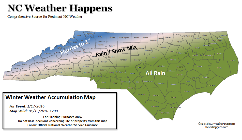
- The mountains can see light snow from flurries to around an inch with some isolated higher amounts in the higher elevations. Best chances are in the NW Mountain Counties.
- The Piedmont has a good chance of a Rain/Snow Mix with no meaningful accumulation expected.
- Elsewhere will have all rain throughout the event.
By Sunday afternoon all of this will be clearing out.
Bottom line is that this is a low impact event for NC.
More relevant than this minor brush with winter are the following:
It is important to mention that once all this clears out Sunday afternoon, there will not be much time for things to dry out so Monday morning we may have to deal with Black Ice issues with temperatures overnight in the 20’s.
Lastly, follow your local media and the National Weather Service for official information.
NC Weather Happens. Enjoy it!
Be sure to get articles like this in your email by subscribing at ncwxhappens.com…its Free, No ads, and No spam but more importantly, No delay! We are also on Twitter @ncwxhappens.
Advertise your business on this high volume webpage. Send us a note and we’ll send you some information.