
Early guidance suggested a more southerly storm track that would have brought a major winter storm to North Carolina. With a trend more westerly, we will see a winter mix beginning Sunday night ending as all rain Tuesday.
Timeline:
- Light snow enters the region Sunday night with 1-3 inches possible by daybreak
- Snow begins to mix in with sleet and freezing rain Monday morning
- Wintry mix continues all day Monday with a change over to all rain early Monday evening
- Rain becomes heavy with possibly a Thunderstorm continues overnight Monday.
- Precipitation departs NC early Tuesday afternoon
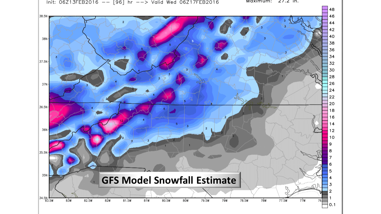
Accumulation:
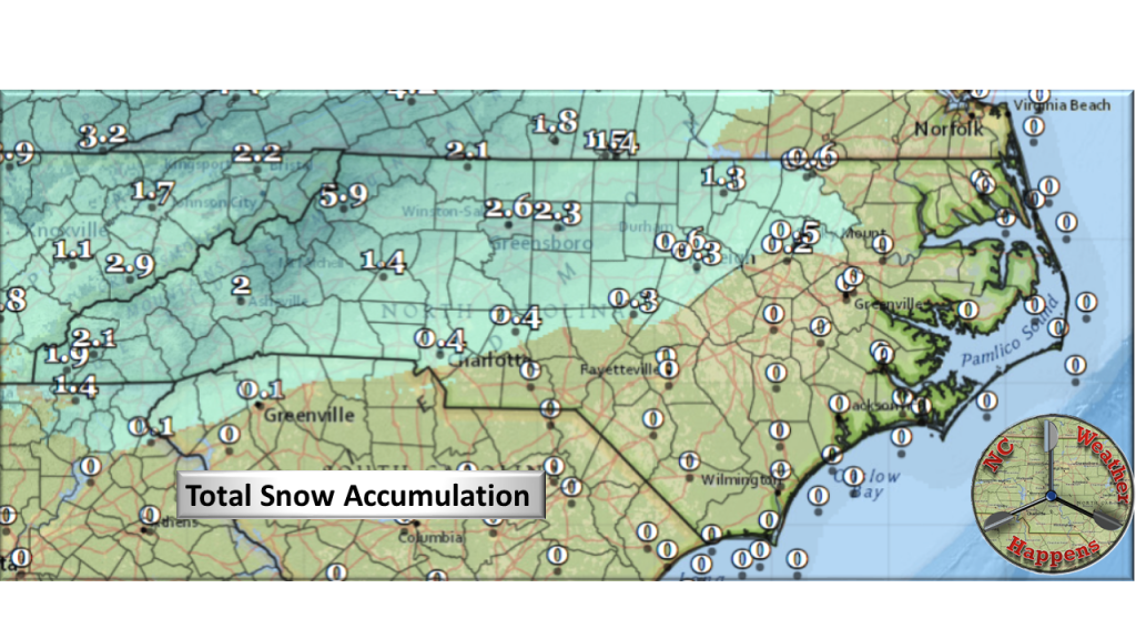
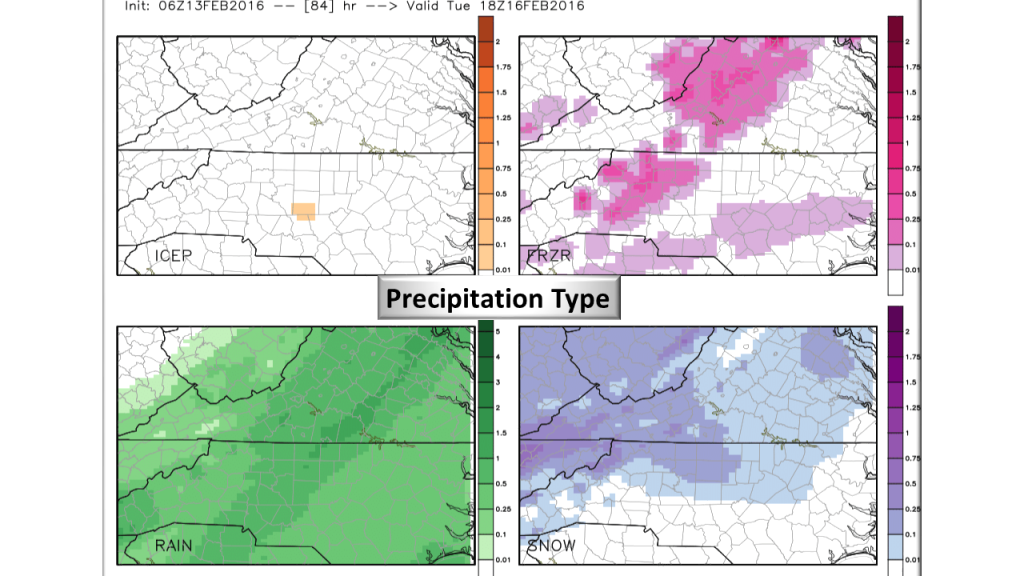
The mountains should remain all snow especially in higher elevations. Roughly, a line north of I-85 should see the most accumulation of snow and sleet elsewhere mostly all rain.
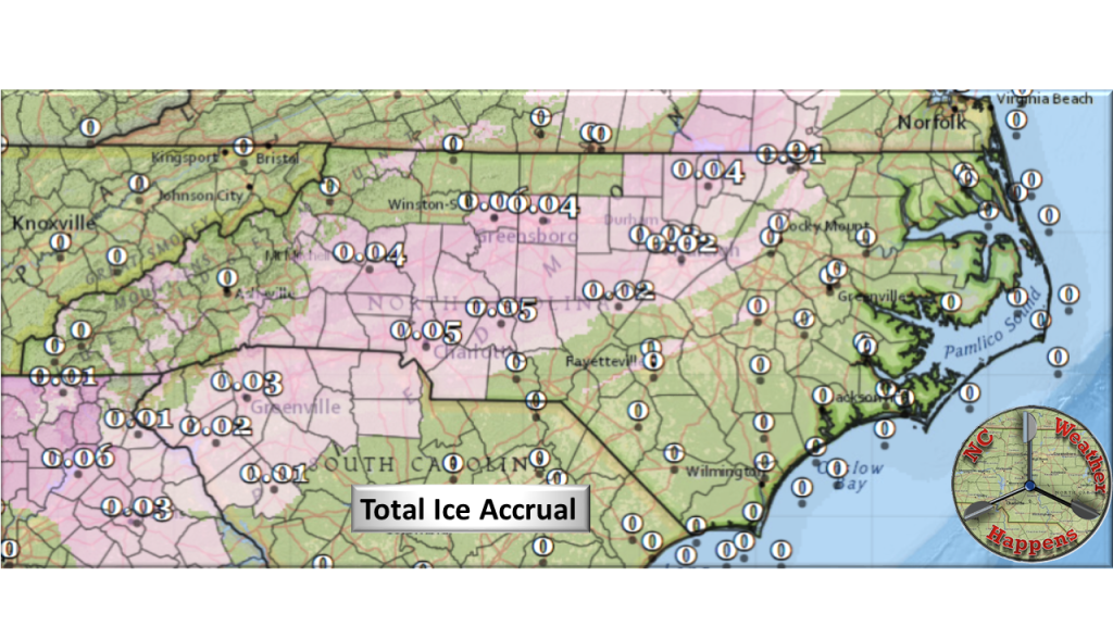
At issue is how long it takes the warm air to intrude the 850mb level which would signal a change over to Sleet and Freezing rain. When this occurs remains to be seen but more snow will accumulate the longer that warm air stays out!
When it finally does come in, a change over to freezing rain will become a larger problem. surface temperatures will remain below freezing and we will still have an eroding CAD (Cold Air Dam) to deal with. As such, Ice accumulation is expected to remain generally light not approaching warning criteria (1/4+ inch).
The predominant precipitation type for this event will be rain.
After the Snow:
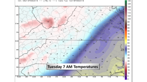
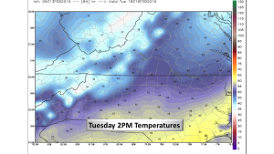
Whatever falls and accumulations, will have a short lifespan as everything changes over to rain and warming temperatures. Tuesday morning temperatures look to be above freezing with a sharp gradient crossing the state.
Bottom Line:
Monday, we will have to deal with travel issues. Roads will be messy and it’s best to just stay in if you can. This will also not be the fun kind of winter storm as it will change over to mess in short order. I will be watching the freezing rain portion of this storm very carefully as that could rapidly become a problem with trees and power lines. At this time however, it doesn’t appear to be more than a glaze. We will receive heavy rainfall once that changes over and I would not be surprised to hear thunder as the system deepens into New England. Winter Storm? Sure. Nuisance Storm? Absolutely!
NC Weather Happens. Enjoy it!
Be sure to get articles like this in your email by subscribing at ncwxhappens.com…its Free, No ads, and No spam but more importantly, No delay! We are also on Twitter @ncwxhappens.
Advertise your business on this high volume webpage. Send us a note and we’ll send you some information.