
“High pressure briefly moves in today before a complex frontal system brings rain back to the area late Tuesday through Wednesday. Much cooler and breezy conditions are expected behind the frontal system Wednesday night into Thursday with a gradual warming of temperatures heading into the weekend”. -NWS GSP.
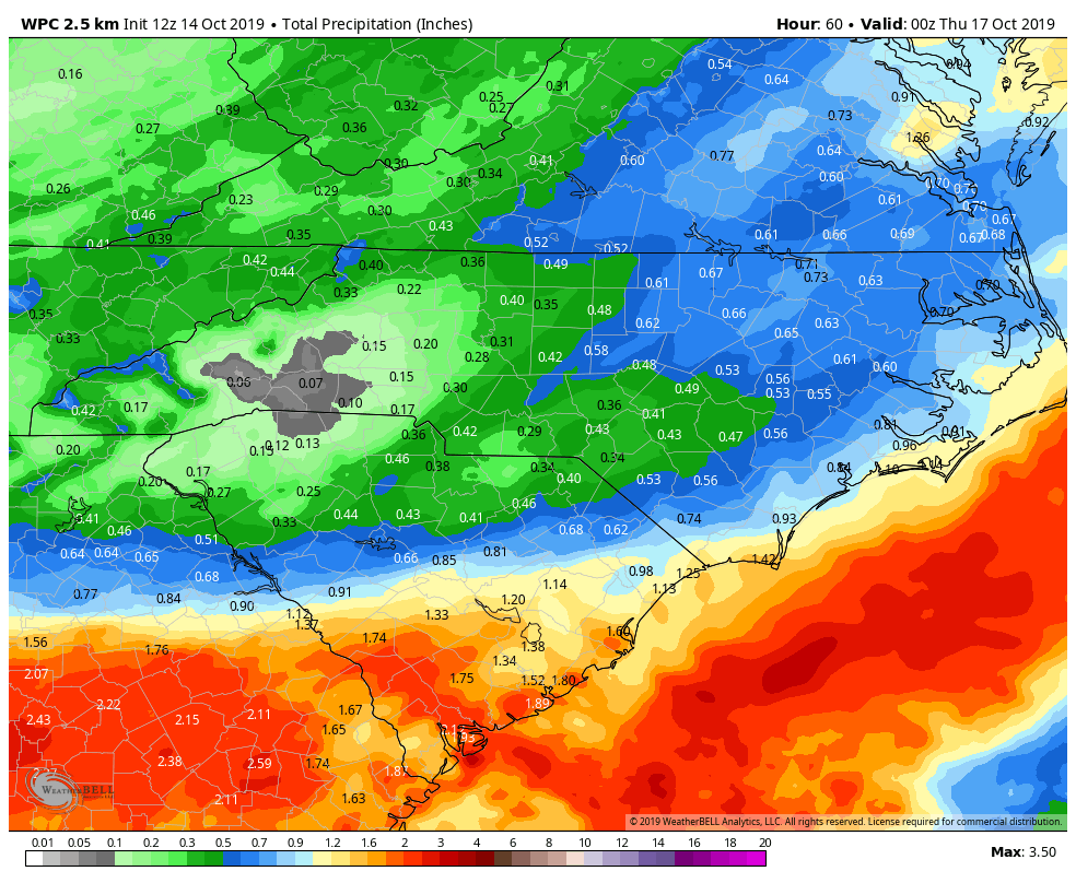
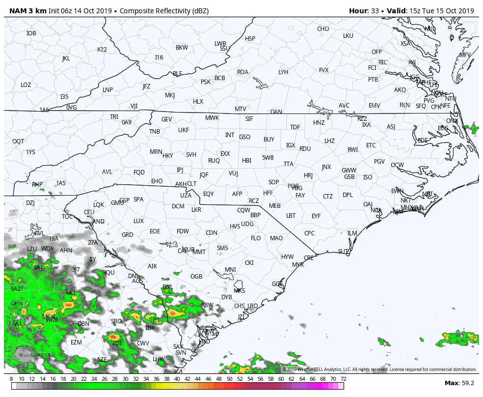
Most everyone received some much needed rain yesterday and a little more is on the way Tuesday. The official forecast brings a half-inch or more of beneficial rain over the western and central portions of the state Tuesday night through Wednesday afternoon while areas along the Coastal Plain will see an inch or more.
Again, some thunder may accompany heavier cells, but severe weather is not expected. The Drought Monitor is released every Thursday and we may see areas of drought stabilize a bit. Recent and expected rain are just not enough to break our current drought conditions, but we will still take what we can get at this point.
High pressure will once again dominate the late week weather with sunny, dry, and seasonable temperatures.
By now you have noticed we have activated our blog functionality. We have new email subscribers from all over the country this morning! To subscribe, just visit NC Weather Happens, LLC and sign up. Also, take a minute to comment your thoughts on the new format.