
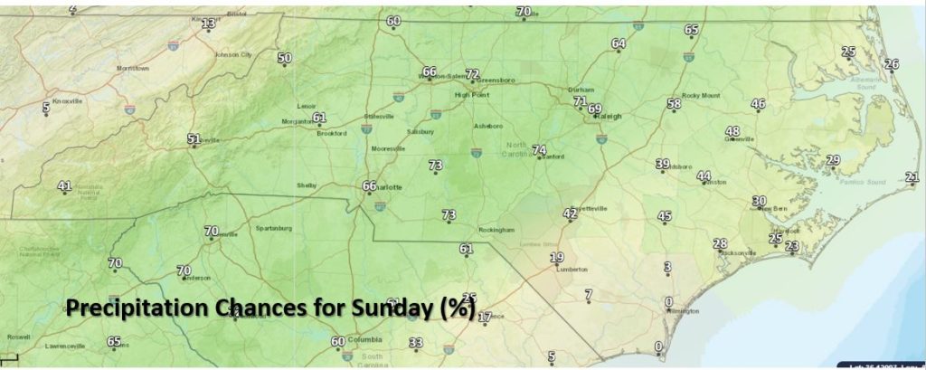
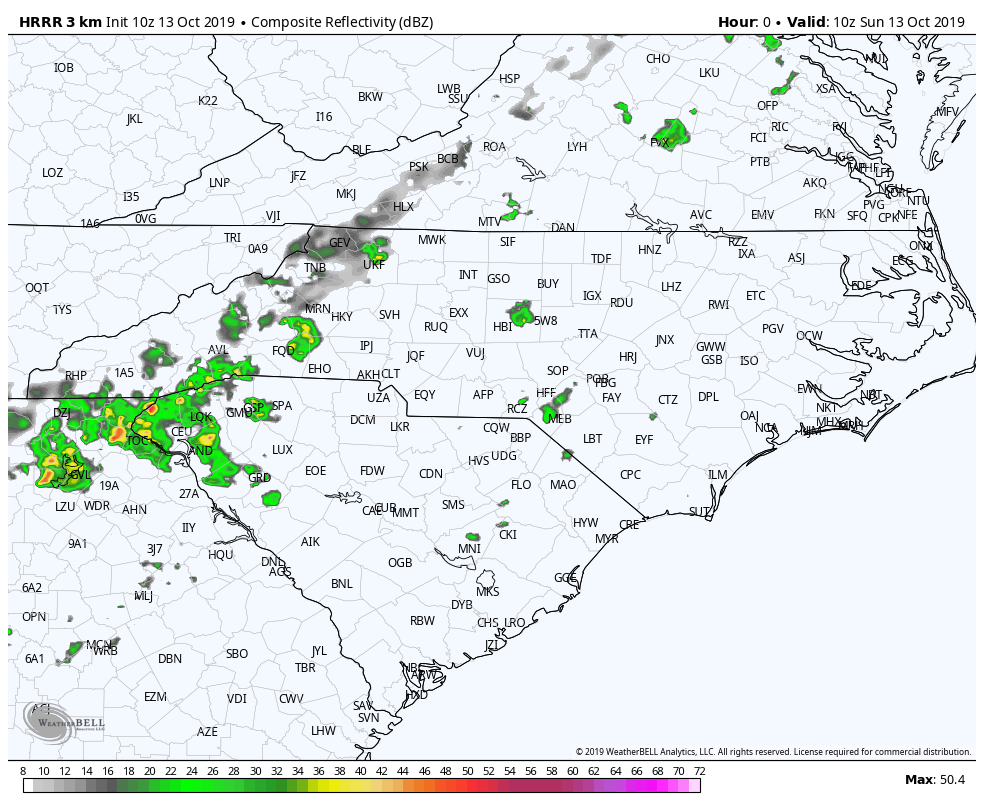
A mix of sun and clouds this morning will keep temperatures on the cool side struggling to reach the 70’s. As the day progresses, rain will begin to filter in from the SW to NE and linger into the overnight hours.
This is not a drought buster by any means but we will take what we can get at this point. Some heavier showers may have a clap or two of thunder and severe storms are not expected.
Looking at the week ahead, temperatures should be more seasonable with another shot of rain coming Tuesday and Tuesday evening with an upper level disturbance. We’ll have more on that in a later post.
Have a great day everyone!
For active RADAR and current information, be sure to visit our website at NC Weather Happens, LLC.