Old Man Winter has taken a much needed break here, but signs in the weather models indicate he is far from being finished.
Enjoy this spring like weather as it comes with a price…Wednesday there is a possibility of thunderstorms ahead of an approaching cold front. Stay tuned as we get closer as there may be at least a Marginal threat of severe storms. Right now, the severe threat appears low as our mountains will likely rob the front of some energy.
Looking at the weekend and beyond, three Winter Weather opportunities are beginning to emerge. (Recall that we have been watching this time period since the first).
- Thursday/Friday – As our front moves out, cold Canadian air will filter in and outside of our mountains, the Northern tier counties and coastal plain may see some flurries or wintry mix. This is not a huge moisture maker, so accumulation is not expected. Surface temperatures will also be too warm to support accumulation.
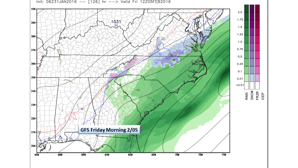
GFS P-Type for Friday - Sunday Night / Monday Morning – A developing offshore low looks to travel up the coast and will likely offer the middle Atlantic states a decent snow. Here in NC, the NE coastal counties stand to see perhaps a light accumulation and flurries are possible in the interior Piedmont counties. This will be one to watch further north but as always, we will be on the southern boundary of the event. Again, we are taking a wait and see stance on this second opportunity.
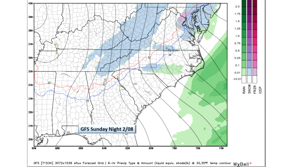
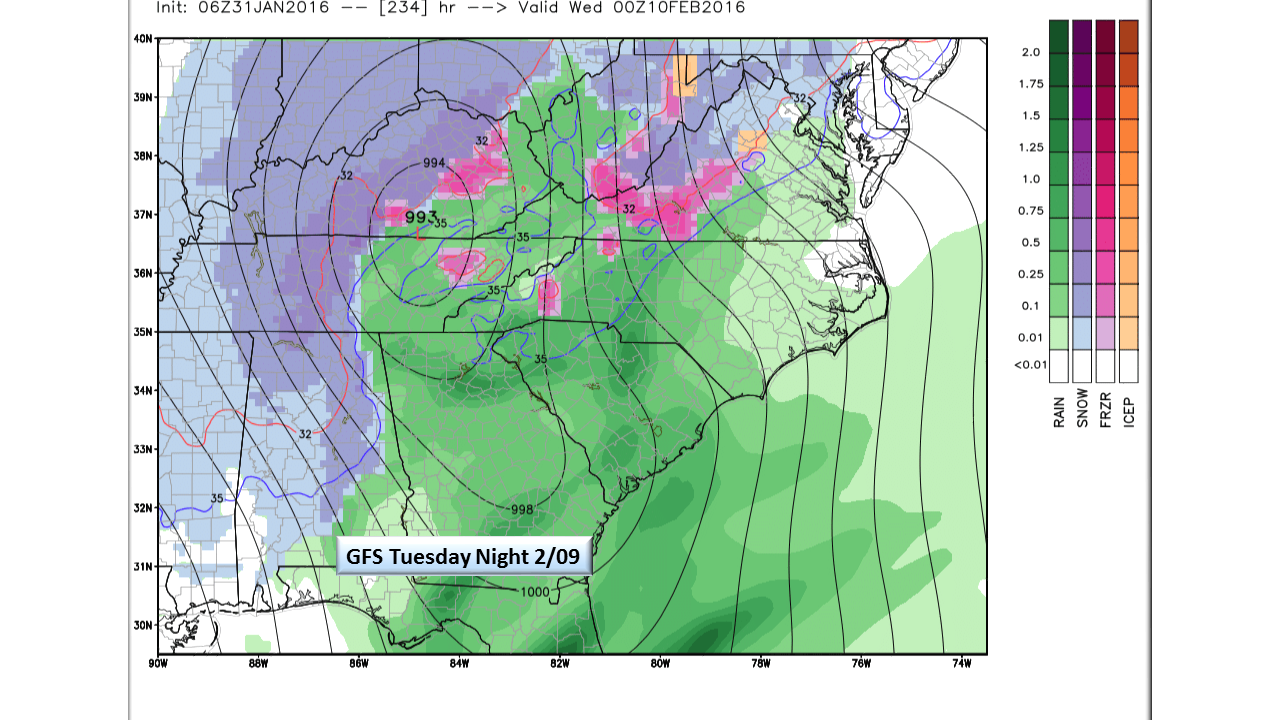
GFS P-Type for Sunday 2/08 - Tuesday 02/9 / Wednesday 2/10 – Models want to develop a gulf coast low and bring it up into the mountains. As this is 10 days away, there is little confidence however, should this track on our side of the mountains, we may have some real winter issues. With cold air already in place, any moisture coming from the Atlantic would make for an icy mess here. Keep this on your calendar and know that we will be watching this system (the most threatening of the three here) very closely.

GFS P-Type for Tuesday 2/09


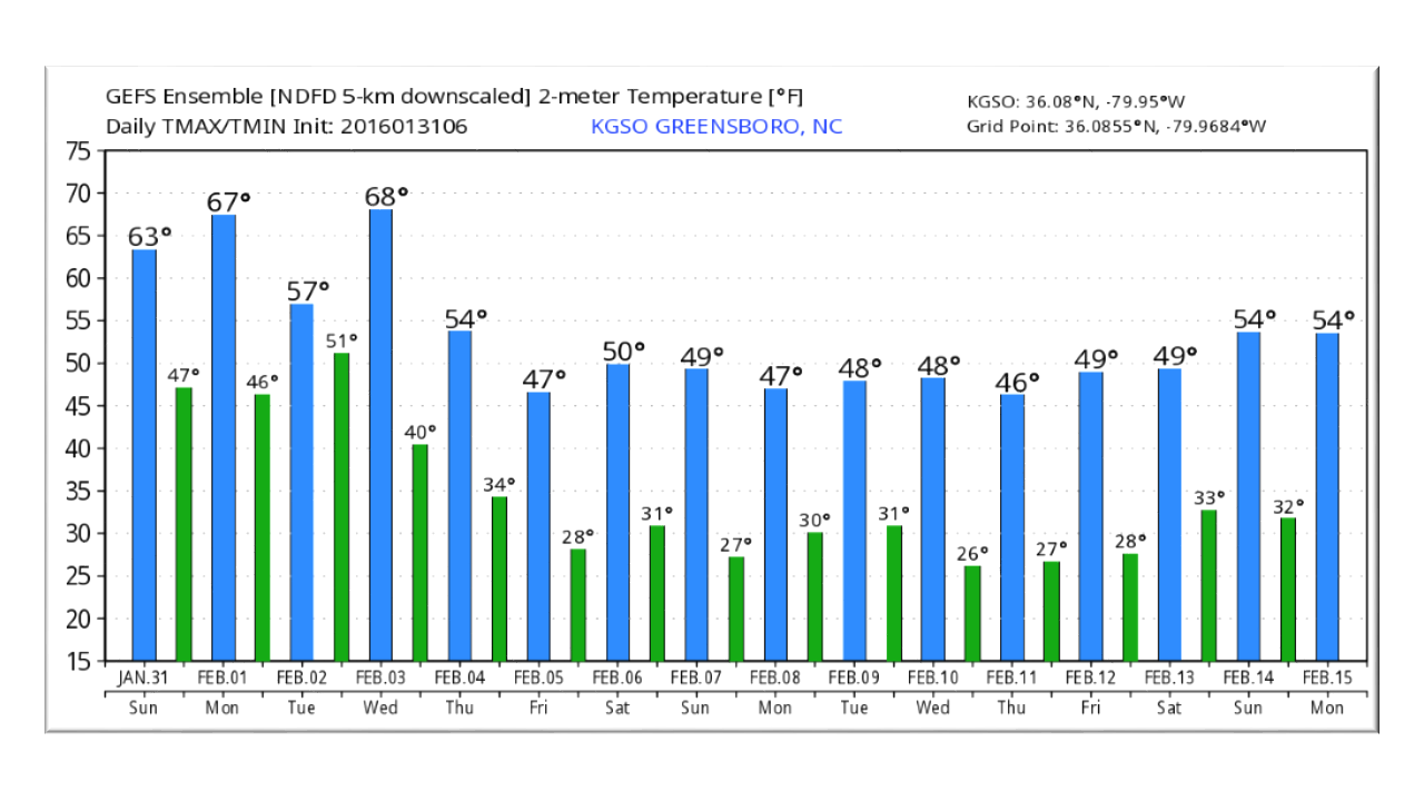
For the next 15 days, our temps will be moderating more towards normal from our present 60 degrees. This is from Greensboro, but is representative of the Piedmont.
Bottom Line:
As we head into the last month of Meteorological Winter, Old Man Winter still has some things in store for us. The next 10 days promise to be busy as three systems could bring us chances of frozen precipitation. Urging caution here, this season has been horrible when using weather models to forecast precipitation and especially precipitation type. What has been excellent has been the trend, so we thought you might like to see that trend here. As we get closer and the medium range models begin seeing these events, we will certainly let you know what we see.
NC Weather Happens. Enjoy it!
Be sure to get articles like this in your email by subscribing at ncwxhappens.com…its Free, No ads, and No spam but more importantly, No delay! We are also on Twitter @ncwxhappens.
Advertise your business on this high volume webpage. Send us a note and we’ll send you some information.