
Prepare a Plan B and be flexible as this is a developing situation
Models overnight have continued to show the development of a coastal low off the North Carolina coast Wednesday morning. This system is forecast to travel up the eastern seaboard into New England Thanksgiving day. Expect travel delays from North Carolina to Maine.
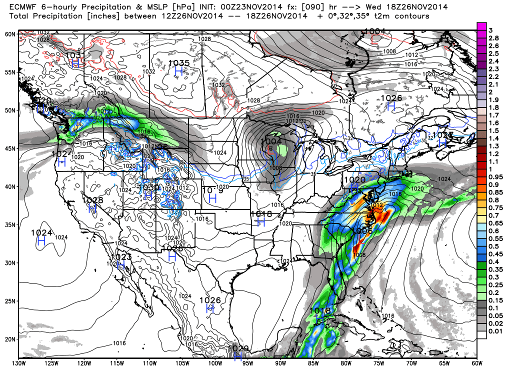
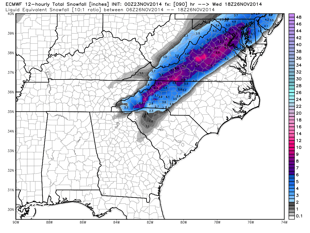
What does this bring to the North Carolina Piedmont? There is still uncertainty in the model solutions however they are continuing to merge on a final solution. Confidence for NC Weather Happens in the weather models is MEDIUM. We are just not completely convinced as a ridge of high pressure over the Great Lakes is NOT in a traditionally favorable location…a location that would send cold air down the eastern side of the Appalachians (a process known as Cold Air Damming).
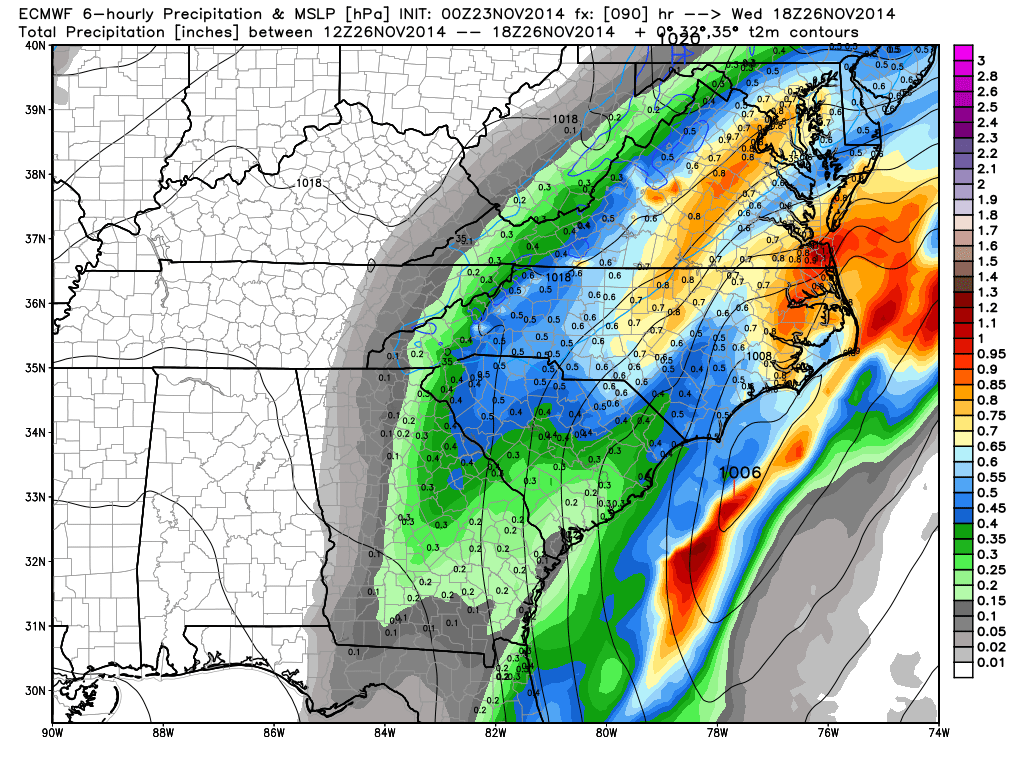
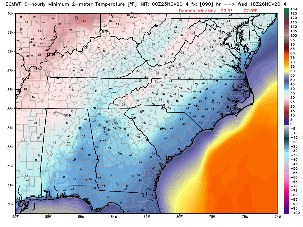
The official NOAA forecast is mentioning the probability of wet snow mixing in with rain but this is likely to change towards a more wintry precipitation scenario. Currently there is just not enough cold air in the forecast or in the models to support frozen precipitation however as shown below with temps Wednesday afternoon right above freezing.
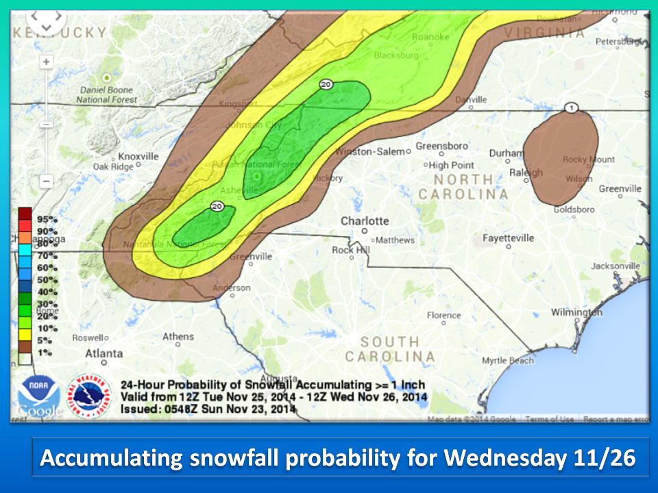
 All that being said, IF all the conditions come together to bring us frozen precipitation then we could have a decent snow in the Piedmont. Again, NC Weather Happens remains skeptical right now and additional information is needed to make a final forecast. Tonight’s model runs should offer greater detail, so stay tuned.
The European Model for 2:00 Wednesday Afternoon:
The GFS Model for 2:00 Wednesday Afternoon:

NC Weather Happens. Enjoy it!