
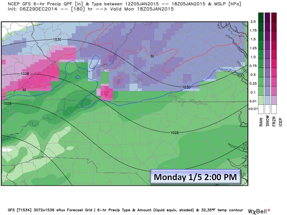
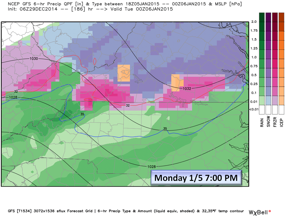
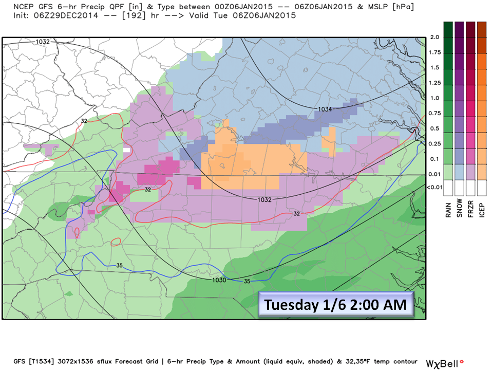
Wintry Mix possible Monday 1/5 and Tuesday 1/6. Confidence LOW.
The Set Up:
Strong High Pressure is indicated over the Great Lakes sending cold Canadian air down the eastern side of the Appalachians while a warm Low Pressure system develops and moves North East out of the Gulf. Another Low pressure develops off our coast in a Miller B (multipoint low pressure) scenario which would bring a wintry mix to our northern tier Piedmont counties and Virginia.
IF this set up works out, the warm gulf moisture would ride up over the denser cold air at the surface creating a wintry mix in areas where temps are at or just below freezing. Any discussion about accumulation at this time is impossible and irresponsible.
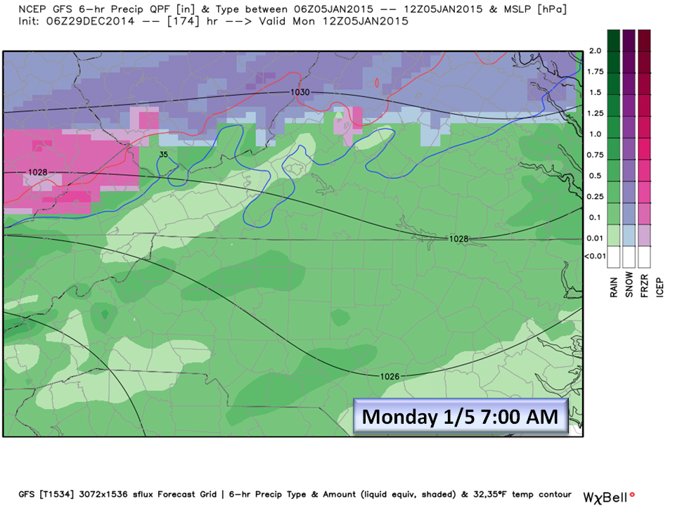
At this time, we are advising you to just keep next Monday and Tuesday on your RADAR for POSSIBLE winter weather.
The Bottom Line:
As we all know by now, forecasting beyond 5 days is risky business this season, but with temperatures trending lower and this persistent SW Pacific flow, it has always been about timing (cold and rain in the same place at the same time) and this period is close enough to bring it to your attention. Confidence will increase in this scenario if we can see this pattern emerge in successive model runs.
We will be monitoring this for any development and let you know as soon as possible if things change.
NC Weather Happens. Enjoy it!
Beat the new Facebook distribution policies on January 1st by following us on ncwxhappens.com