
- 01/10/2015 9:30 am
- Article Expires: 01/10/2015 6:00 pm
Light glaze of Freezing Rain in the Forecast for this week.
The Setup:
A Split Jet Stream pattern that will converge in the Gulf States will send an upper-level Low into the Carolinas. A weak High pressure ridge over the Great Lakes will move into New England and then offshore late in the week. Another shot of cold from the departing High pressure Wednesday with a northern stream disturbance from the Plains will merge providing more moisture potential.

Monday:
Medium to High Confidence:
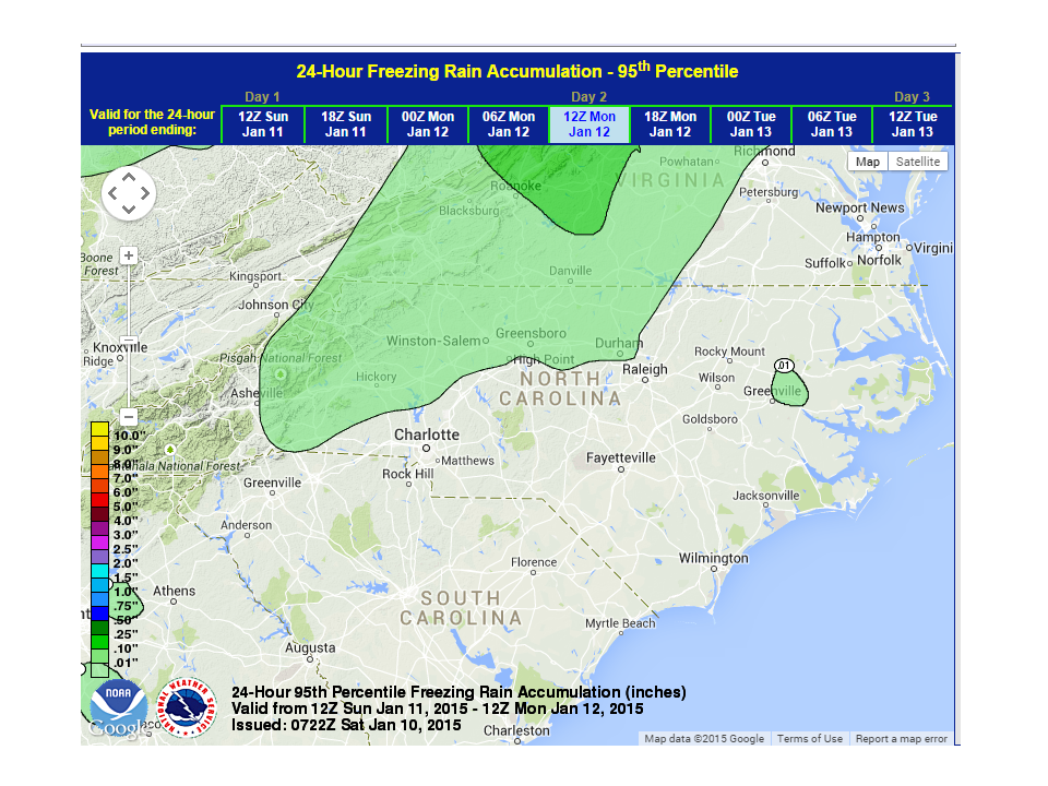
Rain arriving Sunday and Sunday night will be light. Temperatures will be at or just below freezing for short periods Monday night allowing drizzle to freeze on elevated surfaces and trees. Any ice accumulation is expected to be light (generally 1/10th of an inch or less) as there is not a lot of moisture to work with. The Northwest Piedmont has the best chances of seeing any freezing rain. Temps will climb into the Upper 30’s Tuesday under cloudy skies.


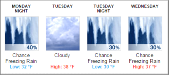
Tuesday Night / Wednesday Morning:
Medium Confidence:
Here’s where it gets tricky… Chances are better for Frozen precipitation Tuesday night as temperatures moderate down from the departing High Pressure in New England. There is still not a lot of precipitation to work with though so again, accumulations should be light. The bets chances for ice accumulation would be in the Northern and Central Piedmont. At this time, accumulation amounts would be speculative at best, but with a more prolonged period below freezing, 1/10th – 2/10th of an inch is possible just based on available moisture.
The Bottom Line:
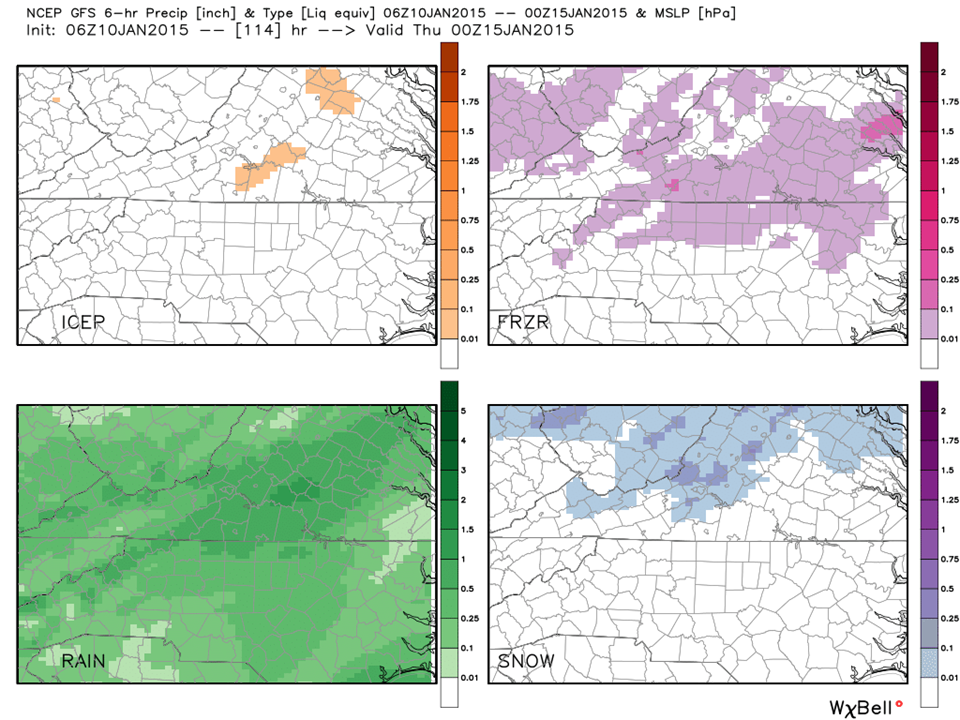
We have 2 opportunities for frozen precipitation this week. Temperatures for Monday Night are expected to be right at freezing and could go either way, so there is no slam-dunk here. The strength of the New England High and its position will determine how much below freezing we get as that is our favorite Cold Air Dam generator! Also going for us (or against us if you enjoy ice) is the amount of precipitation we are expecting (between .25 and .50 inches liquid precip). Most of the precipitation will be a cold rain Monday and Monday Night with a short period of freezing rain. Tuesday night, will have a more prolonged period below freezing so a better chance of accumulating ice is likely.
As we get closer to these events, confidence increases and as you know, this has been a tough year on the weather models and those that interpret them!
NC Weather Happens. Enjoy it.