
- Post time: 6:00 am 1/09/2015
- Weather Discussion and Not a Forecast
- Article Expires 1/09/2015 6:00 pm
January 12 through the 16th will be a very busy Winter Weather Week with Ice, Snow, Sleet, and Rain.
The Situation: Previous model runs have kept New England and Great Lakes High Pressure too low to have much of a winter impact on the Piedmont. All would create a Cold Air Dam sending cooler air into the region, but it just wasn’t THAT cold. Now as we get closer, the Highs are trending a bit stronger. Meanwhile, Gulf originating upper level lows pass through the Carolinas in several waves and later in the week, a passing disturbance develops into a Strong Nor’Easter and moves offshore and into New England.
First Event Sunday 1/12 through Monday 1/13:
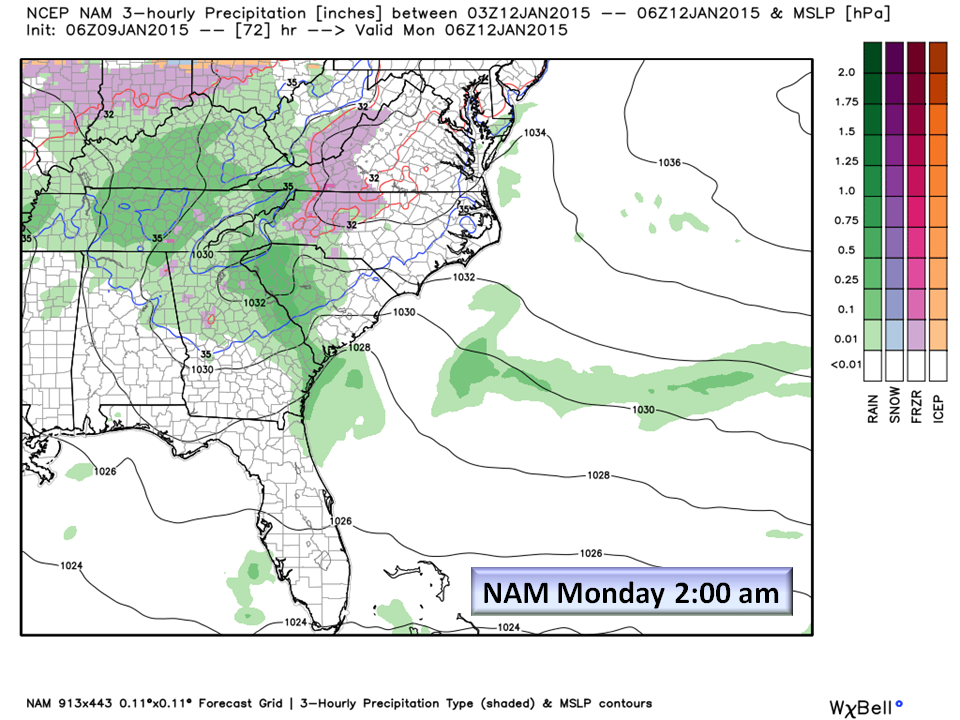
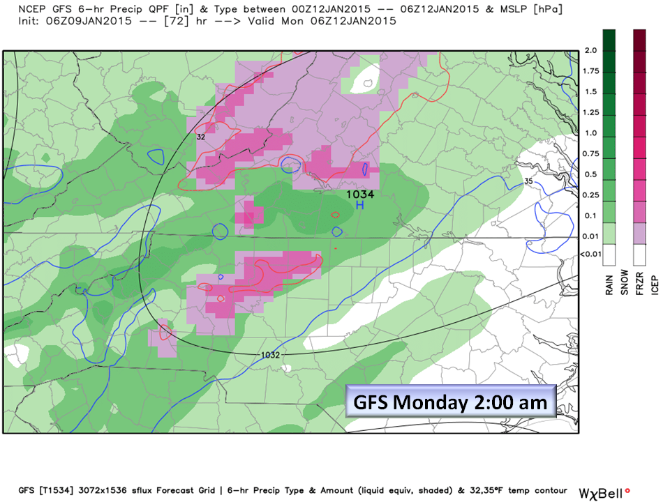
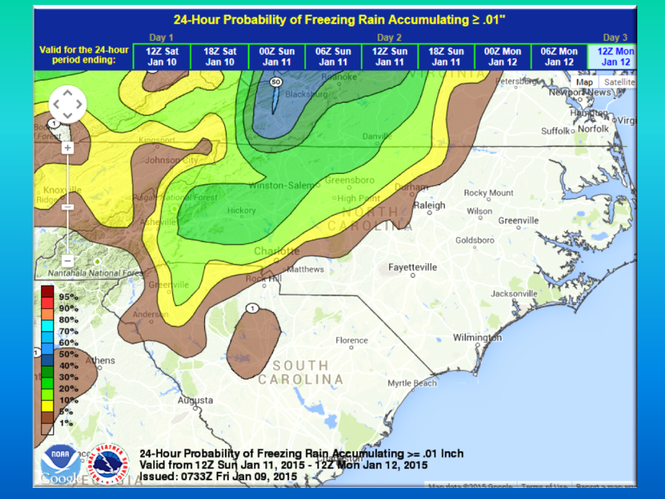
This event has been advertised now since Christmas! After a brief warm up into the low 40’s Sunday afternoon temps drop to freezing or near freezing in the Northern and Northwest Piedmont into the foothills. Moisture arrives late Sunday evening and is forecast to change over to freezing rain before daybreak Monday morning. IF all liquid precipitation falls, we would receive a soaking 1/2 inch of rain. With this morning’s model information, rain would begin and then change over to sleet and freezing rain before changing back to all rain mid morning. In this case, 1/10th of Ice could result. Short Range Models are now showing this event as the NAM clearly shows!

Second Event Wednesday 1/14 through Thursday 1/15:
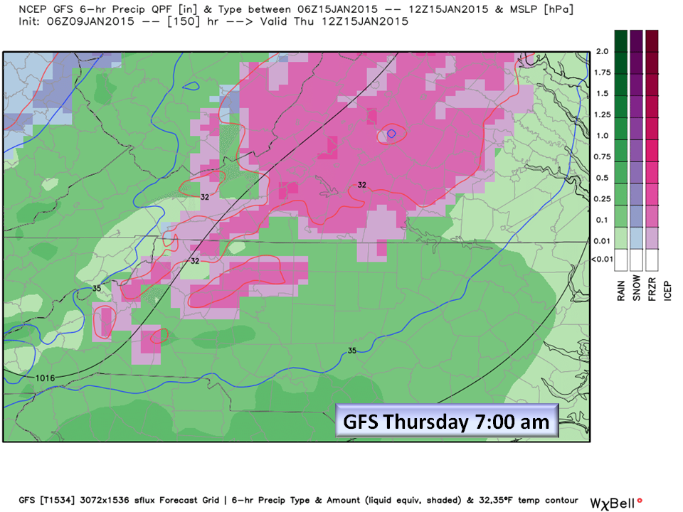
Another Cold Air Dam situation but this time, an upper level system passes south of the Piedmont and develops off the Coast as a Nor’Easter. There is LOW Confidence at this time of any frozen precipitation, but trends (trend is my friend) are increasing in this scenario. What is problematic is once again, How strong will the cool Canadian air be and the specific track and strength of the Low Pressure system? The Raleigh NWS has included Chance of Freezing Rain in the Official Forecast for the Northwest Piedmont for Wednesday as temps are forecast to be right at freezing.
Note: We have to mention this: The European model is suggesting an all Snow event with accumulations generally around 1-3 inches in the Piedmont with higher amounts towards Raleigh and the coastal plain. At this time, the European is apparently not considering warm air intrusion in the mid levels which would turn the snow to freezing rain/sleet…so no snow considered at this time.
The Wednesday / Thursday event will change as we get closer, so stay tuned as we refine a solution for you.
Bottom Line:
We have a very active winter weather pattern coming up, so don’t be caught off guard! The likelihood of a minor ice storm for Sunday night is increasing and we now have Medium confidence that it will happen. There are still some unknowns such as the strengthening of the Cold Air Dam forecast in the Piedmont that could keep this all rain, or all ice. Thermal profiles are keeping Snow out this event.
There is Low Confidence in the development of a coastal low Wednesday and Thursday, but again the track of the Low and the strength of the High need a little more time before we can forecast with certainty. Until then, put Wednesday and especially Thursday on your RADAR for Winter Weather.
Lastly, when we know…you will get the now infamous NC Weather Happens “Milk and Bread Alert”! One could come as early as tonight we’ll see.
As always, NC Weather Happens. Enjoy it!
Subscribe to this blog at ncwxhappens.com and follow us on Twitter @ncwxhappens