
- Posted: 1/12/2015 8:30 am
- Expires: 1/12/2015 8:30 pm
Dodging Ice Bullets Left and Right!!!
Let’s look at Tuesday Night and Wednesday Morning:

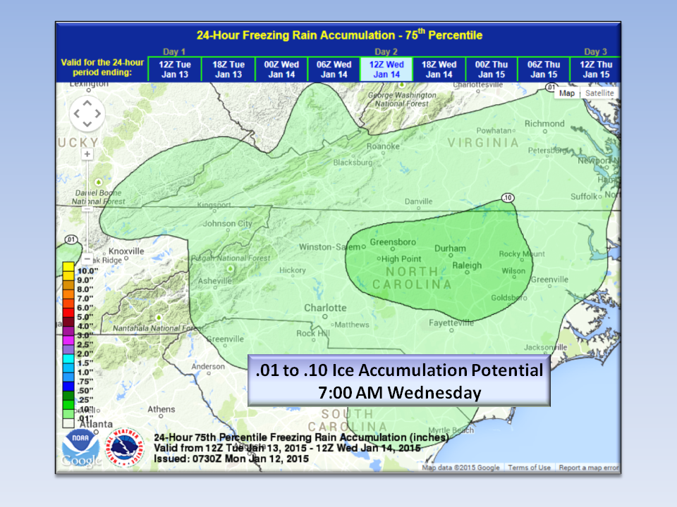
Tuesday, another moderate cold air dam sets up while light precipitation arrives from the west. The cold will be in place at the same time as the moisture, but this round, we just don’t have very much moisture to work with. However, even 1/10th of an inch will cause travel problems especially on bridges and shaded areas. The best areas to receive the greatest accumulation will be East of the Triad and coastal plain.

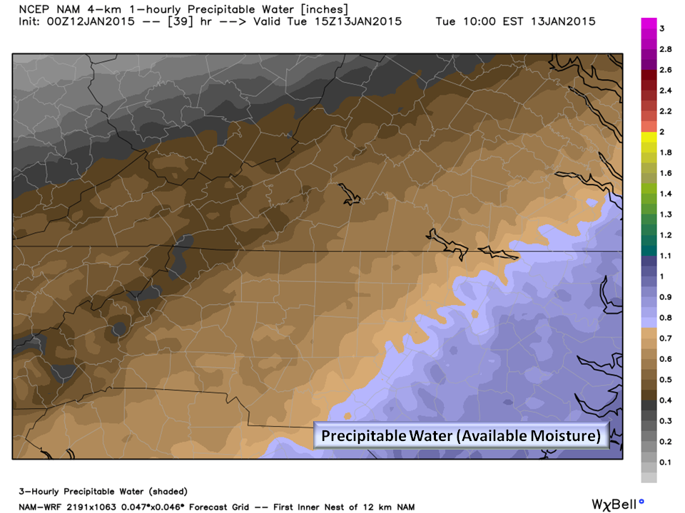
As you can see here, there just isn’t very much moisture to work with. Thermal profile indicators also show a good chance for some sleet mixed in especially in the Northwest Piedmont. Should the cold air dam come in stronger than forecast, we might even see a little snow mixed in…more on that later.
Temps during the day Wednesday will reach about 35 degrees and remain overcast so melting will be slow to occur. Temperatures Wednesday night are expected to be at or just above freezing.
Emergency Management Statement:
- Light Rain will change over to freezing drizzle at event onset, so road treatment will be possible.
- Event begins after sundown Tuesday night ending 10:00 am Wednesday morning.
- A glaze to 1/10th of an inch is possible
Bottom Line:
Wednesday morning may be a dicey commute and it’s not a bad idea to prepare for some school delays. With this little ice accrual, widespread power outages are NOT expected. Go ahead and get your milk and bread just in case schools are closed…never know these days!
NC Weather Happens. Enjoy it!