
Scattered showers will begin tonight from west to east becoming widespread Sunday afternoon.
“High pressure will linger along the East Coast today. A cold front will settle into and waver over the southern middle Atlantic states tonight through early next week”. – NWS-Raleigh
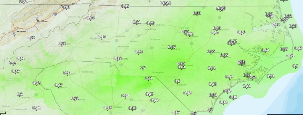
Much needed rainfall chances will increase towards midnight tonight as a cold front passes through. If you have evening plans outdoors, keep them. Generally, everyone should receive near 1/4 inch of rain except higher amounts in the Central Piedmont and Coastal Plain where amounts of 3/4 inches or more are possible. Some thunder could accompany some sowers but at this time, severe storms are not expected. Just enjoy the rain!
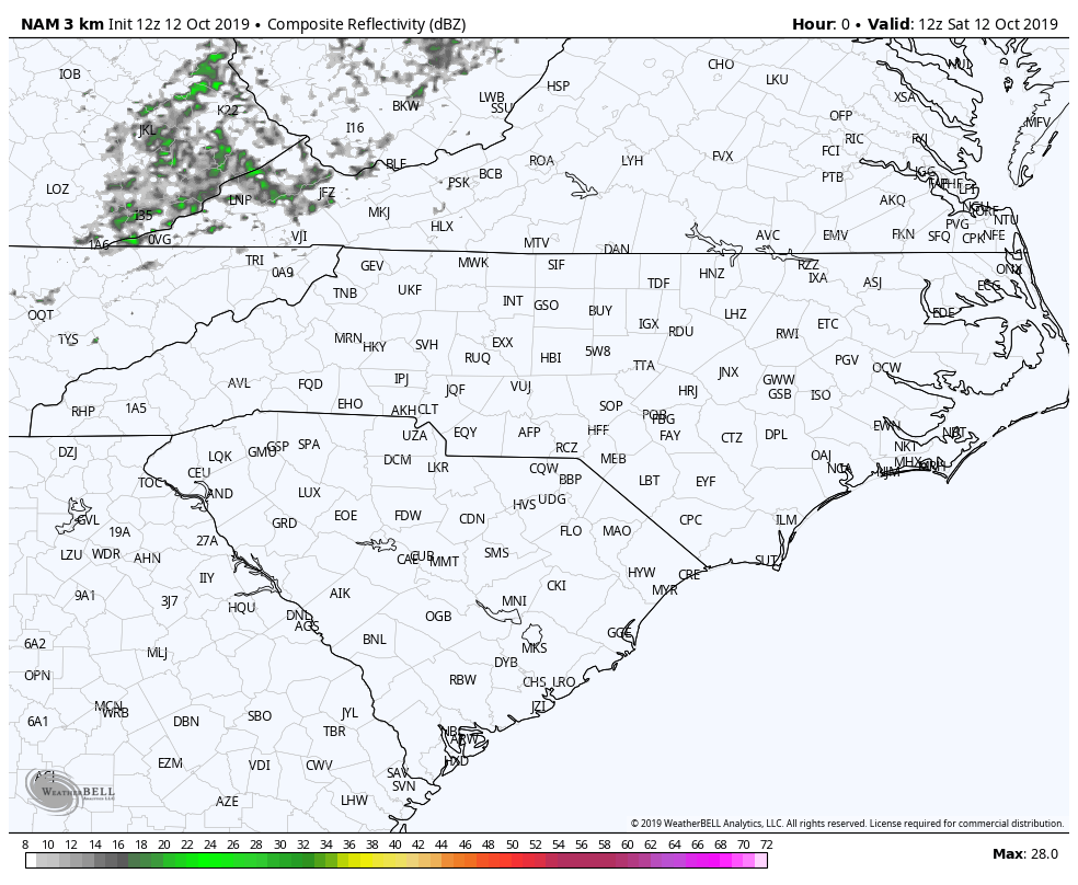
The images shown are the NWS official rainfall forecast through Monday night and the NAM 3km Simulated RADAR loop.
While you are on the NC Weather Happens, LLC web site, why not subscribe to have these sent straight to your email. We will be using the blog more and more going into winter so don’t miss out of receive delayed social media weather information.