
- ARTICLE EXPIRED. UPDATE POSTED HERE
- Posted: 01/13/2015 8:15 am
- Expires: 3:00 pm
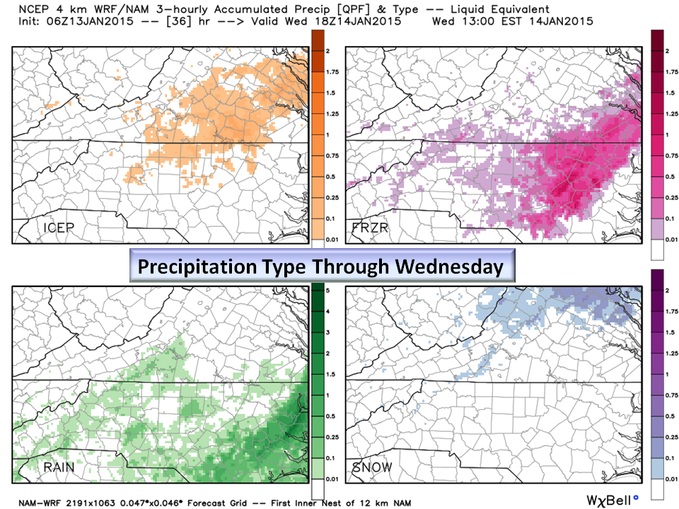
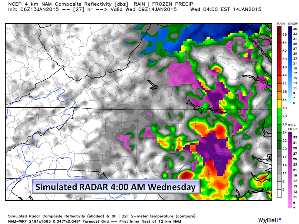
Freezing Rain and Sleet expected in the Piedmont.
The Entire Piedmont is either under a Winter Weather Advisory or a Winter Storm Watch.
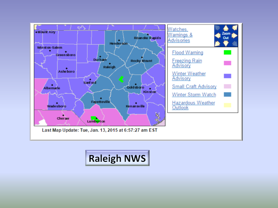

We are expecting accumulating Ice to begin this evening when temps dip below freezing.
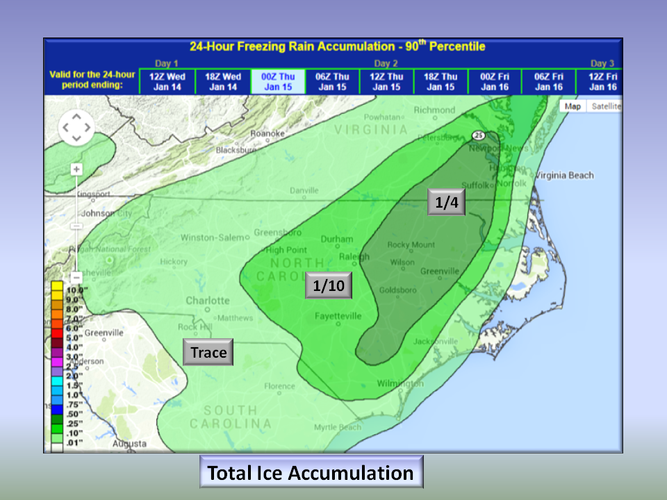
- Portions of the eastern Piedmont (Durham and areas east) will have the most impact with as much as 1/4 inch of Ice. This is the threshold for a damaging event where amounts greater than 1/4 inch bring down tree limbs causing widespread power outages.
- The Central Piedmont can expect to see around 1/10 inch which will cause significant travel issues Wednesday morning. Because this event is beginning as rain, it will be difficult to pre-treat roads.
- Temperatures will dip into the mid to upper 20’s Wednesday night so ANY precipitation that falls WILL FREEZE.
The Bottom Line:
There is a bit more precipitation coming in than expected and it is trending west as of this morning so the event needs to be closely monitored. Areas near the Triad can expect treacherous driving conditions Wednesday morning as roads will likely not be treated while the eastern Piedmont can expect more in the way of a few power outages and small limbs falling. We will be updating this information this afternoon as needed.
Be safe, stay in if you can, and remember…NC Weather Happens. Enjoy it!