
- Posted: Friday 02/27/2015 11:30 AM
- Expires Friday 6:00 PM
We wanted to get this on your calendar for Sunday morning. There is a potential for some Freezing Rain/Wintry Mix lurking around in the models that needs to be watched.
This is essentially a timing issue as a probable Cold Air Dam sets up in the Piedmont while an upper level disturbance approaches from the South, Southwest. At present, the GFS has the low arriving later in the day and should that happen, then we can expect all rain. The Medium-Range NAM wants to bring the Low in over night Saturday which would be during our coldest period of the day. Available moisture for Liquid unfrozen precipitation (QPF) will be between .25 and .75 as of this writing. About the same time as our precipitation arrives, our cold air dam begins to erode and retreat into Virginia.
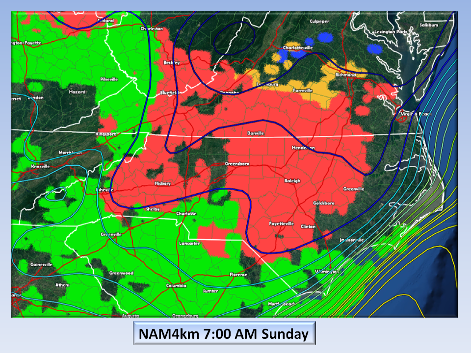
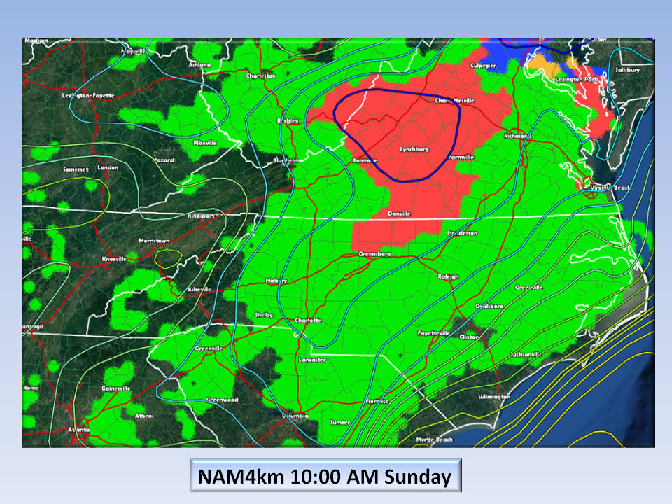
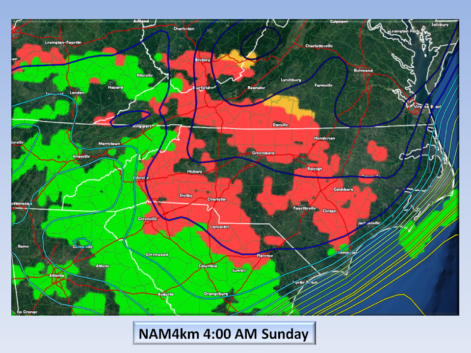
Timing:
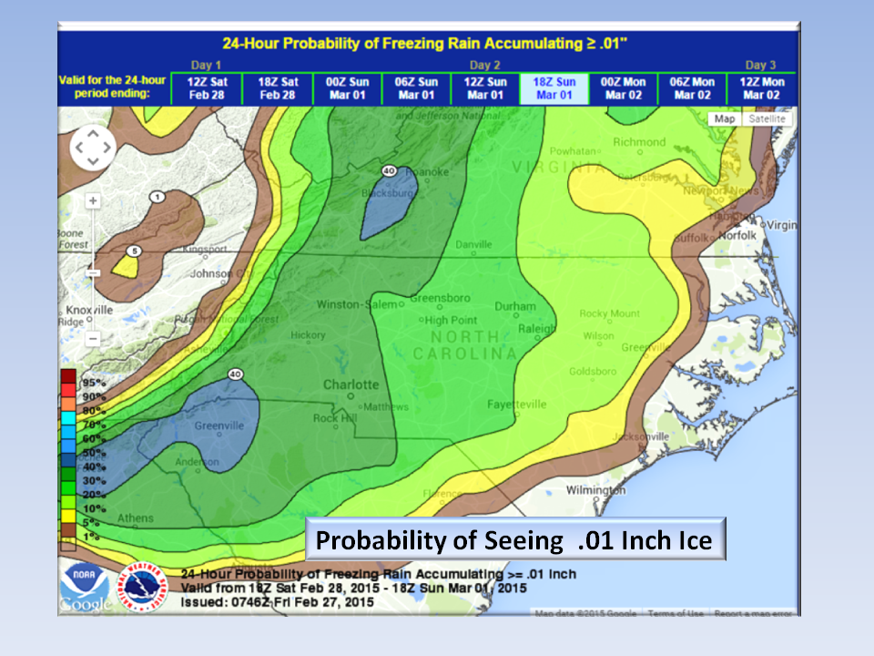
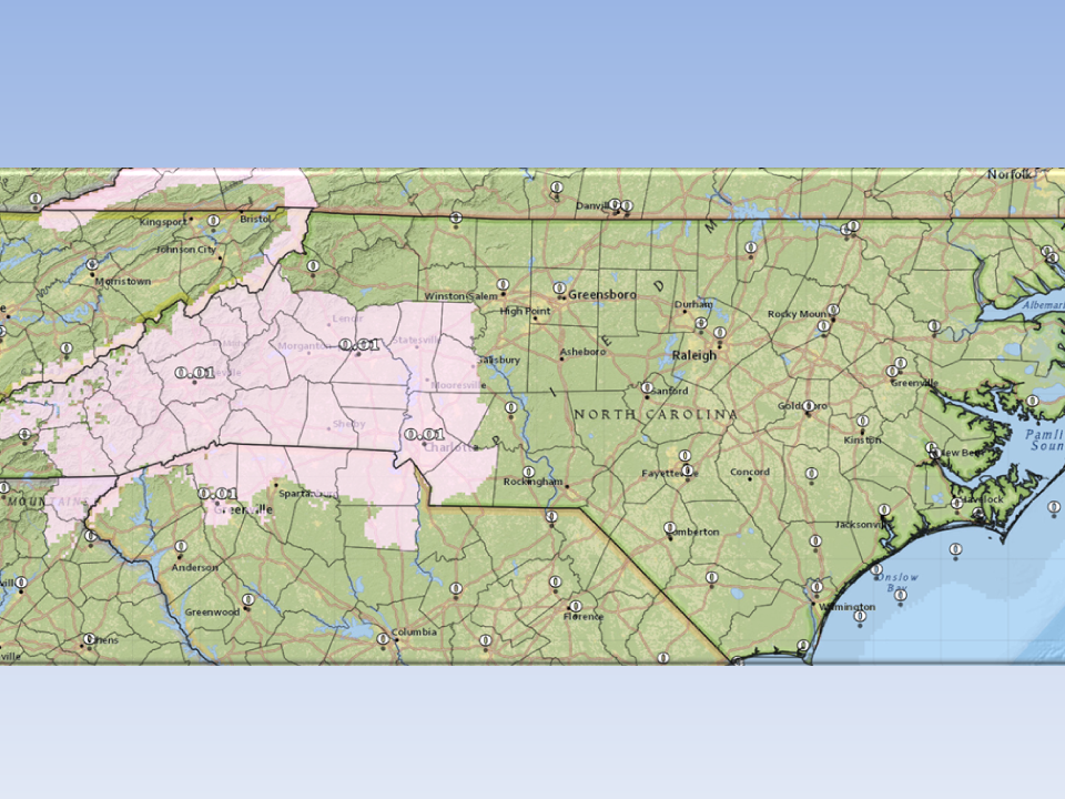
Probabilities:
The probability is low for the Piedmont but it is still high enough to keep an eye on…
The Official Word?
This is being mentioned in their short range outlook but not being forecast at this time. We may see mention of this as we go through the day and more tomorrow if it becomes more likely that we could have some icing issues (not chocolate).
The Bottom Line:
Right now this is on the low-end of chance in the Central Piedmont and more likely for the SW areas of the state. It’s early, but we wanted to let you know what we are looking at especially after the walloping we just received…Now there shouldn’t be any surprises…We’re on it!!!
NC Weather Happens. Enjoy it!
Be sure to get articles like this in your email by subscribing at ncwxhappens.com…its Free, No ads, and No spam but more importantly, No delay! We are also on Twitter @ncwxhappens.
If you are interested in advertising on this high volume webpage, please send us a note and we’ll send you some information.