
While those hamburgers and hot dogs simmer on the grill, and the sweet smell of Coppertone fills the air, weather happens and our first winter models are starting to come out.
Yes, we have not even started June, but it is an exciting time for climatologists as the long-range seasonal models begin to process our upcoming winter. The first out of the gate is the “Japanese Model” JAMSTEC (Japan Agency for Marine-Earth Science and Technology).
Before we get into it, this is NOT a forecast but a discussion about one model and its interpretation.
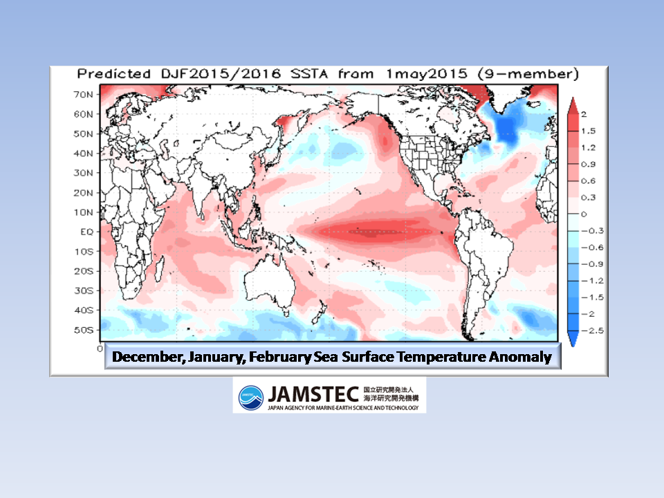
El Nino:
El Nino is forecast to strengthen this season to moderate / strong. If this pans out, we would naturally see more precipitation in the west as troughing develops through the plains digging deep into the south. Where that sets up has yet to be seen, but historically this is the case.
There is an approximately 90% chance that El Nino will continue through Northern Hemisphere summer 2015, and a greater than 80% chance it will last through 2015.
With a warm central pacific pool of water guiding our upper air currents, this will be interesting to see.
Temperatures:
According to this model, we see a similar pattern to last year. A warm Alaska, Cool interior plains states and northeast, but we also notice that the cooler than normal air covers more southern states.


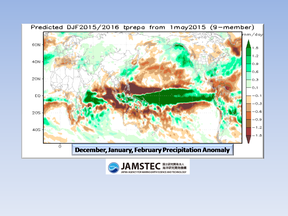
Precipitation:
The big takeaway from this model is the above normal precipitation in the western states. Will it be enough though? For the southeast, we also see above normal precipitation which is a shift from last year which was modeled in the northeast. If this pans out, we may be in for a real winter with many winter weather “opportunities”.
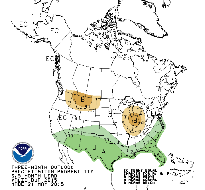
A closer look:

The Bottom Line:
This is one model and the first of many that will give us some guidance on how winter will progress. This season, there are stronger variables in play that will have an impact on Piedmont weather such as: El Nino, Greenland Blocking, warmer north pacific ocean currents, and of course that famous Appalachian Wedge. In keeping you in the loop, I hope you enjoy this HOT SUMMER DAY cause winter is coming…love it or hate it!
As always,
NC Weather Happens. Enjoy it!
Be sure to get articles like this in your email by subscribing at ncwxhappens.com…its Free, No ads, and No spam but more importantly, No delay! We are also on Twitter @ncwxhappens.
If you are interested in advertising on this high volume webpage, please send us a note and we’ll send you some information.